Rocky Bottom, South Carolina
Source: Wikipedia, the free encyclopedia.
Community in South Carolina, United States
This article does not cite any sources. Please help improve this article by adding citations to reliable sources. Unsourced material may be challenged and removed. Find sources: "Rocky Bottom, South Carolina" – news · newspapers · books · scholar · JSTOR (June 2019) (Learn how and when to remove this message) |

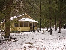
Rocky Bottom is an
U.S. Highway 178 in the Blue Ridge Mountains
, at an elevation of 1,750 ft (530 m). The Foothills Trail also makes its way through Rocky Bottom, with an area for trailgoers to park.
35°02′45″N 82°48′08″W / 35.04583°N 82.80222°W / 35.04583; -82.80222
Municipalities and communities of Pickens County, South Carolina, United States | ||
|---|---|---|
| Cities |  | |
| Towns | ||
| CDPs |
| |
| Other communities | ||
| Footnotes | ‡This populated place also has portions in an adjacent county or counties | |
| ||
