West Columbia, South Carolina
West Columbia, South Carolina | ||
|---|---|---|
 | ||
|
FIPS code 45-75850 | | |
| GNIS feature ID | 1251380[4] | |
| Website | www | |
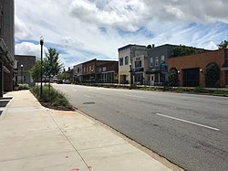
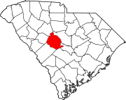
West Columbia, formerly Brookland, is a city and
History


West Columbia was incorporated in 1894 as "Brookland", but the U.S. Postal Service called the town "New Brookland" since there was another town called Brookland. In 1936, the name was changed to "West Columbia" to emphasize its proximity to Columbia, the capital.[1] Numerous businesses, churches and a high school retain the Brookland and New Brookland names.
The Gervais Street Bridge, Mount Hebron Temperance Hall, New Brookland Historic District, and Saluda Factory Historic District are listed on the National Register of Historic Places.[9]
The
Geography
West Columbia lies to the south and west of the Saluda and Congaree rivers.
According to the United States Census Bureau, the city has a total area of 6.3 square miles (16.3 km2), of which 6.1 square miles (15.7 km2) is land and 0.2 square mile (0.5 km2) (3.18%) is water.
Demographics
| Census | Pop. | Note | %± |
|---|---|---|---|
| 1900 | 1,089 | — | |
| 1910 | 900 | −17.4% | |
| 1920 | 1,793 | 99.2% | |
| 1930 | 1,722 | −4.0% | |
| 1940 | 1,744 | 1.3% | |
| 1950 | 1,543 | −11.5% | |
| 1960 | 6,410 | 315.4% | |
| 1970 | 7,838 | 22.3% | |
| 1980 | 10,409 | 32.8% | |
| 1990 | 10,588 | 1.7% | |
| 2000 | 13,064 | 23.4% | |
| 2010 | 14,988 | 14.7% | |
| 2020 | 17,416 | 16.2% | |
| U.S. Decennial Census[13][5] | |||
2020 census
| Race | Num. | Perc. |
|---|---|---|
White (non-Hispanic)
|
11,022 | 63.29% |
Black or African American (non-Hispanic)
|
2,959 | 16.99% |
Native American
|
58 | 0.33% |
Asian
|
490 | 2.81% |
Pacific Islander
|
5 | 0.03% |
Other/Mixed
|
732 | 4.2% |
Latino
|
2,150 | 12.34% |
As of the 2020 United States census, there were 17,416 people, 8,315 households, and 3,764 families residing in the city.
2000 census
As of the
There were 5,968 households, out of which 22.0% had children under the age of 18 living with them, 37.5% were married couples living together, 14.3% had a female householder with no husband present, and 44.7% were non-families. 36.1% of all households were made up of individuals, and 13.0% had someone living alone who was 65 years of age or older. The average household size was 2.13 and the average family size was 2.76.
In the city, the population was spread out, with 18.8% under the age of 18, 10.1% from 18 to 24, 30.0% from 25 to 44, 22.1% from 45 to 64, and 19.0% who were 65 years of age or older. The median age was 39 years. For every 100 females, there were 88.5 males. For every 100 females age 18 and over, there were 86.1 males.
The median income for a household in the city was $30,999, and the median income for a family was $40,253. Males had a median income of $30,033 versus $24,637 for females. The
Education
West Columbia has a public library, a branch of the Lexington County Public Library.[15]
Notable people
- Duce Staley, former professional football player and football coach
- Hal Jeffcoat, former professional baseball player
See also
References
- ^ a b "City of West Columbia South Carolina". City of West Columbia South Carolina. Retrieved October 3, 2012.
- ^ "City Council". City of West Columbia. Retrieved May 1, 2015.
- ^ "ArcGIS REST Services Directory". United States Census Bureau. Retrieved October 15, 2022.
- ^ a b U.S. Geological Survey Geographic Names Information System: West Columbia, South Carolina
- ^ a b "Census Population API". United States Census Bureau. Retrieved October 15, 2022.
- ^ "West Columbia Census Quick Facts". U.S. Census Bureau. 2019. Retrieved June 29, 2020.
- ^ "West Columbia Zoning". Lexington County GIS. Retrieved June 29, 2020.
- ^ "Lexington, SC Annexation". Lexington County GIS. Retrieved June 29, 2020.
- ^ "National Register Information System". National Register of Historic Places. National Park Service. July 9, 2010.
- ^ "FAA Registry (N999LJ)". Federal Aviation Administration.
- ^ 4 killed, 2 hurt as rock star's jet crashes, as well as Today.com News Live, 8:30 AM, September 20, 2008.
- ^ Meg Kinnard "Experts: Pilots of doomed Learjet should've lifted off SC runway instead of trying to stop", NewsDay, (Associated Press) October 22, 2008
- ^ United States Census Bureau. "Census of Population and Housing". Retrieved August 14, 2013.
- ^ "Explore Census Data". data.census.gov. Retrieved December 13, 2021.
- ^ "Locations". Lexington County Public Library. Retrieved September 28, 2022.

