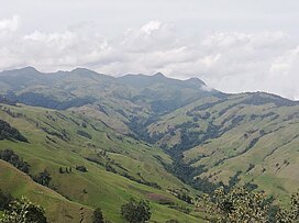
Romeral (volcano)
Appearance
| Romeral | |
|---|---|
| Volcán Romeral | |
 Romeral | |
| Highest point | |
| Elevation | 3,858 m (12,657 ft) |
| Listing | Volcanoes of Colombia |
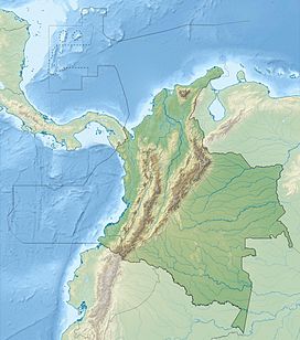
| Coordinates | 5°12′22″N 75°21′50″W / 5.20611°N 75.36389°W |
| Geography | |
| Location | Caldas |
| Parent range | Central Ranges, Andes |
| Geology | |
| Age of rock | Pliocene-Holocene |
| Mountain type | Andesitic-dacitic stratovolcano |
| Last eruption | 5390 BCE ± 500 years |
Romeral is a
North Volcanic Zone in the Andean Volcanic Belt. The volcano was formed in the Late Pliocene, approximately 3 million years ago.[1]
See also
References
- ^ Bohórquez et al., 2005, p.72
Bibliography
- Bohórquez, O.P.; M.L. Monsalve; F. Velandia; F. Gil, and H. Mora. 2005. Marco tectónico de la cadena volcánica más septentrional de la Cordillera Central de Colombia. Boletín de Geología, Universidad Industrial de Santander 27. 55-79. Accessed 2017-06-09.

