
Santa Cruz River (Arizona)
| Santa Cruz River | |
|---|---|
 The Santa Cruz River near Red Rock. | |
 | |
| Location | |
| Countries | United States, Mexico |
| States | Arizona, Sonora |
| Physical characteristics | |
| Source | San Rafael Valley |
| • location | Santa Cruz County, Arizona |
| • coordinates | 31°27′16″N 110°35′17″W / 31.45444°N 110.58806°W[1] |
Canada del Oro | |
The Santa Cruz River (Spanish: Río Santa Cruz "Holy Cross River") is a left tributary of the Gila River in Southern Arizona and northern Sonora, Mexico. It is approximately 184 miles (296 km) long.[3]
Course

The Santa Cruz has its headwaters in the high intermontane grasslands of the
Tucson, Marana, and Picacho Peak State Park to the Santa Cruz Flats just to the south of Casa Grande and the Gila River. Before the development of agriculture in the Santa Cruz Flats, the river's course went right through the flats. As development started, the Greene Canal was formed to divert the Santa Cruz River to the Greene Wash to maximize agriculture in the area. Because of this diversion, the original Santa Cruz River riverbed was destroyed. From the Greene Canal, the Greene Wash empties into the Santa Rosa Wash which empties into the original Santa Cruz River riverbed. This riverbed is followed all the way until it terminates at the Gila River. Between Nogales and Tucson the river valley is flanked by the San Cayetano and Santa Rita Mountains on the east and the Atascosa, Tumacacori, and Sierrita Mountains
on the west.
Hydrography
Most of the Santa Cruz River is
Tucson dried up completely.[5]
The city of
Nogales, Sonora, has been releasing treated sewage into the Santa Cruz River since 1951.[7] This has resulted in the revival of approximately 9 miles (14 km) of riverbank within and north of the city of Nogales, Arizona.[8]
In recent years, due to
seep-willow.[9] Further downstream at the Roger Road Waste Water Treatment Plant has been releasing treated wastewater, which extends the perennial
flow of the river for approximately 46 miles (74 km).
Recreation
The Juan Bautista de Anza National Historic Trail parallels much of the Santa Cruz. In Marana, there are approximately ten paved miles of multi-use recreational path along the Santa Cruz, located on Tangerine Road and through the Gladden Farms community park.
Gallery
-
 Little waterfalls along the Santa Cruz River in downtown Tucson in 1889.
 -
 The Santa Cruz during a flood, c.1903.
 -
 View of the Santa Cruz fromriparian gallery forest, which has since become extinct.
 -
 A wrecked bridge along the Santa Cruz during the flood of 1915. "A" Mountain is in the background.
 -
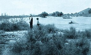
 A view of the Santa Cruz south of Tucson, facing south. The Santa Rita Mountains are in the background.
 -
The normally dry Santa Cruz river wash running high and fast after much heavier than normal rains in September 2014.


.jpg)
See also
References
- ^ "Santa Cruz River". Geographic Names Information System. United States Geological Survey, United States Department of the Interior. 1980-02-08. Retrieved 2020-10-05.
- ^ Brown, David E.; Makings, Elizabeth; et al. (April 2017). "Biotic Resources of the Lower Santa Cruz River Flats, Pinal County, Arizona" (PDF). Desert Plants. 32 (2). Archived (PDF) from the original on October 9, 2020. Retrieved October 5, 2020.
- ^ "The National Map". U.S. Geological Survey. Archived from the original on August 23, 2017. Retrieved March 8, 2011.
- ^ "The Decline of the Santa Cruz River". Archived from the original on 2012-03-11. Retrieved 2011-11-21.
- ^ a b c Davis, Tony (June 22, 2019). "A 'dead' portion of Tucson's Santa Cruz River will flow again — for 5,000 feet". Arizona Daily Star. Archived from the original on October 9, 2020. Retrieved October 7, 2020.
- ^ a b Regan, Margaret (May 3, 2001). "A River Ran Through It". Tucson Weekly. Archived from the original on October 12, 2020. Retrieved October 7, 2020.
- ^ "The Vanishing Santa Cruz River". National Park Service. Archived from the original on November 29, 2020. Retrieved October 7, 2020.
- ^ Tucson Citizen: Who will save the Santa Cruz Archived 2012-07-16 at archive.today
- ^ a b Davis, Tony (September 30, 2019). "The Santa Cruz River starts thriving again, water supply is restored". Arizona Daily Star. Archived from the original on October 2, 2020. Retrieved October 7, 2020.
External links
- Santa Cruz River Civic Science Conservation Initiative
- San Rafael Ranch Natural Area and state park
- Sign posted along the bank of the Santa Cruz River in Tucson
Wikimedia Commons has media related to Santa Cruz River (Arizona).
| International | |
|---|---|
| National | |