
Tabio
Tabio | |
|---|---|
Municipality and town | |
 Chapel of Santa Barbara | |
|
UTC-5 (Colombia Standard Time) | |
| Website | Official website |
Tabio is a municipality and town of
Muisca who inhabited the area. Tabio borders Zipaquirá in the north, Cajicá in the east, Subachoque in the west and Tenjo in the south.[1]
Etymology
The name Tabio comes from the
Río Frío (also called Sinca).[1]
History
The
zipa
, and which included the territory of Tabio.
The natural hot springs in Tabio were famous among the Muisca, and they were said to have a temple there devoted to the Goddess of Waters. Under the Spanish conquest, the native Muisca were expropriated and the area was put under a colonial rule that issued the foundation of Tabio in 1603.[1]
Economy
Secondary and tertiary economic sectors are relatively underdeveloped in Tabio. Main industrial crops are devoted to floriculture. Potatoes, corn, peas, and carrots are also cultivated.[1]
Tourism
Tabio is well known for its natural hot springs, which are said to have therapeutic properties. It is also known for the annual festival of
torbellino, a traditional Andean Colombian dance.[1]
Gallery
-
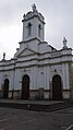 Church of Tabio
 -
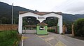
 Municipal Forum
 -
 Tabio rural landscape
 -
 Hot springs


References
Wikimedia Commons has media related to Tabio.