
Supatá
Supatá | |
|---|---|
Municipality and town | |
|
UTC-5 (Colombia Standard Time) | |
| Website | Official website |
Supatá is a municipality and town of Colombia in the Gualivá Province, part of the department of Cundinamarca. Supatá is located 76 kilometres (47 mi) north of the Colombian capital Bogotá. Supatá borders the municipalities Pacho, Vergara, Subachoque, La Vega and San Francisco.[1]
History and geography
Before the arrival of the
Spanish conquistadores in the central highlands of Colombia, the area around Supatá was inhabited by the Panche people. In Chibcha Supatá means "low and fertile land".[2] The village is located on the northwestern edge of the Bogotá savanna at a relatively low elevation of 1,780 metres (5,840 ft) above sea level, while other areas within the municipality are much higher, up to a maximum elevation of 3,400 metres (11,200 ft).[1]
On the El Tablazo mountain, at an elevation of 3,285 metres (10,778 ft) within the boundaries of Supatá, there's a cave named Cueva Chía ("Chía Cave").
Muisca who frequently invaded the territories of the Panche. It is said the people hid the treasures of Chía in this cave.[1]
Economical activities
The main economical activity of Supatá is
yuca.[1]
Gallery
-
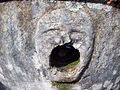 Ancient fountain in Supatá
possibly indigenous -
 Hispania Lake in Supatá


Named after Supatá
- Supatá golden frog, a species of poisonous frog, found in the vicinity of Supatá has been named after the village
References
- ^ a b c d (in Spanish) Official website Supatá - accessed 06-05-2016
- ^ (in Spanish) Etymology Supatá - accessed 29-04-2016
Wikimedia Commons has media related to Supatá.
| International | |
|---|---|
| National | |