
Thorntoun house and estate
Thorntoun School was opened by
. The old Thorntoun mansion house was demolished in the late 1960s, leaving the West Lodge, some of the home farm outbuildings, the stables and the walled garden as 'memorials' to the ancient history of the site. Many fine trees remain from the estate policies and the surviving gardens are very well maintained (2007). An entrance with a slight deviation from the old course has been created to serve the large modern buildings which house the nursing home.The History of Thorntoun house and estate
In 1823 the historian Robertson[1] describes "Thornton" as being "situated about half way betwixt Irvine and Kilmarnock: the manor or place (palace) is an elegant modern mansion, set down on the brow of a considerable height, overlooking, from amid its fine old timber and more recent plantings, a great expanse of rich country."


In 1866 James Paterson, another historian, brought up locally, gives 'Thorntoun' as "This property, situated to the west of Busbie (Knockentiber), is about 300 acres (1.2 km2) in extent. It belonged, of old, according to Wood, to one of the branches of the Montgomerie family."[2]
The Montgomerie, Mure and Ross families
| Etymology |
| Near Thorntoun in 1604 |
Thorntoun was at first part of the Barony of
The Cuninghame Family
Archibald Muir of Thorntoun was knighted by King William III in 1698 and his only daughter, Margaret, married John Cuninghame of Caddel, in the Parish of Ardrossan, in 1699. They inherited Thorntoun and Caddel and had two sons and three daughters. Archibald succeeded his father and John became a successful merchant in Lisbon (Portugal), eventually retiring to live at Carmelbank (previously called Mote), adjacent to Thorntoun. Their father was married a second time to a daughter of Mr. Stevenson of Montgreenan, by whom they had another sixteen children. This John Cuninghame died in 1753.


Archibald Cuninghame, who was a captain in Boscawen's 29th. Regiment of Foot, married Christiana, eldest daughter of Andrew Macredie of
The Wrey Family


Sarah Cuninghame's spouse was George Bourchier Wrey from North Devon. They had a son, George Edward Bourchier Wrey who had succeeded to the property by 1912. He appears to have inherited Carmelbank from his great-uncle, John Cuninghame by this date.[5] The combined rental income of Thorntoun and Carmelbank was £2,640 12s 0d., the second highest in the parish, only exceeded by Robert Morris Pollock-Morris of Craig house.[5] This is a reversal for both of the situation in 1799 and may reflect earnings from the establishment of collieries, etc. rather than the straightforward 'traditional' income from farms and the like.
Coat of arms
The
The Barony of Robertoun
This barony, once part of the Barony of Kilmaurs, ran from Kilmaurs south to the river Irvine. It had no manor house and belonged to the Eglinton family latterly. The following properties were part of the barony: parts of Kilmaurs, Craig,
The Darien Affair

The Darien Company was an attempt by the Scots to set up a trading colony in America in the late 1690s, however the opposition from England and elsewhere was so great that the attempt failed with huge losses and great financial implications for the country and for individuals. Half of the whole circulating capital of Scotland was subscribed and mostly lost. In Cunninghame some examples of losses are Sir Archibald Mure of Thorntoun (£1000), Major James Cunninghame of Aiket (£200), Sir William Cunninghame of Cunninghamhead (£1000), William Watson of Tour (£150) and James Thomson of Hill in Kilmaurs (£100). In modern terms a thousand pounds loss in the 17th century must have been a devastating blow to the family finances.[6]
The journals of Major John Peebles
Located in the Cuninghame of Thorntoun Papers in the National Archives of Scotland is the American Revolution journal of Captain John Peebles (1739–1823), a grenadier officer of the 42nd (Royal Highland Regiment or Black Watch). The journal provides an enlightening insight into the life and activities of the British army during the rebellion. John Peebles was John Cuninghame's father-in-law.
In 1780 Captain John Peebles noted in his journal the "General Rules for Manouvring the Battn. by the Commanding Officer"; appended to these directions are a series of signals for giving orders to the troops.
Signals by drum
The following extracts illustrate the battlefield manoeuvres which drum 'signals' could signal.
Preparative, to begin firing by Companies, which is to go on as fast as each is loaded till the first part of the General when not a shot more is ever to be fired.
Grenadrs. March. to advance in Line.
Point of War. to Charge.
To Arms. to form the Battn. (whether advancing or Retreating in Column) upon the leading division.
Double flam. to halt Upon the word forward, in forming, the Divisions to run up in Order.
The New Jersey Brigade and the Monmouth Campaign
Here are a few extracts from John's American War of Independence journal:
Monday 22d. June rain in the night The Army... moved on to the Black Horse a small Village about 7 or 8 miles from Mount holly & Encampd in two lines facing NW—Genl. Kniphausens Division on the left—the Queens Rangers on our Right... Maxwells Corps of Rebels left the Black horse this Morng.
Sunday 28 June a fight...
[This was the Battle of Monmouth].
Monday 29th. June … Genl. Knyphausens Division moved on to Middletown, with the Provision & baggage Train - & wounded.
Evidence from Ordnance Survey (OS) and other maps


Thomson's map of 1828 gives some detail, showing two entrances and driveways, with substantial woodlands and an enclosed park on the Springside boundary, as used for deer or cattle. He also marks the name 'Mains', indicating the home farm, apparently situated to the right of the house on the 'east' driveway on the Crosshouse side.
The 1912 map appears to show an enclosed area, partially wooded, in the nearby field, of a similar size and shape to the walled garden. This may be a fox covert or cover for pheasants. No sign of this feature is now extant (2007).
A small cottage used to stand near the entrance to the new driveway into the nursing home.[10] The 1912 map shows a track running into the estate at this point and this building may have served as a lodge house. The name 'West Lodge' itself suggests that a second lodge existed at one time and the 1911 OS clearly marks this lodge situated at what is now the realigned entrance to the main driveway.
A number of local names appear to have been lost, such as Thornhill (1604), Greenside, Hayside, and Laurieslaw from 1828 and Montgomery Holme (1745–1828). A Laurieland Row, Crawfurdhill and Thorntoun Row were present in 1860. A Thornyhill cottage is however present (2007) near Busbiehill.
The Royal Mail re-organised its postal districts in the 1930s and at that point many hamlets and localities ceased to exist officially, such as Sprighill, Corsehill, Bankhead and Kirklands.[11][12] The present Springside was called Bankhead up until at least the 1921 - 1928 OS, the hamlet of Springside being originally clustered around the railway station.
A number of Lime kilns are marked on 1860 OS, the nearest being at Holme and West Gatehead farms.
The turnpike and milestones

In 1776[13] Thorntoun is marked on the toll road to Irvine and the two milestones are shown.
A horse trough was present on the left of the main road facing Springside, in between the West Lodge and the lane up to Thorntoun Mains; the trough has long vanished, but its niche in the bank with its side walls is still there. This was a
The name 'turnpike' originated from the original 'gate' used being just a simple wooden bar attached at one end to a hinge on the supporting post. The hinge allowed it to 'open' or 'turn' This bar looked like the 'pike' used as a weapon in the army at that time and therefore we get 'turnpike'. The term was also used by the military for barriers set up on roads specifically to prevent the passage of horses. In addition to providing better surfaces and more direct routes, the turnpikes settled the confusion of the different lengths given to miles,[9] which varied from 4,854 to nearly 7,000 feet (2,100 m). Long miles, short miles, Scotch or Scot's miles (5,928 ft), Irish miles (6,720 ft), etc. all existed. 5,280 feet (1,610 m) seems to have been an average! Another important point is that when these new toll roads were constructed the turnpike trusts went to a great deal of trouble to improve the route of the new road and these changes could be quite considerable as the old roads tended to go from farm to farm, hardly the shortest route. The tolls on roads were abolished in 1878 to be replaced by a road 'assessment', which was taken over by the county council in 1889.
Natural history
.JPG)
The woodland policies contain a mixture of mature oak, Norway maple, beech, copper beech, willow, horse chestnut, aspen, rhododendron, Scots pine, alder, ash, elm, monkey puzzle, willow, sycamore, holy, elder, yew, lime, hawthorn, blackthorn and other species. The woodland floor has drifts of snowdrops, bluebells and some primroses, together with ground ivy, bird's-foot trefoil, coltsfoot, three-veined sandwort, vetch, ladys mantle, red campion, bistort, foxgloves, tuberous comfrey, ivy, yellow saxifrage, pendulous sedge, brambles, etc. An area of the woodland is a genuine 'bluebell wood.' The large leaved Persian
The Collieries and Coal Pits
The 1860, 1898–1904 and, 1911 and 1912 OS maps all show that the extent to which the Thorntoun House was surrounded by
Miscellaneous and Trivia

Strawhorn [16] states in 1951 that a fair number of inhabitants are of Cornish extraction, having been brought up here to break a coal workers strike in the 1880s.
| Etymology |
| Carmel, the oldest form of which is Caremuall, is thought to be derived, according to McNaught,[5] from the Gaelic 'Car' meaning a 'fort', and 'Meall'. meaning a hill. Therefore, 'The fort on the hill'. |
The road running down to Springside is known as the 'Thorntoun Brae' and on the left, just before Thorntoun bridge over the Garrier Burn was the local curling pond, clearly marked on the 1911 OS map[12]
A mill-wand was the rounded piece of wood acting as an axle with which several people would role a millstone form the quarry to the mill and to permit this the width of some early roads was set at a 'mill-wand breadth'. The nearest mills to Thorntoun were those at Busbie beside Crosshouse and Laigh Milton mill, where the building, weir and part of the wheel still exist (2007).
Margaret Muir, was the spouse of Frederick Cunninghame, a merchant in Kilmarnock. She died on 17 March 1685 and could therefore have been a daughter of James Mure and Janet Naper.
One of the bells in
In 1902 a Mrs. Margaret Sturrock, née Finnie was living at Thorntoun House.[17]
A
Letters survive in the National Archives of Scotland concerning the imprisonment of Margaret Cuninghame at Lucca in Tuscany, Italy for evangelical teaching, 1853-1854.
The Cuninghames of Thorntoun & Caddel held title to lands in Ayr and tenements in Glasgow, 1573–1836, including, tacks of lands in Stirling.
The estate factors' accounts of Caddell and Thorntoun, survive for the period 1700-1947. Thorntoun house may have been demolished in 1947.
Sir Philip Bourchier Sherard Wrey stood for election to the Southern Rhodesia legislative council in 1920.
Mr Cunningham attended the famous 1839 Eglinton Tournament in what is now Eglinton Country Park and he was allotted a seat in the Grand Stand.[18]
Views in and around Thorntoun - Spring 2007
-
 Inside the old walled garden.
 -
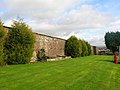 Outside the old walled garden.
 -
 The 'Thorntoun Sign' made by pupils from the old Dr. Barnardo's school.
 -
 The new driveway up to the nursing home.
 -
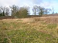
 The Thorntoun woodlands from near Busbiehill at the 1860s mineral railway crossing.
 -
 The Thorntoun woodlands from near Kirkland farm, Springside.
 -
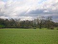 The Thorntoun woodlands from near Kirkland farm, Springside.
 -
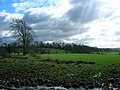
 Thorntoun Brae and bridge viewed from Springside.


See also
- Lambroughton
- Chapeltoun
- Cunninghamhead
- Corsehill
- A Researcher's Guide to Local History terminology
- Cunninghamhead, Perceton and Annick Lodge
- Laigh Milton viaduct
- Knockentiber
References
- ^ a b c d Robertson, George (1823). A Genealogical Account of the Principal Families in Ayrshire. Pub. A. Constable, Irvine.
- ^ a b Paterson, James (1866). History of the Counties of Ayr and Wigton. V.III. – Cunninghame. Pub. J. Stillie. Edinburgh.
- ^ Pont, Timothy(1604). Cuninghamia. Pub. Blaeu in 1654.
- ISBN 0-550-11801-2.
- ^ a b c d McNaught, *McNaught, Duncan (1912). Kilmaurs Parish and Burgh. Pub. A.Gardner.
- ^ Dobie, James (1876). Pont's Cunninghame topographized 1604-1608 with continuations and illustrative notices (1876). Pub. John Tweed.
- ^ Ainslie, John (1821). A Map of the Southern Part of Scotland.
- ^ Armstrong and Son. Engraved by S.Pyle (1775). A New Map of Ayr Shire comprehending Kyle, Cunningham and Carrick.
- ^ a b Thomson, John (1828). A Map of the Northern Part of Ayrshire.
- ^ a b Thompson, George, Head Gardener. Thorntoun Nursing Home. 2007. Oral Communication to Griffith, Roger S. Ll.
- ^ Strawhorn, John and Boyd, William (1951). The Third Statistical Account of Scotland. Ayrshire. Pub. Edinburgh.
- ^ a b Springside's Auld Lang Syne (2002). Springside Women's Health Group. P. 2.
- ^ Taylor, G. and Skinner, A. (1776) 'Survey and maps of the roads of North Britain or Scotland'
- ^ Stephen, Walter M. (1967-68). Milestones and Wayside Markers in Fife. Proc Soc Antiq Scot, V.100. P. 184.
- ISBN 0-903505-17-7. P. 76
- ^ Strawhorn, John and Boyd, William (1951). The Third Statistical Account of Scotland. Ayrshire. Pub. P. 475
- ^ Springside's Auld Lang Syne (2002). Springside History Group. P. 13.
- ^ Aikman, J & Gordon, W. (1839) An Account of the Tournament at Eglinton. Pub. Hugh Paton, Carver & Gilder. Edinburgh. M.DCCC.XXXIX. P. 8.