
Tybee Island, Georgia
Tybee Island, Georgia | ||
|---|---|---|
 Tybee Island Lighthouse. | ||
|
FIPS code 13-78036[3] | | |
| GNIS feature ID | 0333294[2] | |
| Website | www | |
Tybee Island is a city and a barrier island in Chatham County, Georgia, 18 miles (29 km) east of Savannah. The name "Tybee Island" is used for both the island and the city, but geographically they are not identical: only part of the island's territory lies within the city.
The island is Georgia's easternmost point. The phrase "From
As of the
Officially renamed Savannah Beach in a publicity move in 1929,
The U.S. Air Force accidentally dropped an atomic bomb into the sea off Tybee Island during a botched 1958 military training exercise. Though the "Tybee Bomb" did not detonate (according to some reports, it was never armed with a fuse), there has been ongoing concern because the Mark 15 nuclear bomb lost during the mishap was never recovered.
History
Native Americans, using dugout canoes to navigate the waterways, hunted and camped in Georgia's coastal islands for thousands of years. The Euchee tribe likely inhabited the island in the years preceding the arrival of the first Spanish explorers in the area in the 16th century. Tybee is the Euchee word for "salt".
In 1520, the Spanish laid claim to what is now Tybee Island and named it Los Bajos. It was at the northern end of the
Lighthouse
_Light_Station_July_2012_(7803503984).jpg)
Tybee Island's strategic position near the mouth of the
Today, the Tybee Lighthouse is a popular tourist destination, having all of its support buildings on the 5-acre (20,000 m2) site historically preserved. The current black-and-white tower markings are a reversion to its fourth day mark, first used in 1916. The Tybee Island Light Station is one of just a handful of 18th-century lighthouses still in operation in North America.
Civil War
During the
Fort Screven historic district
Fort Screven was first commissioned in 1898[7] and named for Brigadier General James Screven, a Revolutionary War hero killed in action near Midway, Georgia, in 1778. The fort served as a valuable part of coastal defense until it was decommissioned in 1947. Fort Screven is most notable for one of its former commanding officers, General of the Army George C. Marshall, later the architect of the Marshall Plan that helped rebuild Western Europe after World War II. Approximately 70 fort buildings still remain. The entire Fort Screven district was placed on the National Historic Register in 1982. One of the most important remaining structures is the Tybee Post Theater, constructed in 1930. It was one of Georgia's first theaters to have sound features and was the highlight of the fort's recreational activities. Other remaining buildings include the recently restored guard house, the bakery (now a private home), and barracks (now apartments). The ruins of the beach fortifications are also extant, and of the six original batteries, Battery Garland (built in 1899) is accessible to the public. Battery Garland houses the Tybee Museum. Another remaining area is Officer's Row, a group of original homes with a sweeping ocean view, one of which is now a bed and breakfast.
Resort period
During the late 19th century, at the height of the Industrial Revolution, residents in large, polluted cities frequently sought out remote beaches for summertime getaways. Clear, saltwater breezes were thought to be remedies for numerous ailments, including asthma and certain allergies.[8] Steamships began carrying patients and tourists to Tybee Island just after the Civil War.[9] In 1887, the Central of Georgia Railway completed a line to Tybee Island, opening it to a wave of summer tourists.[9] The railroad built the Tybrisa Pavilion in 1891, and by the end of the decade, several hundred summer cottages dotted the island.[9]
In the 1920s, U.S. Route 80 was completed, connecting Tybee Island via road with the mainland. The Tybrisa Pavilion became a popular stop for big band tours and performers included Bing Crosby, Tommy Dorsey, and Blue Steele. The pavilion also housed a bowling alley and roller skating rink.[10] Development continued to push toward the island's southern tip. By 1940, the island had four hotels, including the Desoto Hotel and Hotel Tybee, and numerous smaller lodges. The Tybrisa Pavilion burned down in 1967, and was replaced by the Tybee Pier and Pavilion in 1996.[11]
Cecil B. Day opened the first Days Inn on Tybee Island in 1970.[12]
Tybee Bomb
On February 5, 1958, a
Shark attacks
On June 15, 2016, the Tybee city council voted 4–1 to withhold shark attack numbers where the attacks did not result in loss of life. According to the Savannah Morning News, the vote was a direct result of pressure from local businesses that had seen a decline in tourism due to recent reported shark activity.[15]
Geography

Tybee Island is located at 32°0′24″N 80°50′58″W / 32.00667°N 80.84944°W (32.006672, -80.849374).[16] The island is the north easternmost of Georgia's Sea Islands, which comprise the outer section of the state's Lower Coastal Plain region. Like the other Sea Islands, Tybee consists of a sandy beach on its eastern shore and a tidal salt marsh on its western shore. The interior consists of a maritime forest (the density of which has been reduced by development) and freshwater sloughs.[17]
The Savannah River empties into the Atlantic Ocean just north of Tybee Island, placing the island in a strategic location. To the west, the marsh-lined Lazaretto Creek splits the island off from McQueens Island (the 2-mile (3 km) stretch between the main western shore of Tybee Island and Lazaretto Creek is mostly marshland). Tybee Creek flows along the south shore of Tybee Island and joins the Atlantic at the island's southeastern tip. Little Tybee Island, which consists mostly of protected wetlands, lies across Tybee Creek to the southwest. The size of the sandy beach at the southern tip of Tybee Island varies considerably in response to tidal changes.
According to the United States Census Bureau, the city has an area of 5.2 miles (8.3 km), of which 3.7 miles (6.0 km) is land and 1.4 miles (2.3 km), or 27.2%, is water.[18] The entire island (as distinguished from the city of the same name) has a land area of 21.871 square miles (56.65 km2).[citation needed]
Climate
Tybee Island has hot weather in summer, while in winter the weather is cool with winds.[19] The temperature typically varies from 45 °F to 88 °F and is rarely below 33 °F or above 93 °F.[20] The below table shows the monthly average temperatures:
| Date | Average
low |
Average
high |
Record
low |
Record
high |
Average
precipitation |
Average
snow |
| January | 40 °F | 60 °F | 4 °F (1985) | 85 °F (1985) | 4.37" | 0.1" |
| February | 43 °F | 63 °F | 15 °F (1958) | 84 °F (1986) | 3.3" | 0" |
| March | 49 °F | 69 °F | 21 °F (1980) | 90 °F (1963) | 3.78" | 0" |
| April | 55 °F | 75 °F | 32 °F (1989) | 95 °F (1986) | 3.24" | 0" |
| May | 63 °F | 82 °F | 37 °F (1963) | 99 °F (1986) | 2.95" | 0" |
| June | 71 °F | 86 °F | 45 °F (1997) | 101 °F (1986) | 5.07" | 0" |
| July | 74 °F | 89 °F | 50 °F (1968) | 107 °F (1986) | 6.15" | 0" |
| August | 73 °F | 88 °F | 53 °F (1986) | 103 °F (1954) | 8.23" | 0" |
| September | 69 °F | 84 °F | 46 °F (1967) | 98 °F (1985) | 5.84" | 0" |
| October | 59 °F | 77 °F | 32 °F (1976) | 97 °F (1986) | 3.78" | 0" |
| November | 50 °F | 70 °F | 23 °F (1970) | 88 °F (1961) | 2.68" | 0" |
| December | 43 °F | 62 °F | 10 °F (1983) | 83 °F (1984) | 3.13" | 0" |
Demographics
| Census | Pop. | Note | %± |
|---|---|---|---|
| 1900 | 381 | — | |
| 1910 | 786 | 106.3% | |
| 1920 | 117 | −85.1% | |
| 1930 | 202 | 72.6% | |
| 1940 | 644 | 218.8% | |
| 1950 | 1,036 | 60.9% | |
| 1960 | 1,385 | 33.7% | |
| 1970 | 1,786 | 29.0% | |
| 1980 | 2,240 | 25.4% | |
| 1990 | 2,842 | 26.9% | |
| 2000 | 3,392 | 19.4% | |
| 2010 | 2,990 | −11.9% | |
| 2020 | 3,114 | 4.1% | |
| U.S. Decennial Census[21] | |||

| Race | Num. | Perc. |
|---|---|---|
White (non-Hispanic)
|
2,859 | 91.81% |
Black or African American (non-Hispanic)
|
27 | 0.87% |
Native American
|
15 | 0.48% |
Asian
|
37 | 1.19% |
Pacific Islander
|
3 | 0.1% |
Other/Mixed
|
112 | 3.6% |
Latino
|
61 | 1.96% |
As of the 2020 United States census, there were 3,114 people, 1,305 households, and 831 families residing in the city.
Crime rate
Tybee's violent crime rate is lower than Georgia's but its property crime rate is higher. The table below shows the rate of crime per 100,000 people.
| Statistic | Tybee Island/100k people | Georgia/100k people | National/100k people |
| Murder | 0.0 | 6.6 | 5.3 |
| Rape | 0.0 | 34.0 | 40.4 |
| Robbery | 32.0 | 118.4 | 102.8 |
| Assault | 96.0 | 238.5 | 248.5 |
| Violent crime | 128 | 398 | 386 |
| Burglary | 192.1 | 614.4 | 468.9 |
| Theft | 3,713.2 | 2,130.1 | 1,745.0 |
| Vehicle theft | 96.0 | 259.9 | 236.9 |
| Property crime | 4,001 | 3,005 | 2,451 |
Events
Every year since 1987, Tybee Island has had a Beach Bum parade, traditionally held in May the weekend before Memorial Day weekend. The parade route comes down Tybee's main road, Butler Avenue, and when parade floats come by onlookers have been known to shoot each other with water guns.[23]
Tybee Pirate Fest, which began in 2005, is typically held the weekend before Columbus Day.[24]
Tybee Island was formerly home to "Orange Crush," an annual beach party attracting thousands of students from historically Black colleges and universities. The 2019 event was canceled after an organizer was arrested, and future events were moved to Jacksonville Beach, Florida, with organizers citing "lack of resources, limited parking, civil rights violations, and political injustices."[25]
Education

Tybee Island is part of the
There is also a public charter school on the island.[28]
Photo gallery
-
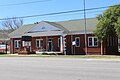 City Hall
 -
 Sunrise from the Tybee Pier
 -
 Fort Screven and the North Beach, viewed from the Tybee Lighthouse
 -
 Tybee Pier and Pavilion
 -
 Tybrisa Street
 -
 Tybee Island Pier in Savannah, Georgia
 -
 The south tip of Tybee Island at low tide
 -
 Lazaretto Marsh, off the western shore of Tybee Island
 -
 Sunrise over north beach
 -
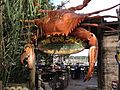 Entrance to The Crab Shack, a popular spot on Tybee Island


See also
- Burton 4-H Center
- Battle of Fort Pulaski
References
- ^ "2020 U.S. Gazetteer Files". United States Census Bureau. Retrieved December 18, 2021.
- ^ a b U.S. Geological Survey Geographic Names Information System: Tybee Island, Georgia
- ^ "U.S. Census website". United States Census Bureau. Retrieved 2008-01-31.
- ^ The legal citation is Ga. L. 1929, p.1380.
- ^ "Tybee Island Beach Management Plan Archived 2012-03-05 at the Wayback Machine." Page 3. Retrieved: 9 September 2008.
- ^ Mary Landers, City wants to buy two Civil War battery sites. Retrieved: 22 January 2009.
- ^ Quatrefoil Consulting (June 2017). "CITY OF TYBEE ISLANDHISTORIC RESOURCES SURVEYPHASE II". City of Tybee.
- ^ Adrienn Mendonca, "Tybee Island." New Georgia Encyclopedia. Retrieved: 9 July 2011.
- ^ a b c "Tybee Island Beach Management Plan Archived 2012-03-05 at the Wayback Machine." Retrieved: 9 September 2008.
- ^ "Tybee Pier and Pavillion". Film Savannah. Retrieved 2023-09-13.
- ^ Tybee Island Pier & Pavilion." Retrieved: 9 September 2008.
- ISBN 9780824604257.
- ^ Air Force Nuclear Weapons and Counterproliferation Agency, "Air Force Search & Recovery Assessment of the 1958 Savannah GA-B47 Accident." 12 April 2001. Retrieved: 11 September 2008.
- ^ a b c "SavannahNOW | Air Force: Duke found dirt - 06/17/2005". Old.savannahnow.com. Retrieved 2010-05-08.
- ^ "SavannahNOW | Sharks bad for business - 06/17/2016". Old.savannahnow.com. Retrieved 2010-05-08.[permanent dead link]
- ^ "US Gazetteer files: 2010, 2000, and 1990". United States Census Bureau. 2011-02-12. Retrieved 2011-04-23.
- ^ Adrienn Mendonca, "Tybee Island Archived 2012-09-08 at archive.today." New Georgia Encyclopedia, 3 June 2005. Retrieved: 9 September 2008.
- ^ "Geographic Identifiers: 2010 Demographic Profile Data (G001): Tybee Island city, Georgia". U.S. Census Bureau, American Factfinder. Archived from the original on February 12, 2020. Retrieved July 21, 2014.
- ^ "Intellicast - Tybee Island Historic Weather Averages in Georgia (31328)". intellicast.com. Retrieved 2018-10-20.
- ^ "Tybee Island Climate, Weather by Month, Average Temperature (Georgia, United States) - Weather Spark".
- ^ "Census of Population and Housing". Census.gov. Retrieved June 4, 2015.
- ^ "Explore Census Data". data.census.gov. Retrieved 2021-12-14.
- ^ Savannah Now, 8/19/2010. http://savannahnow.com/do/2010-05-19/annual-beach-bum-parade-tybee-island-friday
- ^ "8th Annual Tybee Island Pirate Fest". Key to Savannah. Retrieved 21 October 2016.
- ^ Cawthon, Graham (25 March 2021). "No more Orange Crush? Annual event leaving Tybee Island, organizers cite 'civil rights violations'". WCJL. Retrieved 12 May 2021.
- ^ "Chatham County Schools". Chatham County Schools. Archived from the original on 2014-11-29. Retrieved 2012-06-16.
- ^ "Chatham County School District". World Media Group, LLC. Retrieved 2012-06-16.
- ^ "Home - Tybee Island Maritime Academy". tybeeislandmaritimeacademy.com.
External links
Municipalities and communities of Chatham County, Georgia, United States | ||
|---|---|---|
| Cities |  | |
| Towns | ||
| CDPs | ||
| Unincorporated communities | ||
| ||
| International | |
|---|---|
| National | |
| Other | |