
Walbury Hill
| Walbury Hill | |
|---|---|
County Top, Hardy | |
| Coordinates | 51°21′08″N 1°27′57″W / 51.35226°N 1.46577°W |
| Geography | |
 Walbury Hill Walbury Hill in Berkshire | |
| Location | North Hampshire Downs |
| OS grid | SU373616 |
| Topo map | OS Landranger 174 |
Walbury Hill is a summit of the
Walbury Hill lies on the north-facing ridgeline of the
The hill is accessible by minor roads at both its western and eastern sides, and there are car parks at the closest point of approach of each road. There is no
The hill lies within the civil parishes of Combe (which includes the summit), Inkpen and West Woodhay, all of which are within the unitary authority area of West Berkshire and the ceremonial county of Berkshire.[note 2] It forms part of the Kirby House estate, owned by the Astor family.[3][5]
Before the use of satellites was commonplace, Walbury Hill was occasionally used by the BBC as a temporary relay station during events at Newbury Racecourse. There is a small low-level circular brick building, approximately 6 feet (1.8 metres) high, on the south side of the hill, which appears to be a disused reservoir.[citation needed]
Gallery
-
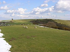 View of Walbury Hill from Combe Gibbet to the west
 -
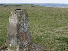 The triangulation pillar, looking west towards Coombe Gibbet
 -
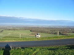 View looking north from Walbury Hill Car Park
 -
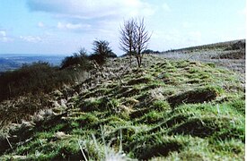 The remains of the hill fort


Notes
- ^ Walbury Hill is 3 metres (10 ft) higher than Leith Hill in Surrey.
- ^ The summit of Walbury Hill became part of Berkshire when the civil parish of Combe was transferred from Hampshire in 1895. Pilot Hill, two miles (three kilometres) southeast, is now the highest point in Hampshire.
References
- ^ ISBN 978-1-84-953239-6.
- ^ "Facts about South East England".
- ^ ISBN 9780319243510.
- ^ a b "North Wessex Downs Area of Outstanding Natural Beauty - Integrated Landscape Character Assessment" (PDF). Archived from the original (PDF) on 6 February 2017. Retrieved 5 February 2017.
- ^ "The thirty landowners who own half a county". Who owns England?.