
Waterdown, Ontario
Flamborough | |
|---|---|
Dissolved village | |
 Waterdown Public Library | |
|
EDT ) |


Waterdown is a village in Canada which since 2001 has been a community of Hamilton, Ontario. Waterdown is approximately 60 km west of downtown Toronto. Waterdown, as of 2021, has a population of approximately 24,400 residents.
On January 1, 2001 the new city of Hamilton was formed from the amalgamation of six municipalities that made up the
Waterdown was created from that part of East Flamborough Township on the edge of the
In 1974, the village was amalgamated with East Flamborough, West Flamborough and Beverly townships to form the Town of Flamborough. In 2001, Flamborough and five other municipalities were amalgamated into the City of Hamilton.
Waterdown has seen significant commercial development, including opening an expansive YMCA facility. Waterdown population growth was approximately 28.9% over the years 1996 and 2001. In 2012, the average house price in Waterdown was nearly $400,000.[3]
Waterdown District High School (WDHS) expanded its facilities in 2012.
History

Indigenous Nations
Perched atop the Niagara Escarpment, the area that became Waterdown has been inhabited for thousands of years. Professor John Triggs of Wilfrid Laurier University found evidence of Algonquin-speaking Aboriginals from as far back as 7,500 BCE.
Following the war, the area around Waterdown was sparsely inhabited by
Robert de la Salle explores Flamborough
1669 saw French explorer Robert de la Salle follow Spencer Creek (from Lake Ontario) up toward present-day Westover and the Indigenous settlement of Tinawatawa. Here, la Salle met up with another French explorer, M. Louis Joilet. Some historians think this meeting happened along the shores of Lake Medad (northeast of present-day Waterdown, beside Hidden Lake Golf Club).[5]
British Conquest of 1760 and the American Revolution
After the fall of New France, the region changed dramatically. The Anishinabe allied with the British Crown, which was reaffirmed by
The area remained largely unaffected until the
The Flamborough area came into Treaty with the Crown on May 22, 1784 (formally confirmed by Treaty No.3 in 1792). The frontline of the new township was laid out by John Collins in 1790, with further surveys conducted through 1797. It was intended to be the Township of Flamborough but was broken into the separate entities of East Flamborough and West Flamborough in 1798. Today, Waterdown is the largest settlement in the former township of East Flamborough.[6]
Alexander Brown and Merren Grierson

One of the first land grants in the area was to
Ebenezer Griffin – the founder of Waterdown
The arrival of entrepreneur Ebenezer Culver Griffin in 1823, purchasing over half of Alexander Brown's property, marked the beginning of the Village of Waterdown. It was Griffin who had his property surveyed into village lots in 1830. The post office dates from 1840.[9]
The name "Waterdown"
A local story credits Ebenezer Griffin with giving Waterdown its name. A
A secondary story with a more plausible reality exists from the early pioneers of this area, naming Waterdown after Waterdown Forest in the UK. This area was a military encampment area that existed in 1782, extending from Tunbridge Wells in Kent in the north-west and Frant in Sussex. Many of the small towns and hamlets around Waterdown have been named after the exact named locations throughout the UK.
Industrial Revolution

Waterdown was born out of the
Convent and academy
In 1927, the School Sisters of Notre Dame opened a Motherhouse in rural Waterdown and subsequently opened a private Catholic girls' school called Notre Dame Academy; classes started on 14 February 1927 with three teachers and 32 attendees. In addition to classrooms, the property included a residence for boarding students.[12] The school was closed in 1993, but the convent continued to function and was renovated in 1997. Nuns continued to live there as the convent became a retirement home; as recently as summer 2019, 54 elderly nuns still reside there.[13] The property was then put up for sale and plans were made move 300 bodies and gravestones from the cemetery to a nearby Catholic cemetery. Plans were also being made to relocate the residents of the convent.[14]
2001 amalgamation
Ontario's
However, despite a local campaign to sway the government, Waterdown was amalgamated into Hamilton with the rest of Flamborough. This prompted the elected Member of Provincial Parliament at the time, Conservative Toni Skarica, to resign. Skarica ran (and won) partially due to a platform of keeping Flamborough unamalgamated and vowed to resign if the government forced an amalgamation with Hamilton. His stance gave him a brief local celebrity status during that time.
Souharissen Natural Area


On August 21, 2014, the Souharissen Natural Area was dedicated in Waterdown by
The Souharissen Natural Area covers 27 acres in the Village of Waterdown. It is the result of years of work following the discovery of 104 Indigenous archeological sites in the Waterdown Bay Development Area in 2005.
Along with the Indigenous sites, the foundations of an early 19th-century dwelling were uncovered in the area. This dwelling may have been used by the first European settlers of Waterdown, Alexander Brown and Merren Grierson. The Natural Area includes a plaque identifying this important landmark, as well as detailing the histories of Merren Grierson and Alexander Brown, which was unveiled by the Lieutenant Governor, Chief LaForme, and researcher Kekoa Reinebold.
Later that day, a community feast was held in Waterdown at a local residence in honour of the return of the Mississaugas of the New Credit First Nation to Flamborough, as well as the visit by the Lieutenant Governor of Ontario and Chief of the Mississaugas of the New Credit. Everyone who was part of the dedication, including the Lieutenant Governor and Chief Laforme, attended.[15]
The Queen's Bench
Flamborough has a tradition of honouring royal milestones, including the "Queen's Trees" in Harpers Corners, located outside the library and at Memorial Park. On September 9, 2015, the Honourable
Natural attractions
Waterdown, and its associated
The Smokey Hollow Falls powered a sawmill and gristmill when the town was founded, and later several other small mills, and as a result of demand on the limited water supply, time shared the water. The last operating sawmill (Slater's Lumber Mill) continued to produce lumber well into the 1970s. It was located along Grindstone Creek behind the Knox Presbyterian Church at the corner of Mill Street North and Church Street. During the 1950s and mid-1960s, the mill used horses and heavy tackle to haul the logs to the cutting area. Today, only remote foundation ruins of the mills remain, although a lookout over the falls and a signboard detailing the area's history is in place.[17]
Furthermore, Waterdown has many wetland trails at the eastern end of town, which are well-marked and have informational signage.[18]
Other attractions
Waterdown is also home to a hockey arena, Harry Howell Arena, which is home of the Flamborough Hockey Association,[19][20] the Flamborough Girls Hockey Association, and the Flamboro Skating Club.[21]
Each July 1 weekend, Waterdown hosts the Oh Canada! Ribfest,[22] a joint community-focused event sponsored by the Rotary Clubs of Flamborough AM[23] and Waterdown.[24] Tens of thousands of people from Waterdown and surrounding communities fill Memorial Park enjoying local music artists, dancers, midway rides, kids' activities, and food.
Notable people
- First World War
- Dylan Everett, (1995–) Gemini-nominated actor known for his roles in Canadian teen comedies and dramas
- World Junior Hockey Championships.[25]
- Terra Lightfoot, country and roots rock performer
- Douglas McGregor, WW1 flying ace
- Erin Pitt, (1999–) actress, best known for her role as Isabelle in An American Girl: Isabelle Dances into the Spotlight
- Josh Ross, country music singer and songwriter
- Carter Verhaeghe, (1995–), National Hockey League (NHL) player
- Mark Visentin, (1992–) Ice hockey player
- John Williams, Jr., (1977–), Canadian Football League (CFL) player
-
 Watertower
 -
 Waterdown, Great Falls
 -
 Waterdown, Great Falls
 -
 Waterdown, Great Falls
 -
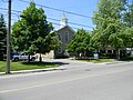 Waterdown's Public Library


References
- ^ "About Us – Village Theatre Waterdown". Retrieved 2021-01-18.
- ISBN 1-896899-22-6.
- ^ "Sold! Housing boom brings radical changes to a new Waterdown". 2013-08-04. Retrieved 2015-06-14.
- ISBN 978-0-9734438-1-3.
- ^ Mills, Stanley (1937). Lake Medad. Hamilton.
{{cite book}}: CS1 maint: location missing publisher (link) - ISBN 978-0-9734438-1-3.
- ISBN 978-0-921592-50-1.
- ^ Tidridge, Nathan (2015). The Extraordinary History of Flamborough. waterdown: Flamborough Heritage Society.
- ISBN 0-7715-9754-1.
- ^ Parker and Woods, Allan and Diane (1984). Exploring the Past: Waterdown. Waterdown: W.L. Printing Limited.
- ISBN 9780665094125. Retrieved June 13, 2020.
- ^ "Canada". School Sisters of Notre Dame. Retrieved June 13, 2020.
- ^ "Notre Dame Academy turns 80". InsideHalton.com. Metroland Media Group. June 3, 2007. Retrieved June 13, 2020.
- ^ Clark, Katrina (July 10, 2019). "Remains of 300 nuns to be exhumed from Waterdown convent cemetery". The Toronto Star. Retrieved June 13, 2020.
- ^ N. Tidridge. "Souharissen Natural Area". Retrieved June 13, 2020.
- ^ N. Tidridge. "The Queen's Bench at Memorial Park". Retrieved June 13, 2020.
- ^ "City of Waterfalls". Cityofwaterfalls.ca. Retrieved August 22, 2008.
- ^ Hamilton Waterfalls and Cascades: Research & Inventory Report, 2nd Edition. Hamilton Conservation Authority. November 2007. pp. 22–44.
- ^ "Hamilton Arenas Listing". Retrieved 2008-08-22.
- ^ "Arenas Maps: Ontario". Retrieved 2008-08-22.
- ^ "Flamboro Skating Club". flamboroskatingclub.com. Retrieved 2016-01-04.
- ^ "Oh Canada Ribfest". Oh Canada Ribfest. Retrieved 2016-01-04.
- ^ "Flamborough AM - Home Page". portal.clubrunner.ca. Retrieved 2016-01-04.
- ^ "Waterdown - Home Page". portal.clubrunner.ca. Retrieved 2016-01-04.
- ISBN 978-0-385-66093-8.
External links
- Watedown BIA
- Flambourough Chamber of Commerce
- Waterdown Ontario Online - Waterdown & Flamborough Community Website
- The Waterdown Ghost: From Waterdown Heritage
43°20′N 79°53′W / 43.333°N 79.883°W
| International | |
|---|---|
| National | |
| Geographic | |