
Xuancheng
Xuancheng
宣城市 Suancheng | ||
|---|---|---|
License Plate Prefix 皖P | | |
| Website | www | |
Xuancheng (
History

Archeological digs in Xuancheng have found pottery and stoneware indicative of the Liangzhu Culture.[4]
During the Spring and Autumn period, the area belonged to the State of Wu, although, upon the decline of Wu, the area was also ruled by the State of Chu and the State of Yue, respectively.[4]
Under the
Xuancheng became a prefecture-level city in 2000.[5]
Geography and Climate

Its terrain is varied and complicated, basically sloping downward from the south to the north. Its
The city has a subtropical humid
| Climate data for Xuancheng (1991–2020 normals, extremes 1981–2010) | |||||||||||||
|---|---|---|---|---|---|---|---|---|---|---|---|---|---|
| Month | Jan | Feb | Mar | Apr | May | Jun | Jul | Aug | Sep | Oct | Nov | Dec | Year |
| Record high °C (°F) | 22.4 (72.3) |
28.6 (83.5) |
33.5 (92.3) |
34.8 (94.6) |
36.6 (97.9) |
38.1 (100.6) |
40.5 (104.9) |
40.2 (104.4) |
39.5 (103.1) |
34.0 (93.2) |
29.5 (85.1) |
24.3 (75.7) |
40.5 (104.9) |
| Mean daily maximum °C (°F) | 7.8 (46.0) |
10.8 (51.4) |
15.7 (60.3) |
22.1 (71.8) |
27.0 (80.6) |
29.4 (84.9) |
33.2 (91.8) |
32.6 (90.7) |
28.2 (82.8) |
23.1 (73.6) |
17.1 (62.8) |
10.5 (50.9) |
21.5 (70.6) |
| Daily mean °C (°F) | 3.5 (38.3) |
5.9 (42.6) |
10.4 (50.7) |
16.5 (61.7) |
21.6 (70.9) |
24.9 (76.8) |
28.4 (83.1) |
27.9 (82.2) |
23.5 (74.3) |
17.8 (64.0) |
11.5 (52.7) |
5.5 (41.9) |
16.5 (61.6) |
| Mean daily minimum °C (°F) | 0.3 (32.5) |
2.4 (36.3) |
6.3 (43.3) |
11.9 (53.4) |
17.2 (63.0) |
21.3 (70.3) |
24.7 (76.5) |
24.4 (75.9) |
20.0 (68.0) |
13.8 (56.8) |
7.5 (45.5) |
1.8 (35.2) |
12.6 (54.7) |
| Record low °C (°F) | −10.2 (13.6) |
−10.0 (14.0) |
−3.6 (25.5) |
1.4 (34.5) |
8.7 (47.7) |
12.7 (54.9) |
18.3 (64.9) |
18.0 (64.4) |
11.0 (51.8) |
2.2 (36.0) |
−4.8 (23.4) |
−12.8 (9.0) |
−12.8 (9.0) |
| Average precipitation mm (inches) | 79.2 (3.12) |
77.8 (3.06) |
118.0 (4.65) |
118.7 (4.67) |
132.7 (5.22) |
255.0 (10.04) |
197.0 (7.76) |
147.8 (5.82) |
86.4 (3.40) |
67.7 (2.67) |
66.9 (2.63) |
51.2 (2.02) |
1,398.4 (55.06) |
| Average precipitation days (≥ 0.1 mm) | 11.7 | 11.3 | 13.8 | 12.4 | 12.7 | 14.0 | 13.2 | 13.0 | 9.7 | 8.6 | 10.0 | 8.8 | 139.2 |
| Average snowy days | 4.0 | 2.0 | 0.6 | 0 | 0 | 0 | 0 | 0 | 0 | 0 | 0.3 | 1.2 | 8.1 |
| Average relative humidity (%)
|
80 | 78 | 76 | 74 | 75 | 81 | 80 | 80 | 81 | 79 | 80 | 78 | 79 |
| Mean monthly sunshine hours | 109.4 | 116.2 | 140.8 | 163.9 | 180.0 | 148.6 | 210.0 | 203.4 | 164.4 | 165.3 | 143.1 | 131.7 | 1,876.8 |
| Percent possible sunshine | 34 | 37 | 38 | 42 | 42 | 35 | 49 | 50 | 45 | 47 | 45 | 42 | 42 |
| Source: China Meteorological Administration[7][8] | |||||||||||||
Administration
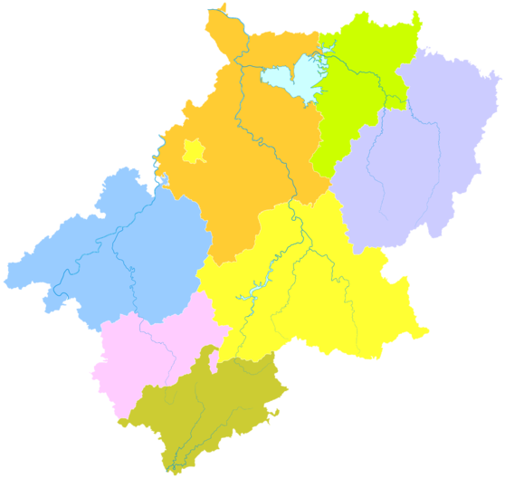
Xuancheng City administers seven
- Xuanzhou District(宣州区)
- Ningguo City (宁国市)
- Guangde City (广德市)
- Langxi County (郎溪县)
- Jing County (泾县)
- Jixi County (绩溪县)
- Jingde County (旌德县)
| Map |
|---|
These are further divided into 115
Language and culture
In Xuancheng,
Xuancheng is a city with 2,000 years of history and cultural relics. It has a profound cultural heritage and rich tourism resources. There are many scenery resorts, such as the country's largest captive breeding bases—Chinese Crocodile Lake, one of the four unique scenes – Taiji Cave, Peach Blossom Pool, Jing Ting Mountain, Zhangshan Canyon, and cultural sites of the New Fourth Army, the Ancestral Hall of the Hu Family in Jixi, the former residence of Mr. Hu Shih, the Jiang's Village in Jingde, and so on. Since reform and opening up, the city has achieved a lot of progress, and is accelerating the development of municipal services, transport, tourism and other infrastructural facilities. Xuancheng, as a new city with pleasant environments of living, enterprising, sightseeing, is on the rise. The Ningguo Stadium is located in the city. The 12,000-capacity stadium is used mainly for association football matches.
Demographics

Its population was 2,500,063 as of 2020 census whom 774,332 lived in the built-up (or metro) area made of Xuanzhou District.
The city is home to 45
Economy
As of 2020, the city's
Xuancheng's
Xuancheng's major industrial products include
Xuancheng is known for its production of high quality Xuan paper (simplified Chinese: 宣纸; traditional Chinese: 宣紙), Xuan writing brushes (simplified Chinese: 宣笔; traditional Chinese: 宣筆), and Xuan ink stones (simplified Chinese: 宣砚; traditional Chinese: 宣硯), all of which are used in traditional Chinese calligraphy and painting.[citation needed] These products make up a large proportion of the city's exports.[citation needed]
Notable people
- essayist and diplomat, one of the leaders of China's New Culture Movement, former president of Peking University (in 1939 Hu Shih was nominated for a Nobel Prizein literature)
- People's Republic of China
- China Central Academy of Fine Arts
- Ren Xinmin (1915–2017): aerospace engineer and a specialist in astronautics and liquid rocket engine technology
- Hu Jintao (1942– ): former General Secretary of the Communist Party and President of China
- Mei Yaochen (1002–60), a major poet of the Northern Song Dynasty
Education
- Hefei University of Technology Xuancheng Campus
- Xuancheng High School
- Xuancheng Vocational & Technical college
Transportation
Rail
Xuancheng is served by the
References
- ^ Cox, W (2018). Demographia World Urban Areas. 14th Annual Edition (PDF). St. Louis: Demographia. p. 22.
- ^ "China: Ānhuī (Prefectures, Cities, Districts and Counties) - Population Statistics, Charts and Map".
- ^ "《安徽统计年鉴2022》电子查阅版". tjj.ah.gov.cn. Archived from the original on 2022-10-18. Retrieved 2022-10-18.
- ^ a b c d e f 历史沿革 [History] (in Chinese). Xuancheng Municipal People's Government. 2021-01-22. Archived from the original on 2021-05-03. Retrieved 2021-05-03.
- ^ a b c d e 宣城概况 [Xuancheng Overview] (in Chinese). Xuancheng Municipal People's Government. 2021-02-18. Archived from the original on 2021-05-03. Retrieved 2021-05-03.
- ^ Travel in Anhui
- ^ 中国气象数据网 – WeatherBk Data (in Simplified Chinese). China Meteorological Administration. Retrieved 30 July 2023.
- ^ "Experience Template" 中国气象数据网 (in Simplified Chinese). China Meteorological Administration. Retrieved 30 July 2023.
- ^ a b c 人口民族 [Population and Ethnicity] (in Chinese). Xuancheng Municipal People's Government. 2021-03-29. Archived from the original on 2021-05-03. Retrieved 2021-05-03.
- ^ a b c d e f g 经济发展 [Economic Development] (in Chinese). Xuancheng Municipal People's Government. 2021-03-29. Archived from the original on 2021-05-03. Retrieved 2021-05-03.
External links
- Xuancheng Government website (in Simplified Chinese)