
Beauregard Parish, Louisiana
Beauregard Parish | |
|---|---|
UTC−5 (CDT) | |
| Congressional district | 4th |
| Website | www |
Beauregard Parish (
Beauregard Parish comprises the DeRidder, LA
History
Spanish and French Rule
Until 1762, the land that would eventually become Beauregard Parish was a part of the Spanish holdings in Louisiana, as, at that time, the border between Spain and France was acknowledged as the Rio Hondo (now known as the Calcasieu river); however the land between the Rio Hondo and the Sabine river was in some dispute as the French were beginning to occupy land on the west side of the Rio Hondo. In 1762, King Louis XV of France secretly gave Louisiana to Spain in the Treaty of Fontainebleau. From 1762 to 1800, the region was a part of New Spain. In 1800, the secret Third Treaty of San Ildefonso transferred possession of Louisiana back to the French, although Spain continued to administer the land until 1803. In this period, the only European settlers to the land that would become Beauregard Parish were a few individuals with Spanish land grants.[4]
Neutral Ground
After the
-
 The Calcasieu River formed part of the eastern boundary of the Neutral Ground.
 -
 The Neutral Ground, orSabine River.


Parish origin
In 1804, the United States organized present-day Louisiana as the
The bill to create Beauregard Parish out of the northern area of Imperial Calasieu Parish was passed in 1912 and took effect at the beginning of 1913.
Parish organization
Although one faction wanted the town of Singer to be the parish seat, DeRidder was chosen by a majority of voters on October 15, 1912. (Today, the unincorporated community of Singer still exists and includes a
Native Americans
At least four tribes lived in Beauregard Parish around the time it was founded. One was about six miles south of Sugartown on Indian Branch, another was just north of the old W.B. Welborn home on Bundick Creek, another was along the mouth of Anacoco Creek and another at Merryville, across the street from where Merryville High School now stands.[7]
The 1941 military build-up
On November 28, 1941, a United Service Organizations was opened in DeRidder. (Of the more than 500 USO's opened during WW II, this was the first off-post USO to open in the U.S.) 89,000 soldiers visited the DeRidder USO; 15,000 took showers; and 27,000 viewed movies. The building was entered into the National Register of Historic Places on February 25, 1992.[8]
August through September 1941 saw the locally stationed military engaged in the Louisiana Maneuvers—the largest military maneuver in United States history (with more than 500,000 soldiers training for war).[9] The rapid influx of so many military personnel created problems that stemmed, in part, from alcohol overconsumption. In response, residents of Beauregard Parish voted to become a dry parish.
Law enforcement
The parish level police agency is the Beauregard Parish Sheriff's Office. The current Sheriff (2020)is Mark V. Herford
Geography
According to the
Major highways
- U.S. Highway 171
- U.S. Highway 190
 Louisiana Highway 12
 Louisiana Highway 26
 Louisiana Highway 27
Adjacent counties and parishes
- Vernon Parish (north)
- Allen Parish (east)
- Jefferson Davis Parish (southeast)
- Calcasieu Parish (south)
- Newton County, Texas (west)
Demographics
| Census | Pop. | Note | %± |
|---|---|---|---|
| 1920 | 20,767 | — | |
| 1930 | 14,569 | −29.8% | |
| 1940 | 14,847 | 1.9% | |
| 1950 | 17,766 | 19.7% | |
| 1960 | 19,191 | 8.0% | |
| 1970 | 22,888 | 19.3% | |
| 1980 | 29,692 | 29.7% | |
| 1990 | 30,083 | 1.3% | |
| 2000 | 32,986 | 9.6% | |
| 2010 | 35,654 | 8.1% | |
| 2020 | 36,549 | 2.5% | |
| U.S. Decennial Census[11] 1790-1960[12] 1900-1990[13] 1990-2000[14] 2010[15] | |||
| Race | Number | Percentage |
|---|---|---|
White (non-Hispanic)
|
29,039 | 79.45% |
Black or African American (non-Hispanic)
|
4,082 | 11.17% |
Native American
|
273 | 0.75% |
Asian
|
222 | 0.61% |
Pacific Islander
|
27 | 0.07% |
Other/Mixed
|
1,635 | 4.47% |
Latino
|
1,271 | 3.48% |
As of the 2020 United States census, there were 36,549 people, 13,520 households, and 9,219 families residing in the parish.
Education
Beauregard Parish School Board operates the parish public schools.[17]
It is in the service area of Sowela Technical Community College.[18]
National Guard
The
Communities

City
- DeRidder (parish seat and largest municipality)
Town
Unincorporated areas
Census-designated places
Unincorporated communities
National Register of Historic Places
There are 12 places listed on the National Register of Historic Places including the Beauregard Parish Courthouse, the Beauregard Parish Jail, the Beauregard Parish Training School, the DeRidder Commercial Historic District and the Burks House. See National Register of Historic Places listings in Beauregard Parish, Louisiana.
Politics
| Year | Republican | Democratic | Third party | |||
|---|---|---|---|---|---|---|
| No. | % | No. | % | No. | % | |
| 2020 | 13,575 | 82.99% | 2,542 | 15.54% | 240 | 1.47% |
| 2016 | 12,238 | 81.16% | 2,393 | 15.87% | 447 | 2.96% |
| 2012 | 11,112 | 78.12% | 2,828 | 19.88% | 285 | 2.00% |
| 2008 | 10,718 | 76.15% | 3,071 | 21.82% | 285 | 2.03% |
| 2004 | 9,470 | 71.30% | 3,666 | 27.60% | 145 | 1.09% |
| 2000 | 7,862 | 64.42% | 3,958 | 32.43% | 385 | 3.15% |
| 1996 | 5,526 | 44.21% | 4,925 | 39.40% | 2,048 | 16.39% |
| 1992 | 5,119 | 40.79% | 5,037 | 40.13% | 2,395 | 19.08% |
| 1988 | 6,466 | 57.30% | 4,704 | 41.69% | 114 | 1.01% |
| 1984 | 7,353 | 63.13% | 4,199 | 36.05% | 96 | 0.82% |
| 1980 | 5,250 | 47.47% | 5,556 | 50.24% | 253 | 2.29% |
| 1976 | 3,196 | 36.38% | 5,322 | 60.57% | 268 | 3.05% |
| 1972 | 4,955 | 69.41% | 1,728 | 24.21% | 456 | 6.39% |
| 1968 | 1,615 | 22.33% | 1,569 | 21.70% | 4,048 | 55.97% |
| 1964 | 3,349 | 52.34% | 3,049 | 47.66% | 0 | 0.00% |
| 1960 | 2,432 | 40.77% | 2,903 | 48.67% | 630 | 10.56% |
| 1956 | 2,711 | 52.68% | 2,276 | 44.23% | 159 | 3.09% |
| 1952 | 789 | 44.20% | 996 | 55.80% | 0 | 0.00% |
| 1948 | 449 | 12.93% | 1,653 | 47.60% | 1,371 | 39.48% |
| 1944 | 759 | 25.43% | 2,226 | 74.57% | 0 | 0.00% |
| 1940 | 528 | 16.47% | 2,677 | 83.53% | 0 | 0.00% |
| 1936 | 549 | 20.11% | 2,181 | 79.89% | 0 | 0.00% |
| 1932 | 146 | 5.92% | 2,319 | 94.08% | 0 | 0.00% |
| 1928 | 468 | 23.62% | 1,513 | 76.38% | 0 | 0.00% |
| 1924 | 235 | 16.47% | 1,191 | 83.46% | 1 | 0.07% |
| 1920 | 202 | 14.83% | 1,146 | 84.14% | 14 | 1.03% |
| 1916 | 59 | 5.73% | 968 | 94.07% | 2 | 0.19% |
See also
References
- ^ "Census - Geography Profile: Beauregard Parish, Louisiana". Retrieved January 21, 2023.
- ^ "Find a County". National Association of Counties. Archived from the original on July 12, 2012. Retrieved June 7, 2011.
- ^ a b Gremillion, John Berton (2008). "Beauregard Parish". library.mcneese.edu. McNeese State University. Archived from the original on January 30, 2015. Retrieved September 3, 2014.
- ^ a b [Claims to Land Between the Rio Hondo and Sabine Rivers in Louisiana. Communicated to the Senate January 31, 1825]
- ^ "The Adams-Onis Treaty of 1819". Archived from the original on July 15, 2009. Retrieved June 28, 2009. -Treaty
- ^ "Beauregard Tourist Commission - Travel information, Historical Landmarks, Travel Planner". Beauregard Tourist Commission. Retrieved March 9, 2018.
- ^ "Beauregard Parish, Louisiana Genealogical Records Information". Archived from the original on June 11, 2010. Retrieved July 8, 2010.
- ^ "The First USO". Archived from the original on May 9, 2008. Retrieved October 15, 2012.
- ^ "Louisiana Maneuvers (1940-41) | HistoryNet". www.historynet.com. November 25, 2008. Retrieved March 9, 2018.
- ^ "2010 Census Gazetteer Files". United States Census Bureau. August 22, 2012. Archived from the original on September 28, 2013. Retrieved August 20, 2014.
- ^ "U.S. Decennial Census". United States Census Bureau. Retrieved August 20, 2014.
- ^ "Historical Census Browser". University of Virginia Library. Retrieved August 20, 2014.
- ^ "Population of Counties by Decennial Census: 1900 to 1990". United States Census Bureau. Retrieved August 20, 2014.
- ^ "Census 2000 PHC-T-4. Ranking Tables for Counties: 1990 and 2000" (PDF). United States Census Bureau. Retrieved August 20, 2014.
- ^ "Beauregard Parish, Louisiana". quickfacts.census.gov. Archived from the original on June 7, 2011. Retrieved November 24, 2012.
- ^ "Explore Census Data". data.census.gov. Retrieved December 29, 2021.
- ^ "Find Schools in the USA and Canada". louisiana.schooltree.org. Retrieved March 9, 2018.
- Louisiana's Technical and Community Colleges. Retrieved June 3, 2021.
- ^ Ragley isn't incorporated according to the State's official website for Beauregard Parish Archived July 22, 2012, at the Wayback Machine
- ^ Leip, David. "Dave Leip's Atlas of U.S. Presidential Elections". uselectionatlas.org. Retrieved March 9, 2018.
External links
Geology
- Snead, J., P. V. Heinrich, and R. P. McCulloh, 2002, De Ridder 30 x 60 minute geologic quadrangle. Louisiana Geological Survey, Baton Rouge, Louisiana.
Places adjacent to Beauregard Parish, Louisiana | ||||||||||||||||
|---|---|---|---|---|---|---|---|---|---|---|---|---|---|---|---|---|
| ||||||||||||||||
| City | 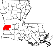 | |
|---|---|---|
| Town | ||
| CDPs | ||
| Other communities | ||
| Ghost town |
| |
| Footnotes | ‡This populated place also has portions in an adjacent parish or parishes | |
| ||
| International | |
|---|---|
| National | |
| Geographic | |
| Other | |