
Bramhope
| Bramhope | |
|---|---|
West Yorkshire | |
| Ambulance | Yorkshire |
| UK Parliament | |
Bramhope is a village and
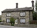
The village is 9 miles (14 km) north of Leeds city centre and it is in the LS16 Leeds postcode area. According to the 2001 census the parish had a population of 3,400.[1] The population had increased to 3,533 at the 2011 Census.[2] It is predominantly made up of large, privately owned houses which tend to be above the average value for properties in West Yorkshire.
Bramhope sits in the
Etymology
The place-name Bramhope appears first in the
History

The earliest known settlement in the area was a British camp established off Moor Road. The
In 1086, Bramhope was the manor of an
The village had a small population until the 20th century. The
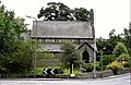
Churches
At the
When the chapel proved too small for the growing population, St Giles' Church was built in 1881.
Road and railway

For many centuries travellers to the market towns in the vicinity used Otley Old Road. However, it was the Leeds to Otley turnpike road, with its tollhouses, opened in 1842, which routed travellers through the outskirts of Bramhope. It is along this route that motorists today travel between Leeds and the northwest. The milestones along the road were erected in 1850.[5]
The
Schools
A village school was built in Eastgate where the
Community

Bramhope has a Round Table, which organises activities to raise money for charity.[10] Bramhope has a cricket club which plays at the Recreation Ground on Old Lane. The club plays in the Leeds and Wetherby Cricket League and has two senior teams.[11]
Memorial Hall
Robert Craven Memorial Hall (originally the Craven Institute, 1896) was part of the bequest of Robert Craven, a local farmer. It is now the village hall and administered as a registered charity. It has a crown bowling green, car park and tennis courts. Inside there are various rooms plus a large hall with stage, which doubles as a badminton court.[12] On the second Saturday of every month a farmer's market is hosted at this hall.[13] The memorial hall also hosts a yearly flower show in the autumn,[14] and a bridge club.[15]
Bramhope Scout Campsite
The 13-acre Bramhope Scout Campsite, to the west of the village, is owned by Central Yorkshire Scouts.[16]
Listed buildings

- Grade I buildings: Puritan Chapel, Otley Road (north side).[17]
- Grade II buildings: Farmhouse at 1 Church Hill;[18] Barn about 5 metres west of Old Manor Farmhouse;[19] Old Manor Farmhouse (rear portion only);[20] Weaver's Cottage, 4 Eastgate;[21] Methodist Church, Eastgate, north side;[22] Gazebo on north-east corner of garden of Belvedere, Hall Drive (south side);[23] Manor House, Manor Close (north side);[24] Sighting tower, south side of Moorland Road;[25] The Hollies, Old Lane (north side);[26] Portal to north entrance to Bramhope railway tunnel.[27]
- Grade II Mileposts: Milepost on east corner of junction with Church Hill and Ditley Road (south side);[28] Milepost at SE 240 441, Otley Road (north side);[29] Milepost at SE 253 432, Otley Road (north side);[30] Milepost at SE 264 421, Otley Road (north side);[31] Milepost on east corner of junction with Breary Lane at SE 255 430, Otley Road (south side);[32] Milepost on east corner of junction with Breary lane east at SE 256 430, Otley road (north side);[33] Milepost on south-east corner of junction with Pool Bank New Road at SE 241 440, Otley Road (south side);[34] Milepost on south-west corner of junction with Pool Bank New Road st SE 241440, Otley Road (south side);[35] Milepost on west corner of junction with Creskeld Lane at SE 258 428, Otley Road (north side).[36]
- Related Grade II listing at Otley: Memorial to victims of Bramhope tunnel disaster (sic), Church Lane (north side), Otley.[37]
Notable people
- Gold medal Winner at London 2012 Jonathan Brownlee[38]
Gallery
-
 Bell onPuritanChurch, 1649
 -
 St Giles' Church, 1881
 -
 Methodist Church, 1896
 -
 Old smithy, 1687
 -
 Old manor farm house, 1691
 -
 Old school house 1873, now flats
 -
 Bramhope Tunnel north portal with castellated towers
 -
 Sighting tower over Bramhope Tunnel route
 -
 Ventilation shaft serving Bramhope Tunnel
 -
 Ventilation shaft in centre of Bramhope


Location grid
Places adjacent to Bramhope | ||||||||||||||||
|---|---|---|---|---|---|---|---|---|---|---|---|---|---|---|---|---|
| ||||||||||||||||
See also
References
- ^ a b "Parish Headcounts, 2001" Archived 13 June 2011 at the Wayback Machine, Bramhope CP (Parish), Office for National Statistics. Retrieved 17 March 2015
- ^ "Civil Parish population 2011". Neighbourhood Statistics. Office for National Statistics. Retrieved 25 February 2016.
- ^ Victor Watts (ed.), The Cambridge Dictionary of English Place-Names, Based on the Collections of the English Place-Name Society (Cambridge: Cambridge University Press, 2004), s.v. BRAMHOPE.
- ^ Harry Parkin, Your City's Place-Names: Leeds, English Place-Name Society City-Names Series, 3 (Nottingham: English Place-Name Society, 2017), p. 27.
- ^ a b c d e f g h i "Bramhope and Carlton Parish Council". A Brief History of Bramhope (source:A History of the Township of Bramhope' by W.F. Seals). 10 October 2000. Archived from the original on 30 December 2009. Retrieved 14 July 2009.
- ^ Hatton, Gordon (19 January 2009). "Geograph.org.uk". Photo of Old Well, Bramhope, and comments. Retrieved 14 July 2009.
- ^ "St Giles Bramhope". St Giles Church website. 2009. Retrieved 14 July 2009.
- ^ "Bramhope Methodist Church". Bramhope Methodist Church website. 2009. Archived from the original on 22 May 2009. Retrieved 14 July 2009.
- ^ "Bramhope and Carlton Parish Council". Bramhope Cemetery. 2005. Archived from the original on 9 May 2008. Retrieved 14 July 2009.
- ^ "bramhope844.co.uk". Bramhope Round Table. 2009. Archived from the original on 11 September 2011. Retrieved 14 July 2009.
- ^ "Headingley Bramhope CC". Headingley Bramhope Cricket Club. 2020. Retrieved 15 January 2020.
- ^ Firth, Graham (2001). "Bramhope Parish Council". The Robert Craven Memorial Hall. Retrieved 14 July 2009.
- ^ "Bramhope Parish Council". Farmers Market. 2008. Retrieved 14 July 2009.
- ^ "Bramhope Parish Council". Bramhope flower show. 2009. Retrieved 14 July 2009.
- ^ "gfirth.plus.com". Bramhope Bridge Club. 2009. Archived from the original on 10 May 2008. Retrieved 14 July 2009.
- ^ "Bramhope Scout Campsite". Central Yorkshire Scouts. Retrieved 20 July 2018.
- ^ Historic England. "Puritan Chapel, Otley Road (north side) (1261799)". National Heritage List for England. Retrieved 14 July 2009.
- ^ Historic England. "Farmhouse, 1 Church Hill (1253371)". National Heritage List for England. Retrieved 14 July 2009.
- ^ Historic England. "Barn approx 5 metres west of Old Manor Farmhouse (1253372)". National Heritage List for England. Retrieved 14 July 2009.
- ^ Historic England. "Old Manor Farmhouse (rear portion only) (1261835)". National Heritage List for England. Retrieved 14 July 2009.
- ^ Historic England. "Weaver's Cottage, 4 Eastgate (1261836)". National Heritage List for England. Retrieved 14 July 2009.
- ^ Historic England. "Methodist church, Eastgate, north side (1253373)". National Heritage List for England. Retrieved 14 July 2009.
- ^ Historic England. "Gazebo on northwest corner of garden of Westwood, Hall drive (1253374)". National Heritage List for England. Retrieved 14 July 2009.
- ^ Historic England. "Manor House, Manor Close (north side) (1253375)". National Heritage List for England. Retrieved 14 July 2009.
- ^ Historic England. "Sighting tower, south side of Moorland Road (1253379)". National Heritage List for England. Retrieved 14 July 2009.
- ^ Historic England. "The Hollies, Old Lane, north side (1253380)". National Heritage List for England. Retrieved 14 July 2009.
- ^ Historic England. "Portal to north entrance to Bramhope railway tunnel (1253370)". National Heritage List for England. Retrieved 14 July 2009.
- ^ Historic England. "Milestone at Church Hill and Ditley Road junction (1261800)". National Heritage List for England. Retrieved 14 July 2009.
- ^ Historic England. "Milepost at SE 240 441, Otley Road (north side) (1253381)". National Heritage List for England. Retrieved 14 July 2009.
- ^ Historic England. "Milepost at SE 253 432, Otley Road (north side) (1253384)". National Heritage List for England. Retrieved 14 July 2009.
- ^ Historic England. "Milepost at SE 264 421, Otley Road (north side) (1253387)". National Heritage List for England. Retrieved 14 July 2009.
- ^ Historic England. "Milepost on east corner of junction with Breary Lane at SE 255 430, Otley Road (south side) (1253385)". National Heritage List for England. Retrieved 14 July 2009.
- ^ Historic England. "Milepost on east corner of junction with Breary lane east at SE 256 430, Otley road (north side) (1253386)". National Heritage List for England. Retrieved 14 July 2009.
- ^ Historic England. "Milepost on south-east corner of junction with Pool Bank New Road at SE 241 440, Otley Road (south side) (1253382)". National Heritage List for England. Retrieved 14 July 2009.
- ^ Historic England. "Milepost on south-west corner of junction with Pool Bank New Road st SE 241440, Otley Road (south side) (1261798)". National Heritage List for England. Retrieved 14 July 2009.
- ^ Historic England. "Milepost on west corner of junction with Creskeld Lane at SE 258 428, Otley Road (north side) (1261801)". National Heritage List for England. Retrieved 14 July 2009.
- ^ Historic England. "Memorial to victims of Bramhope tunnel disaster, Church Lane (north side), Otley. (1135240)". National Heritage List for England. Retrieved 14 July 2009.
- ^ "Brownlee postbox row hits Leeds suburbs". BBC News. 10 August 2012. Retrieved 23 December 2015.
External links
 Media related to Bramhope at Wikimedia Commons
- The ancient parish of Otley: historical and genealogical information at GENUKI (Bramhope was in this parish).
- Flickr: Set of images of Bramhope Tunnel
| Metropolitan districts | |
|---|---|
| Major settlements (cities in italics) |
|
| Topics |
|