
Cavendish, Vermont
Cavendish, Vermont | ||
|---|---|---|
FIPS code 50-12250[1] | | |
| GNIS feature ID | 1462066[2] | |
Cavendish is a
History
Early settlers
Captain John Coffeen, the town's first permanent settler, brought his family and possessions into the wilderness of Cavendish in June 1769. They built a dwelling in the northern part of town on what is now E. I. Heald's farm, on the lot still called the "Coffeen pasture". The Coffeens remained the only family in Cavendish for two years. In the early 1780s, Leonard Proctor and Salmon Dutton came from
Geography
According to the United States Census Bureau, the town has a total area of 39.7 square miles (102.8 km2), of which 39.5 square miles (102.2 km2) are land and 0.23 square miles (0.6 km2), or 0.59%, is water.[8]
Cavendish was one of thirteen Vermont towns isolated by flooding caused by Hurricane Irene in 2011.[9]
Climate
This
| Climate data for Cavendish, Vermont, 1991–2020 normals, 1903-2020 extremes: 842ft (257m) | |||||||||||||
|---|---|---|---|---|---|---|---|---|---|---|---|---|---|
| Month | Jan | Feb | Mar | Apr | May | Jun | Jul | Aug | Sep | Oct | Nov | Dec | Year |
| Record high °F (°C) | 65 (18) |
63 (17) |
82 (28) |
93 (34) |
96 (36) |
100 (38) |
102 (39) |
99 (37) |
97 (36) |
89 (32) |
78 (26) |
71 (22) |
102 (39) |
| Mean maximum °F (°C) | 47 (8) |
49 (9) |
61 (16) |
77 (25) |
86 (30) |
91 (33) |
92 (33) |
90 (32) |
86 (30) |
77 (25) |
64 (18) |
50 (10) |
93 (34) |
| Mean daily maximum °F (°C) | 29.8 (−1.2) |
33.3 (0.7) |
41.6 (5.3) |
55.1 (12.8) |
68.4 (20.2) |
77.1 (25.1) |
82.1 (27.8) |
80.5 (26.9) |
72.9 (22.7) |
59.3 (15.2) |
46.4 (8.0) |
35.1 (1.7) |
56.8 (13.8) |
| Daily mean °F (°C) | 18.7 (−7.4) |
20.7 (−6.3) |
29.3 (−1.5) |
42.2 (5.7) |
54.9 (12.7) |
64.1 (17.8) |
69.0 (20.6) |
67.1 (19.5) |
59.3 (15.2) |
46.8 (8.2) |
35.9 (2.2) |
25.5 (−3.6) |
44.5 (6.9) |
| Mean daily minimum °F (°C) | 7.6 (−13.6) |
8.0 (−13.3) |
17.1 (−8.3) |
29.3 (−1.5) |
41.3 (5.2) |
51.0 (10.6) |
55.9 (13.3) |
53.7 (12.1) |
45.7 (7.6) |
34.3 (1.3) |
25.4 (−3.7) |
15.8 (−9.0) |
32.1 (0.1) |
| Mean minimum °F (°C) | −18 (−28) |
−18 (−28) |
−6 (−21) |
15 (−9) |
26 (−3) |
34 (1) |
41 (5) |
38 (3) |
28 (−2) |
19 (−7) |
7 (−14) |
−10 (−23) |
−23 (−31) |
| Record low °F (°C) | −38 (−39) |
−40 (−40) |
−27 (−33) |
−2 (−19) |
17 (−8) |
20 (−7) |
33 (1) |
28 (−2) |
17 (−8) |
9 (−13) |
−17 (−27) |
−42 (−41) |
−42 (−41) |
| Average precipitation inches (mm) | 3.76 (96) |
2.73 (69) |
3.50 (89) |
3.75 (95) |
3.89 (99) |
4.57 (116) |
4.04 (103) |
3.94 (100) |
3.82 (97) |
4.86 (123) |
3.63 (92) |
4.05 (103) |
46.54 (1,182) |
| Average snowfall inches (cm) | 21.20 (53.8) |
18.70 (47.5) |
17.10 (43.4) |
4.10 (10.4) |
0.10 (0.25) |
0.00 (0.00) |
0.00 (0.00) |
0.00 (0.00) |
0.00 (0.00) |
0.80 (2.0) |
4.50 (11.4) |
16.80 (42.7) |
83.3 (211.45) |
| Source 1: NOAA[11] | |||||||||||||
| Source 2: XMACIS (records & monthly max/mins)[12] | |||||||||||||
Demographics
| Census | Pop. | Note | %± |
|---|---|---|---|
| 1790 | 491 | — | |
| 1800 | 922 | 87.8% | |
| 1810 | 1,295 | 40.5% | |
| 1820 | 1,551 | 19.8% | |
| 1830 | 1,498 | −3.4% | |
| 1840 | 1,427 | −4.7% | |
| 1850 | 1,576 | 10.4% | |
| 1860 | 1,539 | −2.3% | |
| 1870 | 1,823 | 18.5% | |
| 1880 | 1,276 | −30.0% | |
| 1890 | 1,172 | −8.2% | |
| 1900 | 1,352 | 15.4% | |
| 1910 | 1,208 | −10.7% | |
| 1920 | 1,319 | 9.2% | |
| 1930 | 1,418 | 7.5% | |
| 1940 | 1,398 | −1.4% | |
| 1950 | 1,374 | −1.7% | |
| 1960 | 1,223 | −11.0% | |
| 1970 | 1,264 | 3.4% | |
| 1980 | 1,355 | 7.2% | |
| 1990 | 1,323 | −2.4% | |
| 2000 | 1,470 | 11.1% | |
| 2010 | 1,367 | −7.0% | |
| 2020 | 1,392 | 1.8% | |
| U.S. Decennial Census[13] | |||
As of the
There were 617 households, out of which 25.8% had children under the age of 18 living with them, 57.5% were married couples living together, 7.6% had a female householder with no husband present, and 31.8% were non-families. 23.5% of all households were made up of individuals, and 10.9% had someone living alone who was 65 years of age or older. The average household size was 2.37 and the average family size was 2.80.
In the town, the population was spread out, with 20.7% under the age of 18, 5.2% from 18 to 24, 28.1% from 25 to 44, 28.2% from 45 to 64, and 17.9% who were 65 years of age or older. The median age was 42 years. For every 100 females, there were 98.1 males. For every 100 females age 18 and over, there were 97.0 males.
The median income for a household in the town was $34,727, and the median income for a family was $41,591. Males had a median income of $30,223 versus $22,206 for females. The
Notable people
- Lizzie Aiken (1817–1906), a nurse in the American Civil War, who was widely known as “Aunt Lizzie”
- Harriett Ellen Grannis Arey(1819–1901), educator, author, editor, and publisher
- Henry B. Atherton, a soldier in the American Civil War from Vermont, a lawyer and state legislator for New Hampshire during the late 19th century
- Richard Fletcher, Member of the US House of Representatives from Massachusetts
- Ryland Fletcher, 24th Governor of Vermont
- Phineas Gage, working near Cavendish in 1848, survived an accident in which a large iron rod was driven through his head
- John Martyn Harlow, physician; who attended Phineas Gage during his recovery
- governor of Vermont
- William H. Proctor, Wisconsin State Assemblyman and farmer[14]
- Colonel Thomas O. Seaver, Civil War era Medal of Honor recipient
- Aleksandr Solzhenitsyn, Russian writer and historian, Nobel prize winner
- Nettie Maria Stevens, American geneticist
Images
-
 Post office
 -
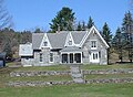 House in Cavendish


References
- ^ a b "U.S. Census website". United States Census Bureau. Retrieved January 31, 2008.
- ^ "US Board on Geographic Names". United States Geological Survey. October 25, 2007. Retrieved January 31, 2008.
- ^ "Cavendish" in The Vermont Encyclopedia (eds. John J. Duffy, Samuel B. Hand & Ralph H. Orth: University of Vermont Press, 2003), p. 79.
- ^ "Profile of General Population and Housing Characteristics: 2020 Demographic Profile Data (DP-1): Cavendish town, Windsor County, Vermont". United States Census Bureau. Retrieved December 8, 2021.
- ^ "History of Cavendish". Cavendish Historical Society. Archived from the original on July 13, 2011. Retrieved March 25, 2011.
- ^ "Cavendish 05142". Virtual Vermont. Retrieved March 25, 2011.
- ^ "Cavendish Semiquincentennial: First Settlers". Cavendish Historical Society. Retrieved March 25, 2011.
- ^ "Geographic Identifiers: 2010 Demographic Profile Data (G001): Cavendish town, Windsor County, Vermont". United States Census Bureau. Retrieved July 30, 2012.
- ^ Floodwaters From Storm Isolate 13 Vermont Towns, The New York Times
- ^ "Cavendish, Vermont Köppen Climate Classification (Weatherbase)". Weatherbase.
- ^ "Cavendish, Vermont 1991-2020 Monthly Normals". Retrieved October 28, 2023.
- ^ "xmACIS". National Oceanic and Atmospheric Administration. Retrieved October 28, 2023.
- ^ "U.S. Decennial Census". United States Census Bureau. Retrieved May 16, 2015.
- ^ 'Wisconsin Blue Book 1882,' Biographical Sketch of William Henry Proctor, pg. 542
External links
- Cavendish Connects Community Website
- Cavendish Community & Conservation Association
- Information at VirtualVermont.com
- Cavendish Community Profile; with an old postcard
| Towns | ||
|---|---|---|
Villages | ||
| CDPs | ||
| Other communities | ||
| ||
| International | |
|---|---|
| National | |