
Chapel Allerton
| Chapel Allerton | |
|---|---|
West Yorkshire | |
| Ambulance | Yorkshire |
| UK Parliament | |
Chapel Allerton is an inner suburb of north-east Leeds, West Yorkshire, England, 2 miles (3.2 km) from the city centre.
It sits within the
Location

The region within the Chapel Allerton ward generally considered to be Chapel Allerton is bounded by Potternewton Lane to the south, Scott Hall Road to the west and Gledhow Valley Road to the north-east.[4]
Surrounding districts include
Name
The name Chapel Allerton is first attested in the
The Chapel part of the name refers to a chapel associated with
The name Chapel Allerton was reduced to Chapeltown (first attested in 1427), and from this time both names co-existed and were essentially interchangeable.[5][9] Ralph Thoresby, writing in 1715, records Chapel-Town as a common name for the township of Chapel Allerton, describing it as "well situated in pure Air, upon a pleasant Ascent, which affords a Prospect of the Country ten or twelve miles". The open space to its east and north of Potter-Newton was "a delicate Green commonly call'd Chapel-Town Moor".[10]
History
Before the Norman Conquest (1066–1072) it was a township covering about five square miles, including what are now known as Alwoodley, Meanwood, Buslingthorpe, Scott Hall, Gledhow, Carr Manor, Moortown and Moor Allerton.[11] This included a major and a minor Roman road, and a Roman altar was discovered in the foundations of the Sexton's cottage for the old Church of St Matthew when it was demolished in 1880.[11]
This area was substantially destroyed by William the Conqueror in what was known as the Harrying of the North, leaving only the remnants of a village with a church around the present-day centre.[12] This is shown by the reduction in value from 40 to 2 shillings in the Domesday Book (1086).
The entry reads: ...In Alreton, Glunier had six carucates of land to be taxed, and there may be three ploughs there. Ilbert now has it, and it is waste. Value in King Edward's time forty shillings, now two shillings. There is a church there and wood pasture half a mile long and a half broad.[11][12]
William awarded the area to the Lacy family, who later sold it to Simon de Alreton, who later bestowed most of it to
In medieval times, the area was mostly small farms, with a village (and chapel) centred on a crossroads. In 1645 there was a plague (probably cholera) in Leeds, particularly virulent around the town markets. Instead of travelling in to sell produce, the people from Chapel Allerton sold it at Chapeltown Green, at the north end of what is now Chapeltown Road. To pay, the buyer had to put money into a basin of vinegar, specially built into a wall.[11]
Chapeltown Moor was an open area extending from Stainbeck Lane on the north down to Potternewton Lane on the south, bounded to the west by the stream known as Stain Beck and the turnpike road to Harrogate on the east. In the 17th and 18th centuries it had a racecourse and was also used for archery, cricket, foot racing, and cockfighting. It was finally enclosed between 1803 and 1813. In 1644 three men were hanged on a gallows there, roughly where the 1878 school is.[12]
By the end of the 17th century, it had become a resort or second home for wealthy people from Leeds[4] and in 1767 was described as the Montpellier of Yorkshire by one visitor.[5][13] In 1834 Edward Parsons described it as "by far the most beautiful and respectable in the Parish of Leeds".[13] An 1853 directory called Chapel Allerton "a neat and pleasant village" with the "beautiful hamlets" of Moor-Allerton, Meanwood and Gledhow and a population of 2497 within its chapelry, noting that "It has many handsome mansions and neat houses, mostly occupied by merchants &c. who have their places of business in Leeds.[9] From 1839 there was a horse-drawn omnibus to Leeds, which was replaced by a horse tram in 1874, later by a steam tram and in 1901 an electric tram.[11] The population rose from 1054 in 1801 to 4377 in 1898.[11]
Chapel Allerton was incorporated into
Architecture
A large part of Chapel Allerton is a conservation area for the character and historical interest of its buildings, noted for a diversity of good quality domestic buildings from various periods.[4] The historic core is around Stainbeck Corner, particularly around Town Street and Well Lane, with 8

After the
Houses
Allerton Hall was situated between Wensley Drive and Stainbeck Lane. In 1755 it was purchased by Josiah Oates, a merchant and an ancestor of
-
 Allerton Hall from Wensley Drive
 -
 Allerton Hall from Stainbeck Lane
 -
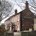 Clough House (The Mustard Pot)
 -
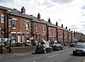
 Houses on Wood Lane
 -
 Methley Place
 -
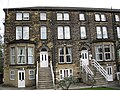
 Hawthorn terraces
 -
 Gledhow Mount Mansion, Roxholme Grove


Public buildings
On Stainbeck Corner are a pair of linked buildings, originally constructed as a police station, a fire station and public library, opened in 1904.[20] The public library is the only element to remain in operation. The police station became a restaurant and other parts of the complex were turned into flats. It is a grade II listed building.[21] The style is dressed sandstone with ashlar details. The main corner doorway is flanked by Tuscan columns supporting a segmental pedimented hood containing a cartouche, and above this is a moulded and painted coat of arms of Leeds. The Harrogate Road doorways are Tudor-arched with rectangular fanlights.[12] There is a bell turret and a clock. In 1904 the fire station was converted to a public library, with some amendments to the frontage style.[12] The interior features tiled walls with 'LPL' on them, a mosaic floor in the entrance hall, stained glass in doors and ionic columns.[21] Further down Harrogate Road in the direction of Leeds is a brick and sandstone building bearing the sign "Leeds Board School 1878". This is still a school, Chapel Allerton Primary School. It is on the site of the Chapeltown Moor gallows.[12]
-
 Former police station (left) and library (right)
 -
 Library entrance
 -
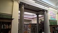 Library interior with Potts of Leeds clock
 -
 Leeds Board School


Inns
The
-
 Nag's Head
 -
 The Regent
 -
 Former Mexborough Arms


Churches
The area is home to a
A Methodist church built in local sandstone opened in 1836[25] on Town Street. It was replaced in the 1870s by a gothic church on Harrogate Road and the stone chapel became a Sunday School, with a date stone 1878 - often mistaken as the date of the building itself. This later became a community centre. The gothic church was demolished in the 1970s and in 1983 a new, smaller Methodist church opened. Its entrance faces the late Georgian building.[26] In January 2005, Chapel Allerton Methodist Church signed a local ecumenical covenant with St. Matthew's Church.[27] Grace Gospel Church also uses the Methodist Church for weekly services.
Originally a congregation
-
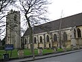 St Matthew's Church
 -
 Methodist Sunday School (now a community centre)
 -
 Current Methodist Church


Amenities
This section needs additional citations for verification. (October 2022) |
The area has an established local centre, which is situated around the junction of Stainbeck Lane and Harrogate Road. This consists of a
Many cafés, bars and restaurants utilise pavement space creating a pavement café culture in the area. As of late 2021, this is being significantly improved by closing the Northern half of the Stainbeck Lane and Harrogate Road junction to create a public plaza. Some of the shops are chains. There are however a significant number of thriving independent businesses.
Chapel Allerton has an arts centre, Seven Arts on Harrogate Road. It provides concerts and community events and performances.
Dyneley House, one of several
The Chapel Allerton Arts Festival is held the week following August Bank Holiday each year, with performances on a stage in Regent Street. It attracts hundreds of people, assisted by volunteers from the local community.[32]

Sport
Chapel Allerton Lawn Tennis and Squash Club is at the back of the square, behind the Mustard Pot pub.[33]
Chapel Allerton Running Club has been established since 1992. Members compete in a range of individual and team road, cross-country and fell races. There is also an annual club championship.[34]
Transport
The
Hospital

Chapel Allerton Hospital is an NHS hospital which includes the Chapel Allerton Orthopaedic Centre. It was established in 1926[36] in the building and grounds of Gledhow Grove mansion, a Grade II listed building which has now been converted to housing. The hospital now occupies buildings which were opened in 1994, across Harehills Lane from its original site.[37]
Notable people
- Margaret Scriven (1912–2001) Tennis player, born in Chapel Allerton, who won four Grand Slam titles, including back-to-back victories in the singles at the French Championships in 1933 and 1934.[38][39]
Notable references in popular culture
This section needs additional citations for verification. (April 2019) |
- Hill View Avenue and Norfolk Green were used as the main setting in 1980s Yorkshire Television dramas The Beiderbecke Tapes and The Beiderbecke Connection. There were also several other scenes shot in the Chapel Allerton area.[40]
- The Yorkshire Television series Fat Friends was in part filmed around Chapel Allerton, as well as in other nearby suburbs such as Kirkstall, Headingley and Moor Grange.
- The Channel 4 series Sirens was in part filmed on Victoria Street.
- The first Café Scientifique was organised by local resident Duncan Dallas in 1998 and held in In Vino Veritas in Regent Street (now Sukho Thai restaurant).
- The House of Koko was used in filming a scene in Emmerdale.
- 2013 BBC mini series The Great Train Robbery was partially filmed on Victoria Street
Location grid
See also
References
- ^ "Local statistics – Office for National Statistics". www.ons.gov.uk. Retrieved 11 December 2018.
- ^ "Leeds City Ward population 2011". Neighbourhood Statistics. Office for National Statistics. Archived from the original on 14 March 2016. Retrieved 26 February 2016.
- ^ "Six Yorkshire postcodes appear in Sunday Times Best Places to Live guide for 2018". The Yorkshire Post. Retrieved 5 July 2018.
- ^ a b c d e f g h i "Chapel Allerton CONSERVATION AREA APPRAISAL & MANAGEMENT PLAN" (PDF). www.leeds.gov.uk. Leeds City Council. 22 October 2008. Retrieved 3 April 2019.
- ^ a b c d e f g h i j R. Faulkner (1995) From Village to Suburb – A History of Chapel Allerton (Chapel Allerton Residents Association)
- ^ a b A. H. Smith, The Place-Names of the West Riding of Yorkshire, English Place-Names Society, 30–37, 8 vols (Cambridge: Cambridge University Press, 1961–63), iv, 137–38.
- ^ a b Harry Parkin, Your City's Place-Names: Leeds, English Place-Name Society City-Names Series, 3 (Nottingham: English Place-Names Society, 2017), p. 34.
- ^ Holy Rosary Church Leeds Silver Jubilee 1937–1962
- ^ a b White, William (1853). Directory and Gazetteer of Leeds, Bradford, Halifax, Huddersfield, Wakefield, and the whole of the clothing districts of the West Riding of Yorkshire. Sheffield: William White. p. 299.
- ^ Ralph Thoresby (1715) Ducatus Leodiensis: or, the topography of the ancient and populous town and parish of Leedes, and parts adjacent in the West Riding of York, pages 113, 124. A. H. Smith, The Place-Names of the West Riding of Yorkshire, English Place-Names Society, 30–37, 8 vols (Cambridge: Cambridge University Press, 1961–63), iv, 138.
- ^ a b c d e f g h Clarke, Eric (1988). Chapel Allerton: an outline history of an urban village. Leeds: Leeds Flower Fund for the Elderly.
- ^ a b c d e f g h i j Tucker, Janet (1987). Chapel Allerton Historic and Architectural Trail. Leeds: Manpower Services Commission.
- ^ ISBN 0-300-10736-6.
- ^ Brown, Michael; Hallett, George (1999). Noble and Spacious: St Matthew's Chapel Allerton 1900–2000. St Matthews, Chapel Allerton. pp. 124–5.
Article by Reg Simmons from the Parish Chronicle of 1950
- ^ Department, Leeds City Engineers. "Dominion Cinema, Montreal Avenue". www.leodis.net. Retrieved 11 December 2018.
- ^ "Leodis- A Photographic Archive of Leeds". Leodis. Retrieved 2 July 2012.
- ^ Historic England. "Allerton Hall (1256001)". National Heritage List for England. Retrieved 14 April 2019.
- ^ "a photographic archive of Leeds – Display". Leodis. 12 May 2010. Retrieved 5 August 2012.
- ^ "ScandiBugs – Gledhow Mount Mansion". Retrieved 26 January 2022.
- ISBN 978-1-906600-64-8.
- ^ a b Historic England. "Chapel Allerton Library and Police Station (1256028)". National Heritage List for England. Retrieved 14 April 2019.
- ^ Rotherham Web Genealogy Archived 4 March 2016 at the Wayback Machine Savile of Mexborough
- ^ Collection, Kirk. "Old Chapel Demolition, St Matthew's Church, Postcard". www.leodis.net. Retrieved 11 December 2018.
- Diocese of Sourozh, Parishes, accessed 10 October 2020
- ISBN 978-1-906600-64-8.
- ^ "Harrogate Road". www.leodis.net. Retrieved 11 December 2018.
- ^ "Leeds North and East Circuit – Chapel Allerton". www.leedsnandemethodist.org.uk. Archived from the original on 10 September 2016. Retrieved 11 December 2018.
- ^ Chapel Allerton Baptist Church, accessed 11 October 2020
- ^ [1] Archived 23 October 2008 at the Wayback Machine
- ^ "FindArticles.com | CBSi".
- ^ Greendown Trust, Dyneley House, accessed 7 November 2023
- ^ Sheridan, Daniel (30 August 2019). "Chapel Allerton Arts Festival 2019 and live music: Everything you need to know". Yorkshire Evening Post. Leeds. Retrieved 29 October 2022.
- ^ [2] Formed in 1880, it now has 16 tennis courts including 3 indoor ones and 6 squash courts. Archived 3 August 2008 at the Wayback Machine
- ^ "Chapel Allerton Running Club". Retrieved 21 February 2015.
- ^ "a photographic archive of Leeds – Display". Leodis. Retrieved 5 August 2012.
- ^ "Share your secrets, share your city". SecretLeeds. Archived from the original on 12 March 2012. Retrieved 5 August 2012.
- ^ "a photographic archive of Leeds – Display". Leodis. 31 May 1938. Retrieved 5 August 2012.
- ISSN 0307-1235. Retrieved 10 June 2019.
- ^ "Peggie Scriven". The Times. The Times Digital Archive. 2 February 2001. Retrieved 11 June 2019.
- ^ Internet Movie Database with link to Beiderbecke Tapes (1987) TV series. Retrieved 1 January 2020
External links
- lovechapelallerton.com cara: Social community group and local discount scheme
- chapelallerton.org
- Chapel Allerton Conservation Area Appraisal and Management Plan
- Chapel Allerton: a short history Archived 29 June 2011 at the Wayback Machine BBC website
- chapel-a.com Archived 10 December 2005 at the Wayback Machine Community discussion forum, reviews and directory.
- YEP Chapel Allerton Community Website
- The ancient parish of Leeds: historical and genealogical information at GENUKI (Chapel Allerton was in this parish).