
Coast Range (EPA ecoregion)
| Coast Range ecoregion | |
|---|---|
Temperate coniferous forests | |
| Borders | List
|
| Geography | |
| Country | United States |
| States |
|
| Coordinates | 43°00′N 123°48′W / 43.0°N 123.8°W |
The Coast Range ecoregion is a
The low
The Coast Range ecoregion has been subdivided into fifteen Level IV ecoregions.
Level IV ecoregions

Coastal Lowlands (1a)
The Coastal Lowlands ecoregion contains
Coastal Uplands (1b)
The Coastal Uplands ecoregion includes the headlands, high marine terraces, hills, and low mountains surrounding the Coastal Lowlands, with medium to high gradient tannic streams. Elevation varies from 400 to 2500 feet (120 to 760 m). The climate is marine-influenced with an extended winter rainy season and minimal seasonal temperature extremes. Abundant fog during the summer dry season reduces vegetation moisture stress. The Uplands region roughly corresponds with the historic distribution of Sitka spruce. After extensive logging, most of the Sitka spruce is gone, and today the forests are dominated by Douglas-fir and western hemlock, with a shrub layer of salal, sword fern, vine maple, Oregon grape, rhododendron, and evergreen blueberry. Wetter slopes and riparian areas feature red alder, bigleaf maple, and western redcedar, with a salmonberry and currant understory. The headlands are covered by grasslands. The region is nearly three times the size of the Coastal Lowlands, covering 1,431 square miles (3,706 km2) in Washington and 1,117 square miles (2,893 km2) in Oregon. Public lands include the Drift Creek Wilderness, the Siuslaw National Forest, and the Lewis and Clark and Cape Meares national wildlife refuges. California has not been mapped yet.[1][2]
Low Olympics (1c)
The Low Olympics ecoregion contains
Volcanics (1d)
The Volcanics ecoregion consists of steeply sloping mountains and capes underlain by fractured
Outwash (1e)
The Outwash ecoregion is a gently sloping fan of
Willapa Hills (1f)
The Willapa Hills ecoregion (named for the Willapa Hills) consists of low, rolling hills and low, gently sloping mountains with medium gradient streams and rivers. It rises to an elevation of approximately 1,300 feet (396 m). This region has a lower drainage density than other upland areas in the Coast Range. Logging is relatively easy and less expensive in this accessible terrain, and industrial timberland has almost completely replaced the historic forests. When disturbed, the silt- and clay-textured soils are easily eroded, thereby degrading stream quality. The vegetation consists of Douglas-fir and western hemlock forests, with sword fern, vine maple, salal, Oregon grape, and rhododendron shrub layer. Wetter slopes and riparian areas support red alder, western redcedar, bigleaf maple, salmonberry, and oxalis. Large herds of Roosevelt elk winter in the region. The region covers 1,277 square miles (3,307 km2) in southwestern Washington and 751 square miles (1,945 km2) in northwestern Oregon, inland from the coast.[1][2]
Mid-Coastal Sedimentary (1g)
The mountainous Mid-Coastal Sedimentary ecoregion lies outside of the coastal fog zone and is typically underlain by massive
Southern Oregon Coastal Mountains (1h)
The Southern Oregon Coastal Mountains ecoregion is a geologically and
Redwood Zone (1i)
The low mountains of the Redwood Zone ecoregion lie entirely within the coastal fog zone. Elevation varies from 50 to 1800 feet (15 to 550 m). Historically, unbroken redwood forests moderated the local climate by trapping the coastal fog and producing shade. Remnants of unlogged redwood forest still survive east of Brookings, Oregon. Today, the region is characteristically covered by a mixed forest of coast redwood and Douglas-fir, with a shrub layer of vine maple, rhododendron, sword fern, and oxalis. The region covers 31 square miles (80 km2) in the far southwestern corner of Oregon. Larger sections in northwestern California have not been mapped yet.[1][2]
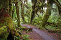
Gallery
Flora
-
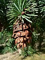 Coast Douglas-fir, Oregon's state tree
 -
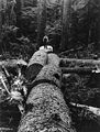 Sitka spruce logged in the Oregon Coast Range
 -
 Port Orford cedar, endemicto the Southern Oregon Coastal Mountains
 -
 Northern California
 -
 Vine maple
 -
 Grasses help stabilize theOregon Dunes.
 -
 Salmonberryblossom
 -
 Salalflowers


Fauna
-
-
 Douglas squirrel near the Oregon Coast
 -
 Snowy egret hunting fish
 -


Landscapes
-

-
 Clearcutting and road building, as in this area near the source of theslope failureand affect surface water quality.
 -
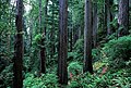
 Olympic rainforests have the highest living biomass density on earth.
 -
 The dynamic Lanphere Dunes in Humboldt County exemplify the coastal dune forest ecosystem.


See also
- Coast Range (disambiguation)
- Ecoregions defined by the EPA and the Commission for Environmental Cooperation:
- The conservation group World Wildlife Fundmaintains an alternate classification system:
References
- ^ a b c d e f g h i
 This article incorporates public domain material from Thorson, TD; Bryce, SA; Lammers, DA; et al. Ecoregions of Oregon (PDF). United States Geological Survey. (color poster with map, descriptive text, summary tables, and photographs; with a Reverse side).
- ^ a b c d e f g h i j This article incorporates public domain material from Pater, D; Bryce, SA; Kagan, J; et al. Ecoregions of Western Washington and Oregon (PDF). United States Geological Survey. (color poster with map, descriptive text, summary tables, and photographs; with a Reverse side).
- ^ "Gymnosperm Database: Sequoia sempervirens". Retrieved 2012-02-05.
- ^ "Gymnosperm Database: Pseudotsuga menziesii". Retrieved 2012-02-05.
- ^ "Gymnosperm Database: Picea sitchensis". Retrieved 2012-02-05.