
Northern Basin and Range ecoregion
| Northern Basin and Range ecoregion | |
|---|---|
.jpg) Salt deposits at Summer Lake | |
 Northern Basin and Range (80) | |
| Ecology | |
| Realm | Nearctic |
| Borders | List
|
| Geography | |
| Country | United States |
| States |
|
| Coordinates | 43°N 117°W / 43°N 117°W |
The Northern Basin and Range ecoregion is a
The valleys support
The Northern Basin and Range ecoregion has been subdivided into fourteen Level IV ecoregions, as described below. Level IV mapping is not yet complete in California, and the information below includes only the sections in Oregon, Idaho, Nevada, and Utah.
Level IV ecoregions

Dissected High Lava Plateau (80a)
The Dissected High Lava Plateau ecoregion is a broad to gently rolling
Semiarid Hills and Low Mountains (80b)
The Semiarid Hills and Low Mountains ecoregion is higher and more rugged than the sagebrush plains and basins of neighboring regions. It is composed of
High Elevation Forests and Shrublands (80c)
The High Elevation Forests and Shrublands ecoregion is composed of steep, rugged, unglaciated mountains with cold winters, at an elevation of 6,000 to 9,900 feet (1,829 to 3,018 m). It is characterized by a mix of
Pluvial Lake Basins (80d)
The Pluvial Lake Basins ecoregion contained vast
High Desert Wetlands (80e)
The nearly level High Desert Wetlands ecoregion consists of
Owyhee Uplands and Canyons (80f)
The Owyhee Uplands and Canyons ecoregion is a sagebrush steppe containing deep river canyons, barren
High Lava Plains (80g)
The High Lava Plains ecoregion is a vast, nearly level to undulating sagebrush steppe containing scattered
Saltbush-Dominated Valleys (80h)
The Saltbush-Dominated Valleys ecoregion, externally drained by the Snake River, is composed of gently sloping valley bottoms and alluvial fans dominated by salt-tolerant vegetation that distinguishes it from the sagebrush steppe of surrounding regions. Elevation varies from 4,500 to 6,000 feet (1,372 to 1,829 m). Light-colored soils with high salt and alkali content are common; they are dry for extended periods and may be leached of salt by irrigation water. Potential natural vegetation is mostly saltbush-greasewood, featuring Nuttall sagebrush, squirreltail,
Sagebrush Steppe Valleys (80i)
The Sagebrush Steppe Valleys ecoregion consists of gently sloping, unforested terraces, basin rims, valley bottoms, footslopes, bajadas, and alluvial fans, with an elevation of 4,600 to 6,500 feet (1,403 to 1,981 m). Less rugged than the surrounding hills and mountains, it is dominated by sagebrush grassland and lacks the woodlands, open conifer forests, and saltbush–greasewood vegetation of neighboring regions. The valleys drain mostly to the Snake River and fish assemblages are unlike those of the internally drained basins to the south. Potential vegetation includes bluebunch wheatgrass, Wyoming big sagebrush, cheatgrass, and Sandberg bluegrass. The steppe valleys are less suitable for cropland agriculture and have less available water than many parts of the Snake River Plain, but non-irrigated wheat and barley farming is common. The region covers 1,865 square miles (4,830 km2) in southeastern Idaho and 7 square miles (18 km2) across the Utah border.[2][4]
Semiarid Uplands (80j)
The disjunct Semiarid Uplands ecoregion includes scattered hills, low mountains, volcanic cones, buttes, and rocky outcrops that rise out of the drier Dissected High Lava Plateau and High Lava Plains, as well as midelevation zones in the
Partly Forested Mountains (80k)
The Partly Forested Mountains ecoregion occupies the elevational belt above the Semiarid Uplands on the Jarbidge,
Salt Shrub Valleys (80l)
The Salt Shrub Valleys ecoregion is composed of arid basins formerly inundated by Pleistocene lakes. Elevation varies from 3,500 to 5,200 feet (1,067 to 1,585 m) The nearly flat to gently sloping basins and playas are poorly drained, have a high
Barren Playas (80m)
The Barren Playas ecoregion includes the playas and sand dunes of
Gallery
Flora
-
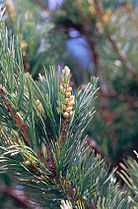 Limber pine
 -
 Utah juniper
 -
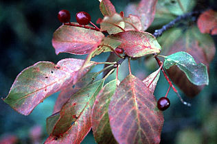 Western chokecherryleaves and berries
 -
 Big sagebrush
 -
 Bottlebrush squirreltail
 -
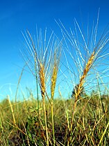
 Needle-and-thread grass
 -
 Rubber rabbitbrush
 -
 Spiny hopsage


Fauna
-
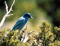 Pinyon jay, found in juniper-pinyon woodlands
 -
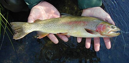 Yellowstone cutthroat trout in the Snake River system
 -
-
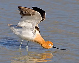
 Sage grousein shrub-steppe habitat


Landscapes
-
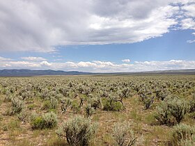 Sagebrush-Steppe in south-central Idaho along Three Creek Road
 -
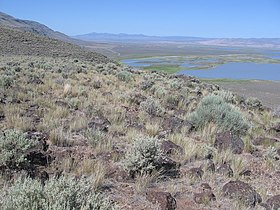 Bunchgrasses on Hart Mountain
 -
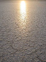 The cracked playa surface of the Alvord Desert
 -
 Cheatgrass covers the fault scarp of Abert Rim.
 -


See also
- Ecoregions defined by the EPA and the Commission for Environmental Cooperation:
- The conservation group World Wildlife Fundmaintains an alternate classification system:
- Colloquial terms for the region:
References
- ^ a b c d e f g h i j k
 This article incorporates public domain material from Thorson, TD; Bryce, SA; Lammers, DA; et al. Ecoregions of Oregon (PDF). United States Geological Survey. (color poster with map, descriptive text, summary tables, and photographs; with a Reverse side).
- ^ a b c d e f g h i j k This article incorporates public domain material from McGrath, CL; Woods, AJ; Omernik, JM; et al. Ecoregions of Idaho (PDF). United States Geological Survey. (color poster with map, descriptive text, summary tables, and photographs; with a Reverse side).
- ^ a b c d e f g h i j This article incorporates public domain material from Bryce, SA; Woods, AJ; Morefield, JD; et al. Ecoregions of Nevada (PDF). United States Geological Survey. (color poster with map, descriptive text, summary tables, and photographs; with a Reverse side).
- ^ a b c d e f g This article incorporates public domain material from Woods, AJ; Lammers, DA; Bryce, SA; et al. Ecoregions of Utah (PDF). United States Geological Survey. (color poster with map, descriptive text, summary tables, and photographs; with a Reverse side).