
Concession Street (Hamilton, Ontario)

Concession Street is an Upper City (mountain) arterial road in Hamilton, Ontario, Canada. It starts at Belvidere Avenue, just west of Sam Lawrence Park, and extends eastward past Mountain Drive Park on Upper Gage Avenue and ends shortly thereafter at East 43rd Street.
Note: East of East 43rd Street the road is known as Mountain Brow Boulevard.
History


Originally known as Stone Road and changed to Concession Street in 1909. As well, the Hamilton mountain was a separate community from the Lower city Hamilton and known as "Mount Hamilton" but by 1891, properties north of Concession Street were annexed by the city of Hamilton and were serviced with water, sewers and sidewalks. Note: Aberdeen Avenue in the Lower City was originally known as Concession Street.[1]
Concession Street is the oldest settlement area on the
During the 19th century it did not occur to inhabitants of Hamilton that the mountain top would become thickly populated. Concession Street had been a deer run, then a cow path, at last evolved into a stoned road and had a
From the year 1910, (interrupted by the outbreak of
In 1949, Mayor Sam Lawrence went on record as favouring a separate mountain ward. The city's focus was now to grow south with the eastern boundary, at the time, now established at Red Hill Creek.[5]
Transportation infrastructure
The Jolley Cut (named after James Jolley, (1813–1892), saddler, harnessmaker, politician), is a mountain/lower city-access road in Hamilton. James Jolley funded construction of the Jolley Cut.[6]
It was not unusual for the mountain settler in those days to undertake the construction of a road down the face of the escarpment, known as a short-cut, which might be used only by the family who constructed it or might open to the public. At the west end they had the Fillman Mountain, the Horning Mountain and later Beckett's Drive — all done by hand labour. Eventually both Fillman & Horning Mountains fell to disuse because they were dangerously too steep.[7]
One time the city even considered adding a
In 1924 the city of Hamilton agreed to add more street lights to the mountain in an area bounded by Fennell Avenue (south), the escarpment (north), Ontario Hospital on West 5th Street (west) and Upper Gage Avenue (east). Street lights on every second pole.[10]
In 1927 the
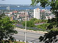
Incline railway
When the
In 1924, following the city's booming development in the east, there was some serious discussion regarding the addition of a third incline railway. The 2 locations be considered at the time were Sherman Avenue or Ottawa Street South. The population of Hamilton Mountain at the time was 6,000.[14]
In 1929, the city's brochures were using the motto, "The City Beautiful and Hub of Canadian Highways" as well as "The City of Opportunity". In regards to the
In 1949 there was a

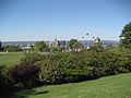
Sam Lawrence Park
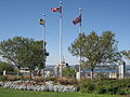
Sam Lawrence Park, one of the parks in the City of Hamilton's Parks system, is 6 hectares (14.85 Acres) in size, and composed of three sections surrounding the Jolley Cut roadway. Located on the brow of the
The shelter at Sam Lawrence Park was built in 1956 on the existing foundations of the old water tank that used to service this part of the mountain. The stone walls, flower gardens, and pathways were originally constructed in the 1950s and 1960s under the direction of K. Matt Broman, the landscape architect who also supervised the development of the Rock Gardens at the
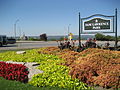
Juravinski Hospital and Cancer Centre
The Henderson General Hospital, now named the Juravinski Hospital and Cancer Centre, got its name in 1954 when it was named after Nora-Francis Henderson who was the first woman on Hamilton City Council and also the first city controller in Canada. She was also a journalist and activist who pushed for children's and women's rights and health care. The hospital underwent major renovations and expansion and was renamed the Juravinski Hospital and Cancer Centre, (after Charles Juravinski and his wife Margaret), after they both made a $43-million contribution to health care in Hamilton. Charles Juravinski sold Flamboro Downs racetrack (Canada's fastest half-mile harness horse racing track)[17] in 2002 and chose to share the money with Hamilton city hospitals. The new hospital will have a Henderson wing.[18]
Major intersections
Note: Listing of streets from west to east.
- Upper Wellington Street
- Upper Wentworth Street
- Upper Sherman Avenue
- Upper Gage Avenue
Gallery
-
 Sam Lawrence Park
 -
 Sam Lawrence Park
 -
 Sam Lawrence Park
 -
 Sam Lawrence Park
 -
 Sam Lawrence Park
 -
 Sam Lawrence Park
 -
 Sam Lawrence Park
 -
 Sam Lawrence Park


See also
References
- ISBN 1-55028-773-7.
- ^ Burkholder, Mabel (1942-11-15). "Out off the storied Past: Mountain Brow Union Mission" (Press release). The Hamilton Spectator.
- ^ Burkholder, Mabel (1956). Barton on the Mountain. Hamilton Public Library.
- ^ a b Burkholder, Mabel (1952). History of Central Ontario (Southwestern) pages 76–79.
- ^ "Mountain wards question finds council split" (Press release). The Hamilton Spectator. 1949-02-09.
- ^ Bailey, Thomas Melville (1981). Dictionary of Hamilton Biography (Vol I, 1791–1875). W.L. Griffin Ltd.
- ^ "Out of the storied past: Some families on the west end of the mountain (By: Mabel Burkholder)" (Press release). The Hamilton Spectator. 1948-01-31.
- ^ "Hamilton Street Railway Company: Streetcar Operations 1874–1951". Retrieved 2008-08-25.
- ^ Publisher: The Hamilton Spectator |title: Will they come into the City? — Movement of township side of mountain. (Jan 26, 1913)|accessdate=2008-08-25
- ^ "Expansion of Hydro proves sound growth" (Press release). The Hamilton Spectator. 1924-02-29.
- ^ "Bus Service to Mountain now mooted" (Press release). The Hamilton Spectator. 1927-11-30.
- ^ a b "Hamilton Street Railway History". Retrieved 2008-08-22.
- ^ a b "Hamilton Transit History". Archived from the original on 2009-10-26. Retrieved 2008-08-22.
- ^ a b "Inclines prove equal to their important task" (Press release). The Hamilton Spectator. 1924-02-29.
- ^ "Get petition on Incline Issue: Residents will be asked to signify preference" (Press release). The Hamilton Spectator. 1949-07-19.
- ISBN 1-55028-804-0.
- ^ "Flamboro Downs". Official web site. Archived from the original on 2007-03-22. Retrieved 2007-04-21.
- ^ "StreetBeat: "Mr. Generosity"" (Press release). The Hamilton Spectator. 2007-04-20.
- MapArt Golden Horseshoe Atlas — Page 647 — Grids H12, H13, H14, H15