
Wellington Street (Hamilton, Ontario)

Wellington Street is a Lower City arterial road in Hamilton, Ontario, Canada. It starts off at Charlton Avenue East as a two-way street for only one block where it's then blocked off by the Corktown Park and a couple of Canadian National Railway lines that cut through it. It then starts up again north of the park on Young Street and is a one-way street the rest of the way (Southbound). It ends in the North End of the City on Burlington Street East, in front of the Lakeport Brewing Company and the Administration offices of the Hamilton Port Authority.
History

Originally Wellington Street was called Lovers' Lane.[1]
The Hamilton General Hospital is major teaching hospital on the corners of Barton Street East and Wellington Street North in downtown Hamilton, Ontario that is affiliated with McMaster University. It is sometimes referred to as "HGH" and was founded in 1848.[2]
The David Braley Cardiac, Vascular and Stroke Research Institute is a $90-million Research Centre that will be home to 500+ scientists and will be built right behind the Hamilton General Hospital. The new building with 165,000 square feet (15,300 m2) is expected to open in 2010. At least 250 new jobs will be added to the local economy.


In 1856, the Daniel C. Gunn Engine Shop on Wellington Street North, produced the first Canadian-built locomotives.[5] In 1976, First Place apartments, a seniors high rise at King and Wellington opened on the site of First United Church, which burned down in 1969.[6]
Kenesky Sports on Barton & Wellington Streets is the site where Emile "Pops" Kenesky invented the hockey
Landmarks
Note: Listing of Landmarks from North to South.


- Pier 10
- Hamilton Port Authority, Administration Office
- Lakeport Brewing Company
- Canadian Nationalrailway tracks
- Hamilton General Hospital
- David Braley Cardiac, Vascular and Stroke Research Institute
- Kenesky Sports & Cycle Co. Ltd.
- Wellington Park
- First Place Hamilton, Seniors apartment building
- Corktown Park
- Escarpment Rail Trail (abandoned railway path)
- Bruce Trail
- Niagara Escarpment (mountain)
Communities
Note: Listing of neighbourhoods from North to South[13]
- Canadian NationalRailway tracks
- Beasley/ Landsdale, Wellington Street is the division between these two neighbourhoods.
- Corktown, Stinson, Wellington Street is the division between these two neighbourhoods.
Images
-
 Kenesky's Sports, site of hockey goalie pads invention
 -
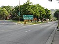
 Wellington South, walking tour
 -
 First Place Hamilton, Seniors Apartments
 -
 Wellington South, walking tour


See also
References
- ISBN 1-896899-22-6.
- ^ "Hamilton Health Sciences". Archived from the original on 2007-02-08. Retrieved 2007-04-27.
- ^ "Good Medicine: A $90-million health research centre set to rise on the edge of Hamilton's industrial heartland points the way to life after steel". Hamilton Spectator. 2007-05-09.
- ^ Hemsworth, Wade (2007-05-09). "'Our city's going to be strong.'". The Hamilton Spectator.
- ^ Bailey, Thomas Melville (1981). Dictionary of Hamilton Biography (Vol I, 1791-1875). W.L. Griffin Ltd.
- ^ "Skyscraperpage.com: Hamilton, Ontario". Retrieved 2007-03-26.
- ^ "Lakeport Brewing Company". Yahoo Finance. Retrieved 2007-04-21.[dead link]
- ^ "Lakeport Brewing Company & Hamilton Port Authority join forces; Warehouse Expansion" (PDF). Hamilton Port Authority (media release- pdf. file). Archived from the original (PDF) on 2007-09-28. Retrieved 2007-04-21.
- ^ "History of Industry in Hamilton, Ontario". Archived from the original on 2006-02-06. Retrieved 2007-04-21.
- ^ "Labatt keeping Lakeport open". Hamilton Spectator. 2007-05-08.
- ^ "Collections Canada: Early days of Hockey (www.collectionscanada.gc.ca)". Archived from the original on 2009-01-21. Retrieved 2008-08-14.
- ^ "Kenesky Sports: Kenesky Goaltending School (www.keneskysports.com)". Archived from the original on 2009-01-21. Retrieved 2008-08-14.
- ^ "Hamilton Neighbourhood Boundaries, (map.hamilton.ca)" (PDF). Archived from the original (PDF) on 2007-09-27. Retrieved 2007-05-11.
- MapArt Golden Horseshoe Atlas - Page 647 - Grids E13, F13, G13, H13
External links
- Beasley Neighbourhood (ourbeasley.com)
- North End Neighbours
- Bruce Trail Association
- Hikes on the Bruce Trail
- Google Maps: Wellington Street (Hybrid)