Daund
This article needs additional citations for verification. (May 2013) |
Daund | |
|---|---|
City | |
MH 12,42 | |
| Website | www |
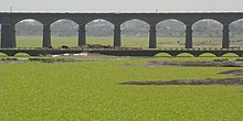
Daund is a city, municipal council, and headquarters of the Daund tehsil in the Pune district in the state of Maharashtra, India. The city of Daund is located on the Bhima River.
In ancient times, a sage named Dhaumya Rishi stayed here; hence, people started calling it after him: "Dhaum". Gradually "Dhaum" became "Dhoand", then "Dhaundh". According to the epic Mahabharata, Krishna's wife Rukmini went in the "Dhindir forest"; this ancient "Dhindir Van" is today's Daund.[citation needed]
History
Maratha era
Peshwa era
In 1739, the Bajirao–Mastani affair had brought clashes among the Peshwa family, hence Bajirao Peshwa took Mastani away from Pune and made her stay in Patas. Henceforth, Bajirao and Mastani met at the Firangai Devi temple in Kurkumbh.
The horse business in Daund flourished during this time.[
Due to heavy loans at the end of the Peshwa Era, Daund and some villages from Pune fell under control of 'Girgosavi'.[clarification needed]
British rule
In the 1850s, with the construction of railways during British rule, the Bombay–Chennai
From 1942 to 1945, two military camps were set up in Daund.
Geography and climate

Daund is located at 18°28′N 74°36′E / 18.47°N 74.6°E, about 514 m (1,686 ft) above sea level on the western margin of the
Daund lies very close to the seismically active zone around
The climate of Daund is generally hot and dry, and the area receives scant rainfall.
Economy
Primary crops include wheat, sugar cane, oranges, and sweet limes. Daund has a large working class population, and the primary occupation is farming.
Transportation
Roads
Daund–Ausa
Rail

Daund is served by rail by the
Daund is a major freight redistribution hub.
Demographics
As of 2011[update]
The town has a significant population working as employees of Indian Railways and the State Reserve Police Force (SRPF).
Religious sites
Since more than 82% of the city's population are Hindus, there are a significant number of temples in the town. Important Hindu temples in Daund include Shree Vitthal Rukmini Temple (प्रति पंढरपूर), Shree Balaji temple, Shree Gajanan Maharaj Temple, and Shree Swami Samarth Temple. The Gram Daivat of Daund is Shree Bhairavnath Maharaj Temple. Shree Firangai Mata temple, located 10 km from Daund at
The town has a Jain Digambara temple known as the "1008 Chandraprabhu Bhagwan Mandir", which is known for its architecture and lack of iron in construction. The temple is built of marble and has a marble manastambha. It is located on Ahmednagar Road.
References
- ^ "Census of India 2011: Data from the 2001 Census, including cities, villages and towns (Provisional)". Census Commission of India. Retrieved 3 June 2015.

