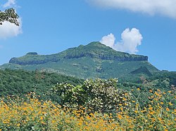
Purandar Fort
| Purandar Fort | |
|---|---|
| Pune district, Maharashtra | |
 Purandhar Fort | |
| Coordinates | 18°16′50.8″N 73°58′25″E / 18.280778°N 73.97361°E |
| Type | Hill fort |
| Height | 1,374 metres (4,508 ft) |
| Site information | |
| Owner | Government of India |
| Open to the public | Yes |
| Condition | Ruins |
| Site history | |
| Materials | Stone |
Purandar Fort is a mountain fort in Pune district in Western Indian state of Maharashtra, India. The fort stands at 1,374 metres (4,508 ft) above the sea level in the Western Ghats, 50 kilometres (31 mi) to the southeast of Pune.[1]
The twin forts of Purandar and Vajragad (or Rudramal) of which the latter is the smaller of the two, is located on the eastern side of the main fort rising 1,347 metres (4,419 ft) above sea level.
History
The oldest known reference of existence of the Purandar fort dates back to the
After the defeat of the Yadavas by the foreign invaders,[
Under the rule of the Berar Sultanate, the fort was besieged several times. To prevent the Purandar Fort from ever falling again, a sacrificial ritual was performed where a man and a woman were buried alive under one of the fort bastions to appease its patron deity.[5] Another ritual was soon performed where the king ordered a minister to bury a first-born son and his mother into the foundation of the bastion which was promptly done with a further offering of gold and bricks. When the bastion was finished, The minister, Yesaji Naik, was given possession of the Purandar Fort and the father of the sacrificed boy was rewarded with two villages.[6]
In 1596 A.D, the Bahudar Shah of the Ahmadnagar Sultanate granted the territory of "Pune" and "Supa" to Maloji Bhosale, the grandfather of Shivaji.[citation needed] The Purandar Fort was included in the territory.

In 1646 A.D, Shivaji, still in his youth, in one of his first victories for the
In 1670 A.D, the truce did not last long as Shivaji revolted against Aurangzeb and recaptured Purandar after just five years.
Under the
In 1790, it was conquered by a Koli chief Kuroji Naik and a Victory Bastion also erected here.[7][8][9]
In 1818, the Purandar Fort was invaded by a British force under General Pritzler. On 14 March 1818, a British garrison marched into Vajragad (the smaller fort). As Vajragad commanded Purandar, the commandant had to accept terms and the British flag was hoisted at Purandar on 16 March 1818. During the British Raj, the fort was used as a prison. During World War II, it was an internment camp for enemy-alien (i.e. German) families. Jews from Germany were interned. A German prisoner, Dr. H. Goetz was held here during World War II. He studied the fort during his stay and later published a book on it. The fort's major use however, was as a sanatorium for the British soldiers.[3]
The thousand-year-old

It is believed that Purandar is the broken part of the Dronagiri Parvat, which Hanuman carried in the Ramayana.[4]
Structures

The fort has two distinct levels. The lower part of Purandar is called the machi. North of the machi is a flat area where the cantonment and hospital was housed.
There are many temples dedicated to Purandareshwar (the fort's patron god, from which it also takes its name) and Sawai Madhavrao Peshwa here. There is a statue of

From the lower level of the machi, a staircase leads to the upper level called Ballekilla. The first structure of the Ballekilla that comes into view is the Dilli Darwaja (Delhi Gate). This area also houses an ancient Kedareshwar (Shiva) temple. The BALLEKILLA is also surrounded by steep drop on three sides.
Current use
The Purandar Fort is a popular tourist destination and is also used by the
Gallery of Purandar Fort
See also
References
- ^ a b Survey of India - Scale 1:50K Map sheet number 47F/15
- ^ This monsoon visit Purandar fort
- ^ a b c Maharashtra state tourism site
- ^ a b c d Hunter, William (1886), The Imperial Gazetteer of India, London: Trubner and Co., retrieved 18 January 2009
- ^ Sholapur District Gazetteer
- ^ Toy, Sidney (1965). The Fortified Cities of India. London: Heinemann Educational Books Ltd. p. 51.
- ^ Gazetteer of the Bombay Presidency: Poona (2 pts.). Government Central Press. 1885.
- ^ "Maharashtra Gazetteers".
- ^ Transactions of the Medical and Physical Society of Bombay. 1862.


