Fort Popham
Fort Popham Memorial | |
U.S. National Historic Site | |
 Fort Popham and the Kennebec River | |
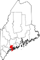
 Fort Popham Location in Maine | |
| Location | Phippsburg, Maine |
|---|---|
| Coordinates | 43°45′17″N 69°47′02″W / 43.75472°N 69.78389°W[1] |
| Built | 1861 |
| Architect | US Army Corps of Engineers |
| NRHP reference No. | 69000012 |
| Fort Popham | |
| Part of U.S. Army Corps of Engineers | |
| In use | 1864–1865, 1898–1899, 1917–1918, 1941–1945 |
| Materials | Granite |
| Garrison information | |
| Garrison |
|
| Added to NRHP | 1 October 1969 |
Fort Popham is a Civil War-era coastal defense fortification at the mouth of the Kennebec River in Phippsburg, Maine. It is located in sight of the short-lived Popham Colony and, like the colony, named for George Popham, the colony's leader. The site is preserved as Fort Popham State Historic Site.[2]
Predecessors
During the
History
Construction of Fort Popham was authorized in 1857 as part of the Third System of fortifications but did not begin until 1861. The fort was built from granite blocks quarried on nearby Fox and Dix Islands. It had a 30-foot (9 m)-high wall facing the mouth of the Kennebec River and was built in a crescent shape, measuring approximately 500 feet (150 m) in circumference.
During the closing months of the American Civil War, from October 1864 to July 1865, the fort was garrisoned by the 7th Unassigned Company of Maine Infantry. The 7th Company was commanded by Captain Augustin Thompson, who is best known as the inventor of Moxie soda.[9]
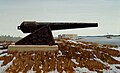
Fort Popham was originally designed to mount 42 heavy guns, a mix of 10-inch and 15-inch
War experience showed that masonry forts were vulnerable to modern rifled guns. As a result, in 1869 construction at Fort Popham stopped before the fortification was completed. The fort was garrisoned again after additional work was performed during the
Fort Popham was probably part of the
Present
The fort, located two miles (3 km) from popular Popham Beach State Park, is open to the public as Fort Popham State Historic Site. It was added to the National Register of Historic Places as Fort Popham Memorial on October 1, 1969, reference number 69000012.
Gallery
-
 The fort's setting
 -
 Entrance
 -
 Interior


See also
References
- ^ "Fort Popham (historical)". Geographic Names Information System. United States Geological Survey, United States Department of the Interior.
- ^ "Fort Popham State Historic Site". Department of Agriculture, Conservation and Forestry. Retrieved January 22, 2023.
- ISBN 978-0-9748167-2-2.
- ^ Wade, p. 131
- ^ Wade, pp. 235, 241
- ^ a b Coast Defenses of the Kennebec River at NorthAmericanForts.com
- ^ Town of Georgetown, Maine website
- ^ Wade, p. 241
- ^ National Archives digitized microfilm record, Microcopy 594, Roll 71, Volunteer Maine Militia, Nineteenth Infantry through 30th Unassigned Infantry
- ISBN 978-1-7323916-1-1.
- ^ a b FortWiki article on Fort Popham
- ^ Fort Popham at NorthAmericanForts.com
- ^ a b Congressional serial set, 1900, Report of the Commission on the Conduct of the War with Spain, Vol. 7, pp. 3778–3780, Washington: Government Printing Office
- ISBN 0-9748167-0-1.
- ^ a b FortWiki article on Fort Baldwin
- ISBN 0-9720296-4-8.
- ^ NRIS entry for Fort Baldwin
Further reading
For this fort's role in Jefferson's embargo, see Smith, Joshua M. "Maine's Embargo Forts", Maine History, Vol. 44, No. 2 (April 2009), pp. 143–154.
For this fort's role in the War of 1812, see Burrage, Rev. Henry S. "Captain John Wilson and Some Military Matters in the War of 1812", Collections and Proceedings of the Maine Historical Society, second series, 10 (1899), pp. 403–429.
External links
- Fort Popham State Historic Site Department of Agriculture, Conservation and Forestry
- Coast Defense Study Group, information on all US forts
- American Forts Network, lists forts in the US, former US territories, Canada, and Central America
- FortWiki, lists most CONUS and Canadian forts
- Information and photos about Fort Popham (personal blog)
- Information and photos about Fort Popham (unofficial Maine Historic Sites page)