
Geology of the Northwest Territories
The geology of the Northwest Territories has been mapped in different quadrangles by the Canadian government. The region has some of the oldest rocks in the world and among the oldest in North America, formed from several sections of stable craton continental crust, including the Slave Craton, Rae Craton and Hearne Craton. These rocks form the Archean and Proterozoic Precambrian basement rock of the region and are the subject of extensive research to understand continental crust and tectonic conditions on the early Earth.
Geologic History, Stratigraphy & Tectonics
The
In the late
Around 1.27 billion years ago in the
In the Neoproterozoic, the four kilometre thick Mackenzie Mountains Supergroup deposited in a poorly understood basin. Hydrothermal fluids emplaced base metals into these deposits, likely during rifting that lasted into the Paleozoic.[6]
Paleozoic (541-251 million years ago)
Marine deposition was common across much of the area in the Paleozoic. Within the Mackenzie Basin, tabulate and rugose corals grew formed the Horn Plateau Formation—a group of isolated reefs from the Devonian fed by nutrients from eroding Canadian Shield rocks and offshore upwelling in the ocean.[7] The Selwyn Basin, which now spans into the Yukon Territory formed at the same time and accumulated graptolite fossils and bitumen.[8]
The siliclastic, fossiliferous wackestone and mudstone of the Ordovician Bad Cache Rapids Formation record a shallow shelf environment on Southampton Island. This unit is overlain by the Ashgill Boas River Formation carbonaceous mudstone and oil shale, Churchill River Formation coral-bearing wackestone and the Sixteen Mile Brook oil shale.[9]
Mesozoic (251-66 million years ago)
In the Mesozoic, kimberlite pipes intruded Archean basement rock in places beginning around 75 million years ago and continuing into the Cenozoic in the Ekati area.[10]
Sedimentation continued in many areas into the Mesozoic. On Banks Island, manganese spherulites with rhodochrosite, iron-manganese oxides and dolomite mark the boundary between the Christopher and Kanguk sedimentary formations from the Cretaceous.[11]
Cenozoic (66 million years ago-present)
In the early Cenozoic, changes in regional structural geology led to widespread erosion and fission track analysis of apatite indicates that in the Beaufort-Mackenzie area, rocks cooled from temperatures around 110 degrees Celsius after one mile of rock eroded above them in the early Eocene.[12] The Northwest Territories was heavily glaciated during the
In the vicinity of the Mackenzie River delta and Sitidgi Lake till and sediments formed into the unglaciated Eskioma Lakes area. The Mackenzie delta formed as alluvium drowned valleys. Thermokarst and an ice-cored landscape took shape in the early Holocene.[14]
Gas Hydrates
Northern Canada and the Northwest Territories are famous for gas hydrates, also known as methane clathrate—methane gas frozen in thick sediments, which might hypothetically lead to intense climate change if they melted. Recognized from bore holes, gas flow during drilling or seismic data, it was not until March and April, 1993 that samples were recovered from a 451 meter deep hole in the Mackenzie Delta.[15]
References
- .
- doi:10.1139/e92-165.
- doi:10.1139/e88-032.
- doi:10.1139/e75-144.
- doi:10.1139/e92-151.
- doi:10.1139/E08-062.
- doi:10.1139/e11-056.
- doi:10.1139/e89-169.
- doi:10.1139/e91-027.
- .
- doi:10.1139/e74-168.
- doi:10.1139/e17-109.
- doi:10.1139/e96-066.
- ^ "Quaternary geology of the Tuktoyaktuk coastlands, Northwest Territories (Technical Report) | ETDEWEB". osti.gov. Retrieved 2018-11-10.
- .
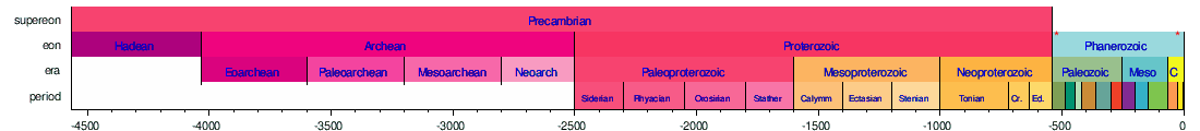
The following five timelines show the geologic time scale to scale. The first shows the entire time from the formation of the Earth to the present, but this gives little space for the most recent eon. The second timeline shows an expanded view of the most recent eon. In a similar way, the most recent era is expanded in the third timeline, the most recent period is expanded in the fourth timeline, and the most recent epoch is expanded in the fifth timeline.


Horizontal scale is Millions of years (above timelines) / Thousands of years (below timeline)

| Provinces | |
|---|---|
| Territories | |