
Geology of Newfoundland and Labrador
The geology of Newfoundland and Labrador includes basement rocks formed as part of the Grenville Province in the west and Labrador and the Avalonian microcontinent in the east. Extensive tectonic changes, metamorphism and volcanic activity have formed the region throughout Earth history.
Newfoundland
In contrast to neighboring Labrador, the island of Newfoundland is largely underlain by younger rocks. The Churchill, Nain, Superior and Grenville Province present in Labrador were all small continents or pieces of continental lithosphere that joined to form sections of the proto-North American continent Laurentia and the broad stable region known as the Canadian Shield. By the end of the Precambrian in the Neoproterozoic, continental crust which had come into existence in the Archean nearly 2.5 billion years had already experienced up to eight supercontinent cycles.[citation needed]
In the late Precambrian and Paleozoic, Avalonia (named after the Avalon Peninsula in Newfoundland) formed as a volcanic island arc off the coast of the supercontinents Pannotia which lost land through rifting and became Gondwana. This volcanic island arc was later split into different areas, but currently underlies southern New England, Maine, Nova Scotia, Prince Edward Island, southern New Brunswick, southern Ireland, England, Wales, Belgium, the Netherlands and much of north Germany. Northwest Newfoundland includes older rocks affected by the Grenville orogeny in the late Proterozoic during the collision of continents to form the previous supercontinent Rodinia.[citation needed]
Examples of ancient rocks from this period include the late Precambrian Harbour Main Group ignimbrite and ash flow tuff with obsidian and augite in the center of the Avalon Peninsula.[1] Rocks of similar age were forming on Grenville Province basement rock in what would become western Newfoundland, such as the Round Pond Granite formed 602 million years ago.[2] Sedimentary and volcanic rocks 15 kilometers thick are exposed in the Avalon Peninsula, deposited in rift basins as flysch and molasse with volcaniclastic rocks in submarine fans. The Gaskiers Formation holds diamictite that may have formed during the Snowball Earth glaciations and Ediacaran fossils and microfossils have been found in some rocks.[3] Northern Newfoundland at the edge of the Laurentian continent witnessed columnar flood basalts in the Cloud Hills area into the Cambrian.[4]
The Avalon Zone is an area of 550 million year old sedimentary and volcanic rocks exposed only in the east that preserves the original geology of the microcontinent and extends 600 kilometers out to sea forming the below water Flemish Cap.[citation needed]
By the early
Geologists group the rocks in this area into the Humber Zone and the Dunnage Zone, with the Dunnage Zone's southern edge defined by the Gander River Ultrabasic Belt. The neighboring Gander Zone has siltstone, shale and quartz sandstone as well as deformed rocks and granite. The sediments were deposited on the continental margin during the closure of the Iapetus Ocean.[5][unreliable source?]
By 356 million years ago, Gondwana collided with Euramerica, closing the Rheic Ocean and creating the supercontinent
Labrador
Labrador is part of the eastern
Nain Archean gneiss is overlain to the north of the community of
The Churchill Province is situated inland in north-central Labrador and was deformed during the
Virtually all of southern Labrador belongs to the major Grenville Province, which underlies much of eastern Canada and the northern US. Extensive faulting and mylonite marks its northern boundary with the other structural provinces. Archean gneisses were metamorphosed again during the Grenville orogeny and intruded by anorthosite-adamellite plutons. The Kaniapiskau Supergroup extends into the Grenville Province, marked by marble and quartzite.[citation needed]
During the Paleozoic around 334 million years ago, flood basalts emplaced in northern Newfoundland and southern Labrador.[6]
Through the Mesozoic and into the Cenozoic, the landscape eroded, shedding sand into the Labrador Shelf, mainly from older metasediments and metavolcanic rocks that reached amphibolite grade on the sequence of metamorphic facies.[7] Close to Makkovik, breccia from the Mesozoic, cut by lamprophyre-carbonatite dikes marks the opening of the Labrador Sea.[8]
The region experienced repeat glaciations during the Pleistocene. Glaciomarine silts and mud records the melting of the glaciers on the Labrador Shelf, with significant deposition around 20,000 years ago. Analysis suggests most of these sediments originated on land in Labrador, although large amounts of limestone (which is completely absent in the Labrador) indicate a second source to the north, likely Paleozoic limestone on the Hudson Strait and Ungava Bay.[9]
Natural resource geology of Labrador
Massive iron deposits are found in the Labrador Trough along with copper, uranium and molybdenum. Iron forms in
References
- doi:10.1139/e69-142.
- doi:10.1139/e85-181.
- .
- doi:10.1139/e65-016.
- ^ Haug, Daniel B. (2013). "Tectonic History of Gros Morne National Park, Newfoundland, Canada".
- doi:10.1139/e65-016.
- doi:10.1139/e78-192.
- doi:10.1139/e75-005.
- doi:10.1139/e86-116.
- ^ Greene, B. A. (1974-08-08). "An Outline of the Geology of Labrador". Geoscience Canada. 1 (3).
The following five timelines show the geologic time scale to scale. The first shows the entire time from the formation of the Earth to the present, but this gives little space for the most recent eon. The second timeline shows an expanded view of the most recent eon. In a similar way, the most recent era is expanded in the third timeline, the most recent period is expanded in the fourth timeline, and the most recent epoch is expanded in the fifth timeline.
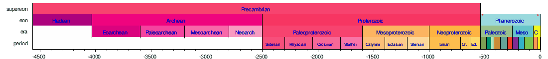


Horizontal scale is Millions of years (above timelines) / Thousands of years (below timeline)

| Provinces | |
|---|---|
| Territories | |