Hienghène
This article relies largely or entirely on a single source. (March 2017) |
Hienghène | |
|---|---|
 "La Poule" (the hen) cliff in Hienghène | |
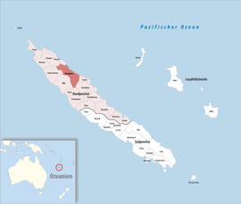
 Location of the commune (in red) within New Caledonia | |
| Coordinates: 20°41′39″S 164°55′20″E / 20.6941°S 164.9222°E | |
| Country | Mixed 2.61% Other 0.73% |
| Time zone | UTC+11:00 |
| INSEE/Postal code | /98815 |
| Elevation | 0–1,628 m (0–5,341 ft) (avg. 20 m or 66 ft) |
| 1 New Caledonia Land Register (DITTT) data, which exclude lakes and ponds larger than 1 km² (0.386 sq mi or 247 acres) as well as the estuaries of rivers. | |
Hienghène ([jəŋ.ɡɛːn];[3][4] Fwâi: Hyehen) is a commune in the North Province of New Caledonia, an overseas territory of France in the Pacific Ocean. It is located on a bay called Hienghène Bay, known for its eroded limestone islets.[5]
The islets are remnants of a limestone and silica formation that once covered the whole of the bay, some 40 million years ago.[5] Erosion from wind and water carved away the softer limestone, leaving the harder silica behind in eye-catching formations. Several of these formations have been given fanciful names, such as the Sphinx, the Towers of Notre Dame, and the Hen (pictured).[5]
References
- ^ "Répertoire national des élus: les maires" (in French). data.gouv.fr, Plateforme ouverte des données publiques françaises. 13 September 2022.
- ^ Population, ménages et logement par commune, en 2019, Institut de la statistique et des études économiques Nouvelle-Calédonie
- ISBN 9789820200951– via Google Books.
- ISBN 9781566914116– via Internet Archive.
Hienghène pronunciation.
- ^ ISBN 0-89577-087-3.
Wikimedia Commons has media related to Hienghène.

