
Humboldt River
| Humboldt River | |
|---|---|
 The Humboldt River, flowing through Carlin Canyon | |
 Map of the Humboldt River watershed | |
| Etymology | Alexander von Humboldt |
| Location | |
| Country | United States |
| State | Nevada |
| Physical characteristics | |
| Source | Humboldt Wells |
| • location | East Humboldt Range, Elko County, Nevada |
| • coordinates | 41°7′13″N 114°58′5″W / 41.12028°N 114.96806°W[1] |
| • elevation | 5,620 ft (1,710 m)[1] |
| Mouth | Humboldt Sink |
• location | Churchill County, Nevada |
• coordinates | 39°59′17″N 118°36′4″W / 39.98806°N 118.60111°W[1] |
• elevation | 3,894 ft (1,187 m)[1] |
| Length | 290 mi (470 km) |
| Basin size | 16,680 sq mi (43,200 km2) |
| Discharge | |
| • average | 390 cu ft/s (11 m3/s)[2] |
| • minimum | 0 cu ft/s (0 m3/s) |
| • maximum | 17,000 cu ft/s (480 m3/s) |
Nevada Historical Marker | |
| Reference no. | 22[3] |
The Humboldt River is an extensive river drainage system located in north-central Nevada. It extends in a general east-to-west direction from its headwaters in the Jarbidge, Independence, and Ruby Mountains in Elko County, to its terminus in the Humboldt Sink, approximately 225 miles (362 km) away in northwest Churchill County.[4] Most estimates put the Humboldt River at 300 to 330 miles (480 to 530 km) long;[5][6] however, due to the extensive meandering nature of the river, its length may be more closely estimated at 380 miles (610 km).[7] It is located within the Great Basin Watershed and is the third-longest river in the watershed behind the Bear River at 355 miles (571 km) and the Sevier River at 325 miles (523 km). The Humboldt River Basin is the largest sub-basin of the Great Basin, encompassing an area of 16,840 square miles (43,600 km2).[4] It is the only major river system wholly contained within the state of Nevada.
It is the only natural transportation artery across the Great Basin and has historically provided a route for westward migration. Additionally, two major railroad routes loosely follow its path. Interstate 80 follows the river's course from its source to its mouth. The river is named for the German naturalist Alexander von Humboldt.[8][9]
History

The region of the river in northern Nevada was sparsely inhabited by
The first recorded sighting of the river was on November 9, 1828, by

In 1841, the river (then known as Mary's River) first became the route of the
In the 20th century, the valley of the river became the route for
Watershed and course

The Humboldt River can be divided geographically into the upper, middle, and lower divisions based on Palisade Canyon and Emigrant Canyon being the major constriction points along the Humboldt River Valley. The upper basin begins in northeastern Nevada and drains about 5,000 square miles (13,000 km2) upstream from Palisade. The middle basin has a drainage area of about 7,800 square miles (20,000 km2) and lies between Palisade and Emigrant Canyons, a narrow gap located just downstream from Comus. The lower basin is an area encompassing some 4,100 square miles (11,000 km2) from below Emigrant Canyon and extending through the Humboldt Sink in northwestern Nevada.[14]
A hydrologic definition instead divides the Humboldt River drainage into two basins—one above and one below Palisade—based on flows that increase above and decrease below this part of the river. The river in the upper basin is 92 miles (148 km) long, and in the lower basin it is 218 miles (351 km) long. The major tributaries of the upper Humboldt River basin are (heading downstream) Bishop Creek,
The source of the main stem of the river is a spring called Humboldt Wells at the northern tip of the East Humboldt Range, just outside the city of Wells. The river flows west-southwest through Elko County, past the communities of Elko and Carlin. Approximately 15 miles (24 km) upstream from Elko, the river receives the North Fork of the Humboldt River and receives the South Fork approximately 7 miles (11 km) downstream of Elko.
In northern Eureka County, it passes through Palisade Canyon between the southern end of the Tuscarora Mountains and the north end of the Shoshone Range. At Battle Mountain, the river turns northwest for approximately 50 miles (80 km), then west at Red House and past Golconda and a spur of the Sonoma Range. It merges with the Reese River near Battle Mountain and receives the Little Humboldt River approximately 5 miles (8 km) upstream from Winnemucca.
Past the junction with the Little Humboldt, the river turns southwest, flowing past Winnemucca and through
The river gains most of its water from snowmelt in the mountains in the eastern part of the watershed, most importantly the Ruby Mountains, Jarbidge Mountains, and Independence Mountains. River flow generally decreases downstream to the west, partly due to water removal from the river for irrigation, especially near Lovelock. Stream-gauge measurements undertaken by the United States Geological Survey suggest that Palisade Canyon, between Carlin and Beowawe, is the point where the river's flow ceases to increase and begins to decrease. Also, since the Humboldt's water comes almost exclusively from snowmelt, its flow is highly variable from season to season (peak flow occurs during the spring melt) and from year to year (depending on the amount of snow every winter)[2][14]
-
 Source of the Humboldt River in Wells
 -
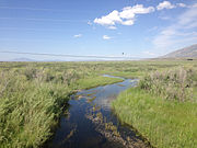 The Humboldt River near Deeth
 -
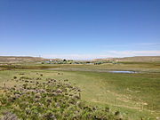
 The Humboldt flows through the Rye Patch Reservoir
 -
 Humboldt River near Lovelock

_in_Deeth,_Nevada.JPG)


Ecology

The
_-_Algonquin_Provincial_Park,_Ontario_01.jpg)
Environmental aspects

The Humboldt River and its surrounding areas have raised some concern about the increasing levels of toxic elements such as arsenic and mercury. These elements show in fish and other wildlife that consume the water. The quantity being absorbed by fish specifically is not of concerning levels, though. Brumbaugh and May took samples of fish from the south fork of the Humboldt River. They determined that mercury levels within the fish were between 0.061 and 0.082 micrograms per gram of flesh.[25] This is well below the EPA's guideline of 0.30 micrograms per gram.[25] However, though low levels are found in animals, many people are concerned that drinking water and surrounding land is still contaminated. They believe the contamination came from prior mining excursions. Mercury was commonly mined in the area and so was gold.[26] Whether it was leaching from the gold mining process or leftover mercury ore, these toxic elements entered the environment and waterway. Since then, these levels have gone down considerably. The U.S. Geological Survey and other committees conducted a couple of surveys to determine the safety of the drinking water. In 1962 the Water Resources Bulletin, out of Carson City, conducted one of the first main tests. This preliminary test was to determine every mineral, element, and ion present.[27] The next big test was done in 1985 by the U.S. Geological Survey. They took samples from a much more local area and determined concentrations were high, but not abnormally high.[28] Another more recent test, which was done in 2002, was specifically on mercury being leached from abandoned mines. However, this test determined that mercury levels dropped off very quickly the further away the tests were done.[29] Finally, the most recent study,[as of?] done in 2019, was an extremely comprehensive test which included samples from numerous places throughout the river's path. This test was based out of the University of Nevada Reno and determined what elements and minerals were present. It also determined that toxic element concentrations were fairly consistent.[30] This means that while these elements are present, they do not pose a severe threat.
See also
- List of Nevada rivers
- Sarah Winnemucca
References
- ^ a b c d "Humboldt River". Geographic Names Information System. United States Geological Survey. 1980-11-28. Retrieved 2014-08-25.
- ^ a b "USGS Gage#10336000 on the Humboldt River near Lovelock". National Water Information System. United States Geological Survey. 1913–2000. Retrieved 2010-02-25.
- ^ a b Nevada Historical Marker 22 Nevada State Historic Preservation Office. 2010. Retrieved 2014-08-25
- ^ a b "Humboldt River Chronology" (PDF). Nevada Division of Water.
- ^ "Science in the Humboldt River Basin | U.S. Geological Survey".
- ^ http://water.nv.gov/mapping/chronologies/humboldt/hrc-pt1.pdf [bare URL PDF]
- )
- OCLC 249566017. Retrieved 2014-08-25.
- ^ Federal Writers' Project (1941). Origin of Place Names: Nevada (PDF). W.P.A. p. 11.
- ISBN 0-12-088253-1.
- ^ Scrugham, James C. (1935). "The Hudson's Bay Company in Nevada, from Nevada: The Narrative of the Conquest of a Frontier Land, vol. I, pp. 39-44]". The Nevada Observer. Archived from the original (reprint, 2006-12-09) on 2010-12-20. Retrieved 2010-12-30.
- ^ Ogden, Peter Skene (copied by Laut, Agnes C., in 1905) (1829). "Journal of Peter Skene Ogden; Snake Expedition, 1828-1829". American Mountain Men. Retrieved 2014-08-25.
{{cite web}}: CS1 maint: multiple names: authors list (link) CS1 maint: numeric names: authors list (link) - ISBN 0-7734-7534-6.
- ^ a b c d e Horton, Gary A. (2000). Humboldt River Chronology: An Overview (PDF). Carson City, Nevada: Nevada Division of Water Planning. Retrieved 2014-08-25.
- ^ "Marys River". Geographic Names Information System. United States Geological Survey. 1980-12-12. Retrieved 2014-08-25.
- ^ "Susie Creek". Geographic Names Information System. United States Geological Survey. 1980-12-12. Retrieved 2014-08-25.
- ^ "Maggie Creek". Geographic Names Information System. United States Geological Survey. 1980-12-12. Retrieved 2014-08-25.
- ^ Autobee, Robert. "Humboldt Project". Bureau of Reclamation. Archived from the original on 2013-03-16. Retrieved 2012-06-05.
- ISBN 0-929591-95-X.
- S2CID 84316986.
- ^ Hyslop, Larry (2013-01-04). "Nature Notes: Beavers Working for Us". Elko Daily Press. Retrieved 2013-01-27.
- ^ "Beaver Creek". Geographic Names Information System. United States Geological Survey, United States Department of the Interior.
- ^ "Beaver Peak". Geographic Names Information System. United States Geological Survey, United States Department of the Interior.
- ^ Maggie and Susie Creek Fish Barriers (PDF) (Report). Bureau of Land Management, Elko District. November 2011. Archived from the original (PDF) on 2015-09-23. Retrieved 2014-10-21.
- ^ a b May, Thomas W.; Brumbaugh, William G. (2007). Determination of Total Mercury in Whole-Body Fish and Fish Muscle Plugs Collected from the South Fork of the Humboldt River, Nevada, September 2005. Reston, Va: U.S. Geological Survey.
- ^ Folger, H., Yager, D. B., Ludington, S. D., & Stillings, L. L. (2003). "Landscape geochemistry for the Humboldt River basin, northern Nevada". Geological Society of America.
{{cite journal}}: CS1 maint: multiple names: authors list (link) - ^ Cohen, P (1962). "Preliminary results of hydrogeochemical studies in the Humboldt River valley near Winnemucca, Nevada". Water Resources Bulletin.
- ^ Peterson, J. A., Wong G. (1985). Geochemical analyses of rock and stream-sediment samples from the north fork of the Little Humboldt River wilderness study area, Humboldt County, Nevada. U.S. Geological Survey.
- S2CID 128982828.)
{{cite journal}}: CS1 maint: multiple names: authors list (link - ^ Mohammad, S., & Tempel, R. N. (2019). Arsenic in the waters and sediments of the Humboldt River, north-central Nevada, USA; hydrological and mineralogical investigation. Environmental Earth Sciences.
{{cite book}}: CS1 maint: multiple names: authors list (link)
Further reading
- Wallace, A.R. et al. (2005). Metallic mineral resource assessment of the Humboldt River Basin, northern Nevada (USGS Fact Sheet 2005-3023]. Reno, NV: U.S. Department of the Interior, U.S. Geological Survey.
- Yager, D.B. and H.W. Folger. (2003). Map showing silver concentrations from stream sediments and soils throughout the Humboldt River Basin and surrounding areas, northern Nevada [U.S. Geological Survey Miscellaneous Field Studies Map MF-2407-I]. Denver, CO: U.S. Department of the Interior, U.S. Geological Survey.
External links
 Media related to Humboldt River at Wikimedia Commons
| National | |
|---|---|
| Other | |