
Kliding
Kliding | |
|---|---|
 Coat of arms | |
Location of Kliding within Cochem-Zell district 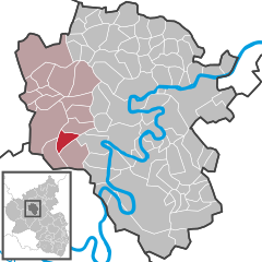 | |
Cochem-Zell | |
| Municipal assoc. | Ulmen |
| Government | |
| • Mayor (2019–24) | Gerhard Müller[1] |
| Area | |
| • Total | 5.27 km2 (2.03 sq mi) |
| Elevation | 415 m (1,362 ft) |
| Population (2022-12-31)[2] | |
| • Total | 217 |
| • Density | 41/km2 (110/sq mi) |
| Time zone | UTC+01:00 (CET) |
| • Summer (DST) | UTC+02:00 (CEST) |
| Postal codes | 56825 |
| Dialling codes | 02677 |
| Vehicle registration | COC |
| Website | www.kliding.de |

Kliding is an
Geography
Location
The municipality lies in the
Climate
Yearly
History
In 1360, Kliding had its first documentary mention as a fief held by the widow of Dietrich, Lord at Ulmen. Electoral-Trier overlordship ended with the French Revolutionary occupation of the Rhine’s left bank between 1794 and 1796. In 1815 Kliding was assigned to the Kingdom of Prussia at the Congress of Vienna. Urschmitt and Kliding, which together formed a single municipality, were split into two separate ones in 1848. In 1869, the consecration of a new chapel at Kliding was celebrated. Since 1946, Kliding has been part of the then newly founded state of Rhineland-Palatinate.
Politics
Municipal council
The council is made up of 6 council members, who were elected by
Mayor
Kliding’s mayor is Gerhard Müller.[1]
Coat of arms
The municipality’s arms might be described thus: Per pale and chevron, argent and vert counterchanged, in dexter chief an oak sprig bendwise slipped fructed of two and leafed of four of the second, in sinister chief a cross patriarchal of the first, in dexter base a waterwheel spoked of four of the second, in sinister base a horseshoe bendwise, the ends to chief, sable.
Culture and sightseeing
Buildings
The following are listed buildings or sites in Rhineland-Palatinate’s Directory of Cultural Monuments:
- Saint Wendelin’s Catholic Church (Kirche St. Wendelin), Oberdorfstraße 1 – Gothic Revival aisleless church, 1861–1862, building inspector Ferdinand Nebel, west tower 1904[4]
Saint Wendelin’s is also noted for its windows. Kliding is also home to a Heiligenhäuschen (a small, shrinelike structure consecrated to a saint or saints) known as the Dreifaltigkeitsheiligenhäuschen (“Trinity Heiligenhäuschen”), which stands on Mühlweg.
Natural monuments
References
- ^ a b Direktwahlen 2019, Landkreis Cochem-Zell, Landeswahlleiter Rheinland-Pfalz, accessed 9 August 2021.
- Statistisches Landesamt Rheinland-Pfalz. 2023.
- ^ Kommunalwahl Rheinland-Pfalz 2009, Gemeinderat
- ^ Directory of Cultural Monuments in Cochem-Zell district
- ^ Schießlay
External links
- Municipality’s official webpage (in German)

| International | |
|---|---|
| National | |