
Binningen, Rhineland-Palatinate
Binningen | |
|---|---|
 Coat of arms | |
Location of Binningen within Cochem-Zell district 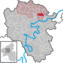 | |
Cochem-Zell | |
| Municipal assoc. | Kaisersesch |
| Government | |
| • Mayor (2019–24) | Günter Urwer[1] |
| Area | |
| • Total | 6.70 km2 (2.59 sq mi) |
| Elevation | 300 m (1,000 ft) |
| Population (2022-12-31)[2] | |
| • Total | 704 |
| • Density | 110/km2 (270/sq mi) |
| Time zone | UTC+01:00 (CET) |
| • Summer (DST) | UTC+02:00 (CEST) |
| Postal codes | 56754 |
| Dialling codes | 02672 |
| Vehicle registration | COC |
| Website | www.binningen.de |
Binningen is an
Geography
The municipality lies in the
History
In 1246, Binningen had its first documentary mention in connection with the Rosenthal
Beginning in 1794, Binningen lay under French rule, during which the Rosenthal Convent was dissolved, sold off and torn down. In 1815 Binningen was assigned to the Kingdom of Prussia at the Congress of Vienna. The church in Binningen was built in 1855 and is named after the two patron saints, Saint Remigius and Saint Maximus. Between 1995 and 2002, the whole church was thoroughly renovated both inside and out.
Since 1946, Binningen has been part of the then newly founded state of Rhineland-Palatinate.
Politics
Municipal council
The council is made up of 12 council members, who were elected by
Mayor
Binningen's mayor is Günter Urwer.[4]
Coat of arms
The municipality's arms might be described thus: Argent a cross gules between in chief two bishop's mitres of the second garnished Or, in base dexter a rose vert and in base sinister a fleur-de-lis azure.
The
Culture and sightseeing
Buildings
The following are listed buildings or sites in Rhineland-Palatinate’s Directory of Cultural Monuments:
- Catholic Church (Kirche St. Remigius und Maximus), Hauptstraße – Gothic Revival quarrystone aisleless church, 1855-1857, architect, V. Statz, Cologne.
- Friedhofstraße, graveyard – basalt wayside cross from 1735.
- Hauptstraße 31 – estate complex; quarrystone building with half-hipped roof, partly timber-frame, 18th/19th century.
- Hauptstraße 35/37 – castle remnant (?), whole complex; plastered building, 17th century (?).
- Rosenthaler Weg, Jewish graveyard (monumental zone) – roughly 90 grave steles.
- Chapel, on Landesstraße (State Road) 108/Kreisstraße 29 – plastered building, Crucifixion scene inside.
- Chapel, near the Eltzerhöfe northeast of the village – with small ridge turret, from 1857.
- Ruins of the Rosenthal Convent, in the Pommerbach valley, southwest of the village –
Dialect
In Binningen, a
References
- ^ Direktwahlen 2019, Landkreis Cochem-Zell, Landeswahlleiter Rheinland-Pfalz, accessed 9 August 2021.
- Statistisches Landesamt Rheinland-Pfalz. 2023.
- ^ Kommunalwahl Rheinland-Pfalz 2009, Gemeinderat
- ^ Binningen’s council Archived February 1, 2011, at the Wayback Machine
- ^ Description and explanation of Binningen’s arms Archived March 9, 2010, at the Wayback Machine
- ^ Directory of Cultural Monuments in Cochem-Zell district
- ^ Binningen speech Archived February 1, 2011, at the Wayback Machine
External links
- Official website
 (in German)
 - Brief portrait of Binningen at SWR Fernsehen (in German)

| International | |
|---|---|
| National | |