
Mount Jerai
This article needs additional citations for verification. (March 2016) |
| Mount Jerai | |
|---|---|
 | |
| Highest point | |
| Elevation | 1,217 m (3,993 ft) |
| Prominence | 1,184 m (3,885 ft) |
| Listing | Ribu |
| Naming | |
| Native name | Gunung Jerai (Malay) |
| Geography | |
 Mount Jerai Location in Malaysia | |
| Location | Kedahans |

Mount Jerai (Malay: Gunung Jerai), formerly Kedah Peak, is a mountain in Kedah, Malaysia with the height of 3,993 feet (1,217 m). Within Kedah itself, the mountain stands at the border of Kuala Muda and Yan districts.
Mount Jerai is known as the Hausberg of the town of Sungai Petani, the district capital of Kuala Muda.
Geology
Mount Jerai is a 1,217- metre tall
Insular origins
There is an information board on top of the mountain stating that it used to be an island called Pulai Serai before the sea levels receded letting it form a mountain. This is probably supported by I Ching's record of Pu Lou Shi (Pulau Sri), a country located west of Sribogha.[2]
Tourism


The summit of Jerai has been developed into a
Gallery
-
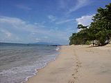
 Mount Jerai towers over a paddy field.
 -
 East face of Jerai, viewed from Gurun.
 -
 Mount Jerai, seen from Guar Chempedak.
 -
 The mountain as seen fromBatu Feringghi, Penang, 41 km (25 mi) southwest.
 -
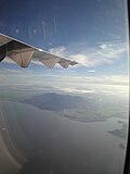 Aerial view of Jerai andcommercial flight.

.jpg)


.jpg)
See also
References
- ^ Bradford, E.F., Geology and Mineral Sources of Gunung Jerai Area, Kedah. Geological Survey District Memoir 13, Geological Survey Malaysia, 1972.
- ISBN 9788120616226. Retrieved 15 April 2016.
5°47′N 100°26′E / 5.783°N 100.433°E
This Kedah location article is a stub. You can help Wikipedia by expanding it. |