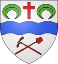
Neuilly-sur-Marne
Neuilly-sur-Marne | |
|---|---|
 The town hall of Neuilly-sur-Marne | |
 Paris and inner ring departments | |
| Coordinates: 48°51′13″N 2°32′56″E / 48.853733°N 2.549027°E | |
| Country | France |
| Region | Île-de-France |
| Department | Seine-Saint-Denis |
| Arrondissement | Le Raincy |
| Canton | Gagny |
| Intercommunality | Grand Paris |
| Government | |
| • Mayor (2022–2026) | Zartoshte Bakhtiari[1] |
| Area 1 | 6.86 km2 (2.65 sq mi) |
| Population (2021)[2] | 37,531 |
| • Density | 5,500/km2 (14,000/sq mi) |
| Time zone | UTC+01:00 (CET) |
| • Summer (DST) | UTC+02:00 (CEST) |
| INSEE/Postal code | 93050 /93330 |
| Elevation | 36–80 m (118–262 ft) |
| 1 French Land Register data, which excludes lakes, ponds, glaciers > 1 km2 (0.386 sq mi or 247 acres) and river estuaries. | |
Neuilly-sur-Marne (French pronunciation: [nøji syʁ maʁn] , lit. 'Neuilly on Marne') is a French commune in the
Geography
Crossed by the river Marne.
Climate
Neuilly-sur-Marne has an oceanic climate (Köppen climate classification Cfb). The average annual temperature in Neuilly-sur-Marne is 12.3 °C (54.1 °F). The average annual rainfall is 721.2 mm (28.39 in) with December as the wettest month. The temperatures are highest on average in July, at around 20.7 °C (69.3 °F), and lowest in January, at around 4.9 °C (40.8 °F). The highest temperature ever recorded in Neuilly-sur-Marne was 42.5 °C (108.5 °F) on 25 July 2019; the coldest temperature ever recorded was −17.0 °C (1.4 °F) on 17 January 1985.
| Climate data for Neuilly-sur-Marne (1991−2020 normals, extremes 1981−present) | |||||||||||||
|---|---|---|---|---|---|---|---|---|---|---|---|---|---|
| Month | Jan | Feb | Mar | Apr | May | Jun | Jul | Aug | Sep | Oct | Nov | Dec | Year |
| Record high °C (°F) | 16.6 (61.9) |
21.4 (70.5) |
26.9 (80.4) |
29.9 (85.8) |
33.1 (91.6) |
38.3 (100.9) |
42.5 (108.5) |
40.5 (104.9) |
35.4 (95.7) |
29.7 (85.5) |
22.5 (72.5) |
18.0 (64.4) |
42.5 (108.5) |
| Mean daily maximum °C (°F) | 7.7 (45.9) |
9.0 (48.2) |
13.1 (55.6) |
16.8 (62.2) |
20.4 (68.7) |
23.8 (74.8) |
26.2 (79.2) |
26.2 (79.2) |
22.0 (71.6) |
16.9 (62.4) |
11.3 (52.3) |
8.1 (46.6) |
16.8 (62.2) |
| Daily mean °C (°F) | 4.9 (40.8) |
5.4 (41.7) |
8.5 (47.3) |
11.5 (52.7) |
15.1 (59.2) |
18.4 (65.1) |
20.7 (69.3) |
20.4 (68.7) |
16.6 (61.9) |
12.7 (54.9) |
8.1 (46.6) |
5.4 (41.7) |
12.3 (54.1) |
| Mean daily minimum °C (°F) | 2.1 (35.8) |
1.9 (35.4) |
4.0 (39.2) |
6.2 (43.2) |
9.8 (49.6) |
13.1 (55.6) |
15.1 (59.2) |
14.7 (58.5) |
11.2 (52.2) |
8.5 (47.3) |
5.0 (41.0) |
2.6 (36.7) |
7.8 (46.0) |
| Record low °C (°F) | −17.0 (1.4) |
−12.5 (9.5) |
−9.5 (14.9) |
−4.3 (24.3) |
−0.6 (30.9) |
4.0 (39.2) |
7.5 (45.5) |
5.0 (41.0) |
1.5 (34.7) |
−4.5 (23.9) |
−8.7 (16.3) |
−8.9 (16.0) |
−17.0 (1.4) |
| Average precipitation mm (inches) | 57.7 (2.27) |
50.6 (1.99) |
51.5 (2.03) |
50.2 (1.98) |
72.4 (2.85) |
62.4 (2.46) |
64.4 (2.54) |
60.4 (2.38) |
52.2 (2.06) |
60.5 (2.38) |
62.8 (2.47) |
76.1 (3.00) |
721.2 (28.39) |
| Average precipitation days (≥ 1.0 mm) | 11.5 | 10.4 | 10.0 | 8.9 | 9.6 | 8.7 | 7.9 | 8.8 | 8.1 | 10.1 | 11.3 | 12.8 | 118.0 |
| Source: Météo-France[3] | |||||||||||||
History
On 13 April 1892, a third of the territory of Neuilly-sur-Marne was detached and became the commune of Neuilly-Plaisance.
|
| ||||||||||||||||||||||||||||||||||||||||||||||||||||||||||||||||||||||||||||||||||||||||||||||||||||||||||||||||||
| |||||||||||||||||||||||||||||||||||||||||||||||||||||||||||||||||||||||||||||||||||||||||||||||||||||||||||||||||||
| Source: EHESS[4] and INSEE (1968-2017)[5] | |||||||||||||||||||||||||||||||||||||||||||||||||||||||||||||||||||||||||||||||||||||||||||||||||||||||||||||||||||
Transport
Neuilly-sur-Marne is served by no station of the Paris Métro, RER, or suburban rail network. The closest station to Neuilly-sur-Marne is
Education
Schools in the commune:[6]
- 12 preschools/nursery schools (maternelles):
- 10 elementary schools
- Junior high schools (collèges): Georges Braque, Albert Camus, and Honoré de Balzac
- 1 Senior high school/sixth-form college : Lycée Cugnot
Senior high schools/sixth-form colleges in the surrounding area include:
- Lycée Georges Clemenceau - Villemomble[7]
- Lycée Gustave Eiffel - Gagny[8]
- Lycée Evariste Galois - Noisy-le-Grand[9]
Monuments
Personalities
- Evens Joseph, footballer
- Sylvain Wiltord, footballer
- William Vainqueur, footballer
Heraldry
See also
References
- ^ "Répertoire national des élus: les maires" (in French). data.gouv.fr, Plateforme ouverte des données publiques françaises. 4 May 2022.
- ^ "Populations légales 2021" (in French). The National Institute of Statistics and Economic Studies. 28 December 2023.
- ^ "Fiche Climatologique Statistiques 1991-2020 et records" (PDF). Météo-France. Retrieved August 23, 2022.
- ^ Des villages de Cassini aux communes d'aujourd'hui: Commune data sheet Neuilly-sur-Marne, EHESS (in French).
- ^ Population en historique depuis 1968, INSEE
- ^ "Établissements scolaires." Neuilly-sur-Marne. Retrieved on September 8, 2016. (notice there are two pages!) - The senior highs/sixth-form colleges (lycées) are not in the city limits
- ^ "Lycée Georges Clémenceau." Neuilly-sur-Marne. Retrieved on September 8, 2016.
- ^ "Lycée Gustave Eiffel." Neuilly-sur-Marne. Retrieved on September 8, 2016.
- ^ "Lycée Evariste Galois." Neuilly-sur-Marne. Retrieved on September 8, 2016.
External links
- Official website (in French)


