
Presidio La Bahía
Presidio La Bahía | |
 Presidio La Bahía as it stands today | |
 Presidio Nuestra Señora de Loreto de la Bahía | |
| Nearest city | Goliad, Texas |
|---|---|
| Coordinates | 28°38′48″N 97°22′54″W / 28.64667°N 97.38167°W |
| Area | 45 acres (18 ha) |
| Built | 1749 |
| NRHP reference No. | 67000024[1] |
| RTHL No. | 4119 |
| Significant dates | |
| Added to NRHP | December 24, 1967 |
| Designated NHL | December 24, 1967[2] |
| Designated RTHL | 1969 |
The Presidio Nuestra Señora de Loreto de la Bahía, known more commonly as Presidio La Bahía, or simply La Bahía is a
During the Texas Revolution, the presidio was the site of the Battle of Goliad in October 1835, and the Goliad massacre in March 1836. It was restored in the 1960s and became a National Historic Landmark in 1967. While several adjacent historical sites in Goliad are now part of the Texas state parks system, La Bahía is owned by the Catholic Diocese of Victoria, Texas but operates as a public museum. It is currently the most important mission in Texas.
Overview
Founded in 1721 on the ruins of the failed French
The presidio was captured by insurgents twice during the
During the siege of the Alamo, Texian commander William B. Travis several times asked La Bahía commander James Fannin to bring reinforcements. Although Fannin and his men attempted a relief mission, they abandoned the attempt the following day. After the fall of the Alamo, General Sam Houston ordered Fannin to abandon La Bahía. He did so on March 19, 1836, but took a leisurely path. Following the Battle of Coleto, the La Bahía garrison was captured and imprisoned in the Presidio.
On March 27, 1836, the Texian captives were marched outside the presidio walls and executed, an event known as the Goliad massacre.
Today, the location is a restored historical site, considered among the most attractive Spanish presidio sites in the United States.[4] Directly adjacent, though technically a separate property, is the Fannin Memorial Monument commemorating the massacre.
Origins
Spain claimed control over the area now known as

Alonso de León recommended that Spanish authorities establish presidios at the Rio Grande, the Frio River, and the Guadalupe River. Due to a shortage of funds the Spanish government chose not to establish any presidios.[9] Consequently, several Spanish missions in East Texas struggled from 1691 to 1693, until they failed, leaving Texas again unprotected by Spain.[10]
France during the subsequent decades established a presence in
Priests at the nearby mission were unable to find an effective means of enticing the Karankawa into mission life or Catholic teachings. In April 1725 the friars requested that the mission be moved to a more favorable location. The next year both the presidio—retaining the name "Presidio La Bahía"—and Mission Espíritu Santo were relocated 26 miles (42 km) inland, along the
Establishment on the San Antonio River
In 1747, the Spanish government sent
In February 1750, the new presidio was under the command of Captain Manuel Ramírez de la Piszena. Piszena had personally paid for a stone house to be built for himself, and the 50 soldiers in the garrison lived either in a large barracks or in one of 40 temporary wood homes that had been built for those with families. A chapel had also been built for the presidio. The presidio was fortified with six 8-lb cannon. Soldiers alternated guard duty at the presidio and the mission; others were assigned to guard the presidio horses or to protect supply trains coming from the Rio Grande or

With the conclusion of the
Mexican independence
The
Unable to win a decisive victory, Salcedo lifted the siege on February 19, 1813 and turned towards San Antonio de Béxar.[31] The rebels remained in control of the presidio until July or August 1813, when José Joaquín de Arredondo led royalist troops in retaking all of Texas.[32] A member of the Republican Army of the North, Henry Perry, led forces back to Texas in 1817 and attempted to recapture La Bahía. The presidio was reinforced by soldiers from San Antonio, and Perry and his men were defeated on June 18 near Coleto Creek.[32]
La Bahía was again the target of invaders in 1821. After the United States and Spain signed the
Texas Revolution
Battle of Goliad
_1836.jpg)
By 1835, La Bahía was one of two major garrisons within
In the pre-dawn hours of October 10, 1835, the Texians attacked the presidio.[40] The Texians quickly hacked through a door on the north wall of the fortress and ran to the interior courtyard. Hearing the commotion, the Mexican soldiers had lined the walls to defend the fort.[41] The Mexican soldiers opened fire, hitting Samuel McCulloch, a freed slave, in the shoulder.[40] Texians returned fire for approximately 30 minutes. During a pause in the fighting, a Texian spokesperson yelled out that the Texians would "massacre everyone of you, unless you come out immediately and surrender."[42] The Mexican garrison immediately surrendered.[42]
Over the next several days, more Texian settlers joined the group at La Bahía. Stephen F. Austin, the commander-in-chief of the newly formed Texian Army, ordered that 100 men remain at La Bahía, under the command of Philip Dimmitt, while the rest should join the Texian Army in marching on Cos's troops in Béxar.[43] Texian troops confiscated the provisions they found at the fort. Although they found 300 muskets, most of them were broken and unable to be repaired.[41][42] The food, clothing, blankets, and other provisions were valued at $10,000.[41] For the next three months, the provisions were parcelled out among companies in the Texian Army.[43] The Texians also gained control of several cannon.[44]
Battle of the Alamo support

At some point, Colonel James Fannin became the commander of the troops at La Bahía. He renamed the presidio Fort Defiance.[45] In February 1836, President Antonio López de Santa Anna led a large force of Mexican Army troops into Texas to quell the revolution. Santa Anna and part of his force entered Béxar on February 23 and initiated a siege of the Alamo. Alamo commander William B. Travis immediately sent a courier to Fannin, asking him to provide reinforcements to the Alamo.[46] At first unable to make up his mind, Fannin finally decided to ride to the relief of the Alamo.[47] Historian Robert Scott suggests that the trip was initiated after Fannin's objections were overridden by his officers.[48]
On the morning of February 26, 1836, he set out with 320 men, 4 cannon, and several supply wagons for the 90 miles (140 km) march from Goliad to the Alamo.[47] The Goliad garrison had no horses to move the wagons and artillery and were forced to rely on oxen.[49] Barely 200 yards (180 m) into their journey, one of the wagons broke down, and the expedition stopped for repairs.[47] The group then took six hours to cross the waist-deep water of the San Antonio River. By the time they reached the other side it was dark, and the men camped along the river. The cold front reached Goliad that evening, and the poorly-dressed soldiers were "quickly chilled and miserable" in the driving rain.[50] On awakening, Fannin realized that all of the Texian oxen had wandered off, and that his men had neglected to pack food for the journey.[51] It took most of the day for the men to round up the oxen; after two days of travel, Fannin's men had not even ventured 1 mile (1.6 km) from their fort.[52]
In a letter to Acting Governor James Robinson, Fannin said that his officers approached him to ask that the rescue trip be cancelled, as they had received word that General Urrea's army was marching towards Goliad.[50] The officers and men in the expedition claimed that Fannin decided on his own to abort the mission. Several of the men agreed with the decision, with Dr. Barnard writing in his journal, "With but three or four hundred men, mostly on foot, with but a limited supply of provisions, to march a distance of nearly one-hundred miles through uninhabited country for the purpose of relieving a fortress beleaguered by five-thousand men was madness!"[53]
Goliad massacre
After learning of the fall of the Alamo, General Sam Houston ordered Fannin and his men to abandon La Bahía and fall back to Victoria. They began the retreat on March 19, 1836, carrying with them nine pieces of artillery but little food or water. Fannin showed no signs of haste, and on the banks of Coleto Creek Mexican General José de Urrea and his men attacked. Although the Texians initially repulsed the attacks, they soon ran out of water and Fannin surrendered.[45]
The Texians were escorted back to La Bahía, arriving by March 22, 1836. Although Urrea requested that Santa Anna treat the prisoners with clemency, on March 27, 1836, the men were marched from the fort and executed by Mexican soldiers, in an event known as the Goliad massacre.[45]
Restoration
In the 1960s, local philanthropist Kathryn O'Connor donated $1 million to restore the presidio. Construction took place between 1963 and 1968, under the oversight of architect Raiford Stripling. The building[clarification needed] was essentially rebuilt from the ground up to look exactly as it had originally.[54] In his Spanish Missions of Texas, Herbert Malloy Mason remarked that the presidio was one of "the finest examples of Spanish ecclesiastical building on the North American continent".[55]
Gallery
-
 The Presidio chapel as it looked in 1936
 -
 Presidio chapel
 -
 Defensive turret along the walls of the fort
 -
 Gate leading from the chapel courtyard to the fortress courtyard
 -
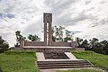 Goliad Massacre Monument
.jpg)


.jpg)
See also
- National Register of Historic Places listings in Goliad County, Texas
- Recorded Texas Historic Landmarks in Goliad County
- Presidio San Luis de las Amarillas
Footnotes
- ^ "National Register Information System". National Register of Historic Places. National Park Service. July 9, 2010.
- ^ Staff (June 2011). "National Historic Landmarks Survey: List of National Historic Landmarks by State (Texas)" (PDF). National Park Service. Retrieved January 23, 2018.
- ^ a b c Roell (1994), p. 15.
- ^ Mason, Herbert Molloy Jr. (1974), Missions of Texas, Birmingham, AL: Southern Living Books
- ^ Chipman (1992), p. 26.
- ^ a b Weber (1992), p. 149.
- ^ Chipman (1992), p. 83.
- ^ Weber (1992), p. 153.
- ^ Chipman (1992), p. 88.
- ^ Weber (1992), p. 155.
- ^ Weber (1992), pp. 159–160.
- ^ Chipman (1992), p. 111.
- ^ Chipman (1992), p. 112.
- ^ Weber (1992), pp. 165–166.
- ^ Weber (1992), p. 168.
- ^ Chipman (1992), p. 126.
- ^ Roell (1994), p. 11.
- ^ Roell (1994), p. 12.
- ^ Roell (1994), p. 13.
- ^ a b Roell (1994), p. 14.
- ^ Urrutia, Lafora and Ruby, 1769 Map of the Frontier, US Library of Congress
- ^ Weber (1992), p. 198.
- ^ Chipman (1992), p. 173.
- ^ Roell (1994), p. 19.
- ^ Owsley (1997), p. 40.
- ^ Almaráz (1971), p. 109.
- ^ Almaráz (1971), p. 115.
- ^ Almaráz (1971), p. 159.
- ^ Almaráz (1971), p. 164.
- ^ Roell (1994), p. 20.
- ^ Almaráz (1971), p. 168.
- ^ a b Roell (1994), p. 21.
- ^ Roell (1994), p. 23.
- ^ Weber (1992), p. 300.
- ^ Scott (2003), p. 19.
- ^ Scott (2003), p. 18.
- ^ Hardin (1994), p. 14.
- ^ Hardin (1994), p. 15.
- ^ Scott (2000), p. 19.
- ^ a b c Hardin (1994), p. 16.
- ^ a b c Scott (2000), p. 20.
- ^ a b c Hardin (1994), p. 17.
- ^ a b Roell, Craig H., Goliad Campaign of 1835, Handbook of Texas, retrieved 2008-07-14
- ^ Scott (2000), p. 21.
- ^ a b c Roell, Craig, Battle of Coleto, Handbook of Texas, retrieved 2008-07-15
- ^ Nofi (1992), p. 78.
- ^ a b c Edmondson (2000), p. 324.
- ^ Scott (2000), p. 99.
- ^ Todish et al. (1998), p. 44.
- ^ a b Scott (2000), p. 100.
- ^ Edmondson (2000), p. 328.
- ^ Nofi (1992), p. 95.
- ^ Scott (2000), p. 101.
- ^ Mason (1974), p. 78.
- ^ Mason (1974), p. 71.
References
- Almaráz, Félix D. Jr. (1971), Tragic Cavalier: Governor Manuel Salcedo of Texas, 1808–1813 (2nd ed.), ISBN 0-89096-503-X
- Chipman, Donald E. (1992), Spanish Texas, 1519–1821, ISBN 0-292-77659-4
- Edmondson, J.R. (2000), The Alamo Story-From History to Current Conflicts, ISBN 1-55622-678-0
- OCLC 29704011
- Mason, Herbert Molloy Jr. (1974), Missions of Texas, Birmingham, AL: Southern Living Books
- ISBN 0-938289-10-1
- Owsley, Frank Lawrence Jr.; Smith, Gene A. (1997), Filibusters and Expansionists: Jeffersonian Manifest Destiny, 1800–1821, ISBN 0-8173-0880-6
- Roell, Craig H. (1994), Remember Goliad! A History of La Bahia, Fred Rider Cotten Popular History Series, Austin, TX: Texas State Historical Association, ISBN 0-87611-141-X
- Scott, Robert (2000), After the Alamo, Plano, TX: Republic of Texas Press, ISBN 978-0-585-22788-7
- Todish, Timothy J.; Todish, Terry; Spring, Ted (1998), Alamo Sourcebook, 1836: A Comprehensive Guide to the Battle of the Alamo and the Texas Revolution, Austin, TX: Eakin Press, ISBN 978-1-57168-152-2
- ISBN 0-300-05198-0
Further reading
- McCullar, Michael (1985), Restoring Texas: Raiford Stripling's Life and Architecture, College Station, TX: Texas A&M University Press, ISBN 978-0-89096-254-1
External links
- Official website
- Historic American Buildings Survey (HABS) No. TX-387, "La Bahia Presidio Chapel, South on U.S. Route 183, Goliad, Goliad County, TX", 5 photos, 2 data pages, supplemental material
- Nuestra Señora de Loreto Presidio - Handbook of Texas Online
- article about the restoration while it was in progress

Municipalities and communities of Goliad County, Texas, United States | ||
|---|---|---|
| City |  | |
| Unincorporated communities | ||
| ||