
River Waveney
This article needs additional citations for verification. (November 2022) |
| Waveney | |
|---|---|
 The River at Beccles | |
.png) Course of the Waveney. | |
| Location | |
| Country | England |
| Counties | Norfolk, Suffolk |
| Physical characteristics | |
| Source | |
| • location | near Redgrave, Suffolk |
| • coordinates | 52°22′16″N 0°59′41″E / 52.3712°N 0.9946°E |
| • elevation | 25 m (82 ft) |
UK | |
• coordinates | 52°34′59″N 1°38′49″E / 52.583°N 1.647°E |
• elevation | 0 m (0 ft) |
| Length | 58.75 mi (94.55 km) |
| Basin size | 339 sq mi (880 km2) |
| Basin features | |
| Tributaries | |
| • right | River Dove |
The River Waveney is a river which forms the boundary between Suffolk and Norfolk, England, for much of its length within The Broads. The earliest attestation of the name is from 1275, Wahenhe, from *wagen + ea, meaning the river by a quagmire.[1]
Course
The source of the River Waveney is a ditch on the east side of the B1113 road between the villages of
The river rises close to the 82-foot (25 m) contour,
Below the lakes are the remains of a
At
At
There was a special version of the Norfolk wherry in use on the Waveney, with boats measuring no more than 70 by 16 feet (21 by 5 m). There were also steam wherries.
Daniel Defoe enlivens this account of the Waveney's Broads course:
The River Waveney is a considerable river, and of a deep and full channel, navigable for large barges as high as Beccles; it runs for a course of about fifty miles, between the two counties of Suffolk and Norfolk, as a boundary to both; and pushing on, tho' with a gentle stream, towards the sea, no one would doubt, but, that when they see the river growing broader and deeper, and going directly towards the sea, even to the edge of the beach; that is to say, within a mile of the main ocean; no stranger, I say, but would expect to see its entrance into the sea at that place, and a noble harbour for ships at the mouth of it; when on a sudden, the land rising high by the sea-side, crosses the head of the river, like a dam, checks the whole course of it, and it returns, bending its course west, for two miles, or thereabouts; and then turning north, thro' another long course of meadows (joining to those just now mention'd) seeks out the River Yare, that it may join its water with hers, and find their way to the sea together.
The River Waverney was improved for navigation under an
The short section of the river from Haddiscoe to Burgh Ferry was part of a grand scheme to link Norwich to the sea at Lowestoft. The scheme originated in 1818, but was opposed by the merchants of Yarmouth and it was not until 28 May 1827 that an Act of Parliament authorised the Norwich and Lowestoft Navigation Company, giving then powers to raise £100,000, with an additional £50,000 if required. From Burgh Ferry, boats would use a widened Oulton Dyke to reach Oulton Broad and a new sea lock would be constructed to link the broad to Lake Lothing. This had four sets of gates, so that it could be used at all states of the tide, was capable of holding vessels which were 150 by 50 feet (46 by 15 m) and used a system of sluices to enable the channel through Lake Lothing to be flushed with water from Oulton Broad. Completed in 1829, it was demonstrated in 1831 and although four operations of the sluices were estimated to have removed 10,000 tons of gravel and shingle out to sea, its subsequent operation was not as effective.[13]
In the other direction, construction of
With the decline in the use of wherries for commercial trade on the rivers prior to the
Mutford lock links Oulton Broad to Lake Lothing and is the only working lock on the whole of the Broads. Two swing bridges carried the
Milling
In common with most of the rivers of Suffolk and Norfolk, the Waveney is relatively flat, falling around 67 feet (20 m) on the section between Hoxne Mill, near to its junction with the River Dove, and Beccles Bridge, where the river is tidal. These points are 25 miles (40 km) apart, giving an average fall of 1 in 1,970. Despite these factors, the river has powered at least 15 mills, evidence for some of which indicates that the river has been used for this purpose for over 900 years. Most milled corn for flour or animal feed, but some were used for other purposes. Of those that remain, all are in private ownership.[21]
The mill furthest upstream was Scole Flax Mill, although it was not a watermill, being powered by steam. It was built by C.F. Costerton in 1854, in an attempt to alleviate poverty during the agricultural depressions of the 1840s, which followed the cessation of war with France. He persuaded farmers to grow flax, and provided the facilities to process it, both at the mill and at a factory in Eye run by his business partner Peter Naylor. The flax was grown for its fibres, which were used to make linen sheeting, sacking and rope, and for its seeds, from which linseed oil was obtained. Production was encouraged by presenting a cup each year to the farmer who had produced the highest yield on 3 acres (1.2 ha) of land. With the mill affected by a decline in local supplies and overseas competition, it closed in 1881, after which the machinery was removed and the buildings demolished.[22]
The first watermill was at Hoxne. The present building was erected in 1846, and consists of a brick ground floor, with two storeys above that which are timber framed and weatherboarded, and a slate roof. It replaced a structure built in 1749, but that was not the first mill at Hoxne, since a mill is shown on Kirby's map of Suffolk, dated 1736, and two mills are mentioned in the
Syleham Mill is first mentioned in connection with some monks from near Thetford, who founded a monastery in 1020. The final structure to occupy the site was built some time after 1779. Initially it had six sets of stones and two wheels, powered by a 6-foot (1.8 m) fall in the river, but in 1849, Henry Warne moved his business from Hoxne Mill to Syleham, and used the mill to power looms on which a coarse cloth made from linen and cotton called drabbet was woven. 96 people were employed there in 1855, but although manufacture of drabbet ceased in 1914, the adjacent factory continued to be used for the making of clothing. The mill and part of the factory were destroyed by fire in 1928, but the factory was rebuilt, and continued to produce men's garments until 1989, when it was closed with the loss of 100 jobs.[24] The next mill was Luck's Mill, about which very little is known, but it was shown on Kirby's map of 1736, and was demolished in the 1880s or 1890s.[25]
Needham Mill also had ecclesiastical connections, as it was owned by Sibson Abbey, a Cistercian abbey founded in 1150. It was sold in 1611, and appears on Kirby's map of 1736. Although known as Needham Mill, it is on the Suffolk side of the river, in the parish of Weybread. Milling continued until 1934, when the mill was sold. The ironwork and wheel were sold for scrap in 1940, and it was converted into a house in 1971. The weir and sluice were rebuilt in 1963 at a cost of £12,714. The work created a gauging station for flow measurement, and increased the capacity of the channels to reduce the risk of flooding.[26] Weybread mill is also noted in the Domesday survey. Both Needham and Weybread were run by William Mann in 1779, and Weybread mill was run by a miller and baker called Jacob Stanton from 1785. He became bankrupt in 1794, and the sale details indicate that there were two wheels driving five pairs of stones, and a newly invented water-powered engine for cutting hay and straw. Details from its sale in 1918 indicate that one wheel was 20 feet (6.1 m) in diameter by 12 feet (3.7 m) wide, making it the biggest wheel on the Waveney, while the other was 16 feet (4.9 m) in diameter. It had five storeys, and sold for £1,250, but burnt down two years later and was not rebuilt.[27]
Mendham had a mill in 1086, although the present building was constructed in 1807, and was extended in 1871, when a 25 hp (19 kW)
Limbourne Mill in
Water quality
The Environment Agency measures the water quality of the river systems in England. Each is given an overall ecological status, which may be one of five levels: high, good, moderate, poor and bad. There are several components that are used to determine this, including biological status, which looks at the quantity and varieties of
The water quality of the River Waveney system was as follows in 2019.
| Section | Ecological Status | Chemical Status | Length | Catchment | Channel |
|---|---|---|---|---|---|
| Tributary of Upper Waveney[34] | Moderate | Fail | 3.5 miles (5.6 km) | 8.29 square miles (21.5 km2) | |
| Waveney (u/s Frenze Beck)[35] | Moderate | Fail | 6.5 miles (10.5 km) | 17.24 square miles (44.7 km2) | |
| Frenze Beck[36] | Moderate | Fail | 7.3 miles (11.7 km) | 14.51 square miles (37.6 km2) | |
| Waveney (Frenze Beck to Dove)[37] | Moderate | Fail | 3.5 miles (5.6 km) | 5.08 square miles (13.2 km2) | |
| Tributary of Waveney[38] | Moderate | Fail | 11.0 miles (17.7 km) | 18.58 square miles (48.1 km2) | |
| Metfield Stream[39] | Moderate | Fail | 4.3 miles (6.9 km) | 4.55 square miles (11.8 km2) | heavily modified |
| The Beck[40] | Moderate | Fail | 3.3 miles (5.3 km) | 15.09 square miles (39.1 km2) | |
| Waveney (R Dove - Starston Brook)[41] | Moderate | Fail | 12.0 miles (19.3 km) | 17.82 square miles (46.2 km2) | heavily modified |
| Starston Brook[42] | Moderate | Fail | 5.0 miles (8.0 km) | 6.74 square miles (17.5 km2) | |
| Broome Beck[43] | Moderate | Fail | 8.1 miles (13.0 km) | 18.38 square miles (47.6 km2) | heavily modified |
| Waveney (Starston Brook - Ellingham Mill)[44] | Moderate | Fail | 12.9 miles (20.8 km) | 24.08 square miles (62.4 km2) | heavily modified |
| Waveney (Ellingham Mill - Burgh St. Peter)[45] | Moderate | Fail | 12.6 miles (20.3 km) | 46.38 square miles (120.1 km2) | heavily modified |
| Bure & Waveney & Yare & Lothing[46] | Moderate | Fail | heavily modified |
The reasons for the quality being less than good include sewage discharge affecting most of the river, physical modification of channels, and poor management of agricultural and rural land adjacent to the river system.
Location
| Point | Coordinates (Links to map resources) |
OS Grid Ref | Notes |
|---|---|---|---|
| Source | 52°22′16″N 0°59′38″E / 52.371°N 0.994°E | TM039789 | |
| Homersfield | 52°25′16″N 1°21′25″E / 52.421°N 1.357°E | TM283856 | Concrete bridge |
| Bungay | 52°27′22″N 1°26′42″E / 52.456°N 1.445°E | TM341898 | Old head of navigation |
| Geldeston | 52°27′58″N 1°31′19″E / 52.466°N 1.522°E | TM393911 | Current head of navigation |
| Beccles | 52°27′54″N 1°33′40″E / 52.465°N 1.561°E | TM420912 | |
| Jn with Oulton Dyke | 52°29′24″N 1°40′55″E / 52.490°N 1.682°E | TM500943 | to Lowestoft harbour |
| Jn with Haddiscoe Cut | 52°31′55″N 1°37′12″E / 52.532°N 1.620°E | TM456989 | to River Yare |
| Jn with Breydon Water | 52°34′59″N 1°38′49″E / 52.583°N 1.647°E | TG471046 | Mouth |
See also
- Rivers of the United Kingdom
References
- ^ A.D. Mills, Oxford Dictionary of British Place Names, 2003, p.486
- ^ Blair 2006, p. 72
- ^ a b c Ordnance Survey 2006, 1:25,000 map, Sheet 230
- ^ "Weybread Pits". Fishkeep. Archived from the original on 3 March 2016. Retrieved 26 August 2012.
- ^ "Homersfield Bridge". Engineering Timelines. Archived from the original on 26 January 2018. Retrieved 12 July 2009.
- ^ "Homersfield Bridge". Norfolk Historic Buildings Trust. Archived from the original on 7 May 2021. Retrieved 16 November 2021.
- ^ "The Otter Trust". BBC. Archived from the original on 14 March 2012. Retrieved 27 August 2012.
- ^ Ordnance Survey 2011, 1:25,000 map, Sheet OL40
- ^ a b c Cumberlidge 2009, p. 221
- ^ a b "Mutford Lock". Sentinel Leisure Trust. Archived from the original on 21 October 2013. Retrieved 20 October 2013.
- ^ a b Boyes & Russell 1977, pp. 111–112
- ^ Defoe, Daniel. "Letter 1, Part 3: Norfolk and Cambridgeshire". Vision of Britain. Retrieved 7 May 2022.
- ^ Boyes & Russell 1977, pp. 113–117.
- ^ Boyes & Russell 1977, pp. 117–118
- ^ Cumberlidge 2009, p. 205
- ^ Boyes & Russell 1977, pp. 119–120.
- ^ "Geldeston Lock". River Waveney Trust. Archived from the original on 16 April 2021.
- ^ Hanson 2020.
- ^ "Broads Local Plan". Norfolk and Suffolk Broads Authority. Archived from the original on 6 February 2007. Retrieved 20 October 2013.
- ^ Cumberlidge 2009, p. 220
- ^ Pluck 1994, pp. 2–3, 15
- ^ Pluck 1994, pp. 36–37
- ^ Pluck 1994, pp. 39–45
- ^ Pluck 1994, pp. 47–52
- ^ Pluck 1994, pp. 54–55
- ^ Pluck 1994, pp. 56–59
- ^ Pluck 1994, pp. 61–66
- ^ Pluck 1994, pp. 69–70
- ^ Pluck 1994, pp. 77–81
- ^ Pluck 1994, p. 84
- ^ Pluck 1994, pp. 85–89
- ^ Pluck 1994, pp. 91–95
- ^ "Glossary (see Biological quality element; Chemical status; and Ecological status)". Catchment Data Explorer. Environment Agency. 17 February 2016.
 Text was copied from this source, which is available under an Open Government Licence v3.0. © Crown copyright.
- ^ "Tributary of Upper Waveney". Catchment Data Explorer. Environment Agency. Retrieved 13 July 2018.
- ^ "Waveney (u/s Frenze Beck)". Catchment Data Explorer. Environment Agency. Retrieved 14 November 2020.
- ^ "Frenze Beck". Catchment Data Explorer. Environment Agency. Retrieved 14 November 2020.
- ^ "Waveney (Frenze Beck to Dove)". Catchment Data Explorer. Environment Agency. Retrieved 14 November 2020.
- ^ "Tributary of Waveney". Catchment Data Explorer. Environment Agency. Retrieved 14 November 2020.
- ^ "Metfield Stream". Catchment Data Explorer. Environment Agency. Retrieved 14 November 2020.
- ^ "The Beck". Catchment Data Explorer. Environment Agency. Retrieved 14 November 2020.
- ^ "Waveney (R Dove - Starston Brook)". Catchment Data Explorer. Environment Agency. Retrieved 14 November 2020.
- ^ "Starston Brook". Catchment Data Explorer. Environment Agency. Retrieved 14 November 2020.
- ^ "Broome Beck". Catchment Data Explorer. Environment Agency. Retrieved 14 November 2020.
- ^ "Waveney (Starston Brook - Ellingham Mill)". Catchment Data Explorer. Environment Agency. Retrieved 14 November 2020.
- ^ "Waveney (Ellingham Mill - Burgh St. Peter)". Catchment Data Explorer. Environment Agency. Retrieved 14 November 2020.
- ^ "Bure & Waveney & Yare & Lothing". Catchment Data Explorer. Environment Agency. Retrieved 14 November 2020.
Notes
- ^ Defoe continues: "Some of our historians tell a long fabulous story of this river's being once open, and a famous harbour for ships belonging to the town of Leostof adjoining; But that the town of Yarmouth envying the prosperity of the said town of Leostof, made war upon them; and that after many bloody battles, as well by sea as by land, they came at last to a decisive action at sea with their respective fleets, and the victory fell to the Yarmouth men, the Leostof fleet being overthrown and utterly destroyed; and that upon this victory, the Yarmouth men either actually did stop up the mouth of the said river, or oblig'd the vanquished Leostof men to do it themselves, and bound them never to attempt to open it again. I believe my share of this story, and I recommend no more of it to the reader; adding, that I see no authority for the relation, neither do the relators agree either in the time of it, or in the particulars of the fact; that is to say, in whose reign, or under what government all this happened; in what year, and the like: So I satisfy my self with transcribing the matter of fact, and then leave it as I find it."
Bibliography
- Blair, Andrew Hunter (2006). The River Great Ouse and tributaries. Imray Laurie Norie and Wilson. ISBN 978-0-85288-943-5.
- Boyes, John; Russell, Ronald (1977). The Canals of Eastern England. David and Charles. ISBN 978-0-7153-7415-3.
- Cumberlidge, Jane (2009). Inland Waterways of Great Britain (8th Ed.). Imray Laurie Norie and Wilson. ISBN 978-1-84623-010-3.
- Hanson, Reece (10 October 2020). "Lock restoration project unearths 'buried treasure' in bid to keep history alive". Beccles and Bungay Journal. Archived from the original on 22 January 2021.
- Pluck, Douglas F (1994). The River Waveney, Its Watermills and Navigation. Bungay, Suffolk: Morrow. ISBN 0-948903-13-9.
Gallery of crossings
-
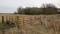 First crossing, at source, Redgrave & S. Lopham Fen
 -
 Second crossing, as channel forms, Redgrave Fen
 -
 Denmark Bridge, Diss
 -
 Pair of swans nr walking path under A140 bridge
 -
 View of Waveney nr Roman road: Scole Bridge towards A143
 -
 Billingford Bridge & weir, January 2011
 -
 Hoxne weir footbridge
 -
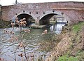
 Homersfield Bridge: oldest concrete bridge in Great Britain
 -
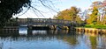
 Bungay: Earsham St bridge, (beyond private footbridge)
 -
 Staithe weir gates and footbridge, Bungay
 -
 Beccles: upstream view of Bridge St bridge, showing height limit
 -
 Beccles quay: downstream view from Bridge St bridge


External links
|