
Saskatchewan Highway 316
Highway 316 | ||||
|---|---|---|---|---|
| Route information | ||||
| Maintained by Ministry of Highways and Infrastructure | ||||
| Length | 17 km (11 mi) | |||
| Major junctions | ||||
| South end | ||||
| North end | ||||
| Location | ||||
| Country | Canada | |||
| Province | Saskatchewan | |||
| Rural municipalities | Blucher No. 343 | |||
| Highway system | ||||
|
| ||||
| ||||
.svg)
Highway 316 is a
RM of Blucher No. 343 and runs from Highway 16 near Clavet north to Highway 5. It is a primary weight highway and the land around it is an industrial and commercial area. The highway intersects with Highway 394 and the Canadian National and Canadian Pacific Railways.[1][2]
It is about 17 kilometres (11 mi) long.
Nearby attractions
- Nutrien's Patience Lake potash mine[3]
- Cheviot Lake
- Patience Lake
-
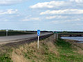 Highway 316 road sign located at the Highway 16 turn off.
 -
 Nutrien Patience Lake Mine north of Highway 16.


See also
References
- ^ Sask Biz. "Community Profiles". Retrieved 17 May 2007.
- ^ Canadian Online Map Digitization Project, J. Adamson. "1941 Waghorn's Map of Saskatchewan". rootsweb. Retrieved 17 May 2007.
- ^ "Potash Operations". Nutrien. Nutrien Ltd. Retrieved 12 August 2023.
External links
- Saskatchewan Highways Website-- Highway Numbering
- Saskatchewan Road Map RV Itineraries
- Big Things of Canada, A Celebration of Community Monuments of Canada
This Saskatchewan road, road transport or highway-related article is a stub. You can help Wikipedia by expanding it. |