
Saskatchewan Highway 39
| ||||
|---|---|---|---|---|
| ||||
| North end | ||||
| Location | ||||
| Country | Moose Jaw No. 161 | |||
| Major cities | Estevan, Weyburn | |||
| Highway system | ||||
|
| ||||
| ||||
Highway 39 is a provincial paved
Travel route

Starting in the south-east is
Weyburn, the opportunity city, has also been dubbed the Soo Line City due its connection with Chicago on the Soo Line of the Canadian Pacific Railway CPR.[16] The city of 9,433[17] people is on Sk Hwy 35, Sk Hwy 39, and Sk Hwy 13.[18] The small towns of Exon and Converge have been absorbed into the city of Weyburn today.[19] The Pasqua branch or the Souris, Arcola, Weyburn, Regina CPR branch, Portal Section CPR on the Soo Line, Moose Jaw, Weyburn, Shaunavon, Lethbridge section CPR, The Brandon, Marfield, Carlyle, Lampman, Radville, Willow Bunch sectionCNR, and the Regina, Weyburn, Radville, Estevan, Northgate section CNR have all run through Weyburn.[20] Weyburn is located astride the Williston geological Basin which contains oil deposits, and several wells operate in the vicinity.[18] Weyburn features roadside attractions of a large Lighthouse Water Tower, Wheat sheaves and Prairie Lily.[21] Weyburn is near the upper delta of the 470-mile (760 km) long Souris River. The Souris River continues south-east through North Dakota eventually meeting the Assiniboine River in Manitoba.[16] In the 19th century this area was known as an extension of the Greater Yellow Grass Marsh. "Extensive flood control programs have created reservoirs, parks and waterfowl centres along the Souris River."[18] Between 1988 and 1995, the Rafferty-Alameda Project was constructed to alleviate spring flooding problems created by the Souris River.[22]

Near the northern terminus is
-
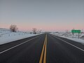 Highway 39 at Roche Percee
 -
 Short Creek Cairn
 -
 Estevan, and the Estevan Coalfield, along the Souris River, viewed from the Space Shuttle, February 2001


History
The railways would not build across the western frontier without settlement as it would be too costly to provide train service across a barren wilderness. The Clifford Sifton immigration policy encourages settlers to arrive. Western settlement began and immigration encroached across the Manitoba and United States borders into the North-West Territories which later became Saskatchewan. Immigration settlement to the last best west and the early highways began in the south-east. The Federal Government survey crew reached this south-eastern area of the District of Assiniboia, North-West Territories in 1880. In 1881, the province of Manitoba expanded to its present boundaries and land could be purchased for $10.00 an acre.[34] President Lincoln's U.S. Homestead Act was passed in 1862 and lands there were taken. In 1872, Canada passed the Dominion Lands Act attracting homesteaders to the West.[35]
Saskatchewan Provincial Highway 39 paralleled the headwaters of the Souris River as well as the Canadian Pacific Railway (CPR) along the south-eastern portion of its route. The highway traverses a course on a diagonal from south-east to north-west. The road followed the early surveyed road allowances made by the Provincial Highway 39, the precursor of the Saskatchewan Highway 39 followed the surveyed grade of the CPR or Soo Line between the United States border and east of Moose Jaw. Travel along Provincial Highway 39 before the 1940s would have been travelling on the square following the township road allowances, barbed wire fencing, and rail lines. As the surveyed township roads were the easiest to travel, the first highway was designed on 90 degree right angle corners as the distance traversed the prairie along range roads and township roads.[36]
With the establishment of settlements and population came the attendant need for education, health, fire, and police protection and an urgent need to improve methods of travel. The
. Historically, community residents could pay taxes or supply a couple days per quarter section labour constructing roads, bridges, and fireguards instead of paying taxes. This civic government with its elected officials attended to the maintenance and construction of the early pioneer road. Two horse then eight horse scrapers maintained these early dirt roads."The final meeting of the joint LIDs was held on November 5, 1910. By now taxes were up to $8.00 per quarter section. During the last few years of the LID Government a few changes began to take place. The road work day was reduced from ten to eight hours. The first grader was bought on March 31, 1906. Further road machinery was purchased, drag scrapers at $7,25 each and wheel scrapers at $51.00 each. Road overseers were also weed inspectors. In 1908, each Township received $100.00 for road work. Farmers were paid $30.00 an acre for land used for road building.... Road appropriations for 1927 were $2,500.00 for each Division with a tax rate of 6 mills... In 1928, the R. M.[Rural Municipality of Estevan No. 5] purchased a Holt 60 Caterpillar tractor and a 12-foot grader for $9,200.00. Road building now cost $103.00 a mile. The next year an elevating grader was purchased for $2,425.00. In 1930... Construction began on Highway 39."-A Tale That is Told: Estevan 1890 - 1980.[37]
By 1940 Hwy 39 is shown on maps as travelling on the diagonal and straightened, no longer is the road depicted on the square.
In 1947 and 1948, the highway was paved from North Portal to its junction with Hwy 6 at Corinne.
Highways and Transportation Minister Maynard Sonntag announced a highway resurfacing for Hwy 39 for the summer of 2001.
CanAm Highway
The 71.7 kilometres (44.6 mi) segment between Weyburn and Corinne is designated as a portion of the CanAm Highway. Near Corinne, Hwy 39 is concurrent with Hwy 6, at Corinne, the CanAm Highway continues north on Hwy 6. South of Weyburn the CanAm Highway crosses the Canada–United States border via Hwy 35. "The projects on Highways 39 and 6 will help to improve traffic flow through these Canada/U.S. ports. 'Highways 6 and 39 are very important to Saskatchewan – serving as tourism links and major north-south trade corridors to the U.S.,' Sonntag said."[48]
Major intersections
From south to north.
| Rural municipality | Location | km[1] | mi | Destinations | Notes | |||
|---|---|---|---|---|---|---|---|---|
North Portal | 0.0 | 0.0 | Continuation into North Dakota | |||||
| Canada–United States border at Portal–North Portal Border Crossing | ||||||||
| 1.1 | 0.68 | Hwy 604 north | ||||||
| | 10.9 | 6.8 | Hwy 703 west | |||||
| | 20.2 | 12.6 | Crosses Souris River | |||||
Roche Percée Access Road | ||||||||
| | 27.0 | 16.8 | Bienfait, Oxbow | South end of Hwy 18 concurrency | ||||
Estevan | 33.2 | 20.6 | Hwy 39 follows Estevan Bypass; north end of Hwy 18 concurrency | |||||
| 41.1 | 25.5 | |||||||
| 46.2 | 28.7 | West end of Estevan Bypass | ||||||
Benson No. 35 |
No major junctions | |||||||
Hwy 702 east | ||||||||
| 80.8 | 50.2 | |||||||
Hwy 705 | ||||||||
Weyburn | 122.0 | 75.8 | 16th Street | |||||
| 123.5 | 76.7 | Crosses Souris River | ||||||
| 124.0 | 77.1 | CanAm Highway continues along Hwy 35 south | ||||||
| 126.5 | 78.6 | |||||||
Weyburn No. 67 | McTaggart | 137.7 | 85.6 | |||||
Lewvan | South end of Hwy 621 concurrency | |||||||
| | 152.7 | 94.9 | Hwy 621 south | North end of Hwy 621 concurrency | ||||
| Lang | 170.7 | 106.1 | ||||||
Hwy 710 | ||||||||
| | 191.5 | 119.0 | Regway, U.S. border | South end of Hwy 6 concurrency | ||||
Bratt's Lake No. 129 | Corinne | 194.4 | 120.8 | |||||
| | 195.2 | 121.3 | north end of Hwy 6 concurrency; CanAm Highway follows Hwy 6 north | |||||
Redburn No. 130 | Wilcox | 204.0 | 126.8 | |||||
Dog River | ||||||||
| | 225.8 | 140.3 | Hwy 623 south – Truax | South end of Hwy 623 concurrency | ||||
| | 227.6 | 141.4 | North end of Hwy 623 concurrency | |||||
| Drinkwater | 240.8 | 149.6 | ||||||
| Interchange; through traffic follows Hwy 301 | ||||||||
1.000 mi = 1.609 km; 1.000 km = 0.621 mi
| ||||||||
Highway 39A
| |
|---|---|
| Length | 11 km[1] (6.8 mi) |
Highway 39A is a highway in the Canadian province of Saskatchewan serving the city of Estevan. It runs from the Highway 18 / Highway 39 concurrency east of Estevan to Highway 39, northwest of the city. It is the original configuration for Highway 39 through Estevan and was designated after the Estevan Bypass was opened in 2015.[49]
The highway runs concurrently with Highway 18 from it southern terminus east of Estevan along 4th Street, to Souris Avenue where Highway 18 turns south and leaves the concurrency, becoming concurrent with Highway 47. It continues to 13th Avenue where Highway 47 turns north and Highway 39A continues northwest, leaving Estevan to its northern terminus with Highway 39. Highway 39A is about 11 km (7 mi) long.[50]
Major intersections
| Rural municipality | Location | km[1] | mi | Destinations | Notes |
|---|---|---|---|---|---|
North Portal, U.S. border | |||||
Estevan | 5.1 | 3.2 | North end of Hwy 18 concurrency; south end of Hwy 47 concurrency | ||
| 5.6 | 3.5 | North end of Hwy 47 concurrency | |||
Weyburn, Regina | |||||
1.000 mi = 1.609 km; 1.000 km = 0.621 mi
| |||||
References
- ^ a b c d "Google Maps". Google Maps. Retrieved 24 June 2016.
- ^ "TYPE ADMN_CLASS TOLL_RD RTE_NUM1 RTE_NUM2 ROUTE 1 Gravel ..." Government of Canada. Retrieved 17 February 2008.[permanent dead link]
- ^ a b Government of Saskatchewan. "IMPROVING HIGHWAY 39 NEAR MILESTONE". Archived from the original on 10 June 2011. Retrieved 10 April 2007.
- ^ "Ribbon cutting held on Highway 39 at North Portal". M2 Presswire. July 2000. Retrieved 24 April 2008. [dead link]
- ^ a b Infrastructure Canada, Government of Canada (2 October 2006). "Prime Minister Chrétien and Premier Calvert announce $164 million ..." Archived from the original on 12 August 2007. Retrieved 10 April 2007.
- ^ Macdonald, Julian (1999–2003). "Provincial Highways @ Saskatchewan Highways Website". Archived from the original on 15 February 2008. Retrieved 17 February 2008.
- ^ "Western Canada Group Travel Planner: Getting to Western Canada". 1999–2003. Archived from the original on 19 September 2007. Retrieved 17 February 2008.
- ^ Microsoft Streets and Tips (Map) (2004 ed.). Microsoft Corp. § Route Planner.
- ^ "Canada Border Services Agency". Government of Canada. 8 April 2008. Archived from the original on 22 May 2011. Retrieved 10 April 2008.
- ^ "Memories of North Portal and Districts". North Portal 75th Anniversary Committee. 19 April 1979. Retrieved 10 April 2008.
- ^ Gent, Doug (March 2008). "Pinto Saskatchewan". Retrieved 10 April 2007.
- ^ Fogleman., Larry. "Gallery - Roche Percée, Saskatchewan, Canada". Retrieved 10 April 2008.
- ^ McLennan, David (2006). "Roche Percée". The Encyclopedia of Saskatchewan. CANADIAN PLAINS RESEARCH CENTER, UNIVERSITY OF REGINA. Retrieved 15 February 2008.
- ^ "Estevan Catches The Energy" (PDF). Canwest special edition. Regina Leader Post. 25 February 2008. Retrieved 10 April 2008. [dead link]
- ^ "Estevan No. 5". Sask Biz. Saskatchewan Government. Retrieved 10 April 2008.
- ^ a b Weyburn Writer's Association (2006). "Hey, seeds!". Our Roots Nos Racines. University of Calgary, Université Laval. Archived from the original on 27 May 2011. Retrieved 15 April 2008.
- ^ "2006 Community Profiles - Census Subdivision". Statistics Canada. Government of Canada. 2008. Retrieved 15 April 2008. [permanent dead link]
- ^ a b c "Canadian Rural Partnership - Rural Development - Public - Private Partnerships in Rural and Northern Canada Study - Appendix C - List of Projects". Government of Canada. 26 September 2005. Archived from the original on 12 November 2007. Retrieved 15 April 2008.
- ^ Adamson, J (5 November 2003). "Saskatchewan, Canada, Rand McNally 1924 Indexed Pocket Map Tourists' and Shippers' Guide<" (PDF). Online Historical Map Digitization Project. Ancestry / Rootsweb. Retrieved 15 April 2008.
- ^ Adamson, J (5 November 2003). "Canadian Maps: May 1948 Waghorn's Guide. Post Offices in Man. Sask. Alta. and West Ontario". Online Historical Map Digitization Project. Rootsweb. Retrieved 15 April 2008.
- ^ Donnan, Richard (1999–2006). "Lighthouse Water Tower Weyburn, Saskatchewan". LARGE CANADIAN ROADSIDE ATTRACTIONS. Archived from the original on 31 December 2007. Retrieved 15 February 2008.
- ^ "Water Control - Saskatchewan Dams and Reservoirs". Saskatchewan Watershed Authority. Archived from the original on 1 January 2007. Retrieved 15 April 2008.
- ^ "Corner Gas Online". Pants Online Inc. Archived from the original on 8 March 2008. Retrieved 10 April 2008.
- ^ a b "2006 Community Profiles". Statistics Canada. Government of Canada. 2006. Retrieved 26 December 2007.
- ^ Solonyka, Ed (1998–2006). "Large Roadside Attractions". Archived from the original on 8 January 2008. Retrieved 29 December 2007.
- ^ "Temple Gardens Mineral Spa". Retrieved 15 April 2008.
- ^ "Tunnels of Moose Jaw–Home Page". Retrieved 15 April 2008.
- ^ "Moose Jaw WDM". Retrieved 15 April 2008.
- ^ Government of Saskatchewan. "Sask Biz Moose Jaw". Retrieved 12 August 2007.
- ^ Government of Saskatchewan. "Sask Biz Moose Jaw (No.161)". Retrieved 12 August 2007.
- ^ "Moose Jaw Regional Profile". Retrieved 15 April 2008.
- ^ "Inland Container Terminal Analysis, Final Report - December 12, 2006" (PDF). Retrieved 15 April 2008.
- ^ Government of Saskatchewan. "Sask Biz Pense No. 16". Retrieved 12 August 2007.
- ^ Anderson, Frank w. (1998). The Yellowhead Trail in Manitoba and Saskatchewan. Saskatoon, Saskatchewan: Frank W. Anderson. p. 50.
- ^ Adamson, J. "Saskatchewan Gen Web Project - SGW - Saskatchewan Genealogy Roots". Rootsweb. Retrieved 24 March 2008.
- ^ Adamson, J (14 October 2003). "Canadian maps 1926 Highway Map". Department of Highways. Canadian Maps Online Digitization Project. Retrieved 10 February 2008.
- ^ Kraushaar, Clint; Barb Dodd; Gavin Bush; Adam Currie; Rosanda Eagles; Monique Elias; Angela Mennie; Jonell Taylor (1981). "Rural Municipality of Estevan No. 5". A Tale That is Told: Estevan 1890 - 1980. Estevan Public Library and Estevan Community Access Project. Retrieved 10 April 2008.
- ^ "Official road map of Western Canada 1940". Shell. H.M. Gousha Company, Chicago Ill. Archived from the original on 27 September 2007. Retrieved 25 April 2008.
- ^ a b "The Atlas of Canada - Major Roads, 1955". Natural Resources Canada, Earth Sciences Sector, Geomatics Canada. Government of Canada. 19 July 2004. Archived from the original on 14 March 2012. Retrieved 25 April 2008.
- ^ a b c Wenger, Pete (24 June 1953). "Cratered, cracked surface of highway 39 irks public". The Leader-Post. Regina, Saskatchewan. p. 2. Retrieved 18 September 2012.
- ^ Mang, A.R. (10 September 1953). "Sub-grade carries the load". The Leader-Post. Regina, Saskatchewan. p. 15. Retrieved 18 September 2012.
- ^ Shell Map of British Columbia, Alberta, Saskatchewan and Manitoba (Map). 1:2,471,040. Shell Oil Company. 1956. Retrieved 18 September 2012.
- ^ a b "Per mile cost of highway 39 exceeds Trans-Canada figure". The Leader-Post. Regina, Saskatchewan. 8 September 1955. p. 2. Retrieved 18 September 2012.
- ^ "Temporary repair work improves No. 39 highway". The Leader-Post. Regina, Saskatchewan. 24 April 1952. p. 2. Retrieved 18 September 2012.
- ^ Government of Saskatchewan. "RESURFACING SET FOR HIGHWAY 39". Archived from the original on 25 November 2010. Retrieved 10 April 2007.
- ^ "Group wants better U.S. connection". The Leader-Post. Regina, Saskatchewan. 13 March 2008. Archived from the original on 24 September 2015. Retrieved 18 September 2012.
- ^ "Premier likes Soo Line twinning plan". The Leader-Post. Regina, Saskatchewan. 14 August 2007. Archived from the original on 12 May 2014. Retrieved 18 September 2012.
- ^ "Saskatchewan NDP articles". Improving Highways - Weyburn Estevan Area. 3 March 2004. Archived from the original on 12 November 2007. Retrieved 15 April 2008.
- ^ "The Estevan Bypass is Officially Open". Government of Saskatchewan. 10 November 2015. Retrieved 8 September 2017.
- Mapquest. AOL. Retrieved 9 September 2017.
External links
- A document from Saskatchewan Highways and Transportation: Winter Highway Conditions
- Big Things of Canada, A Celebration of Community Monuments of Canada
- Fading Town of Pasqua, Saskatchewan
- Saskatchewan Highways Website—Highway Numbering
- Ralph, Saskatchewan
- Saskatchewan Road Map Travel Guide: #39 Canada / United States Border To City of Moose Jaw
- United States / Canada Border - Saskatchewan Canada Welcome to Saskatchewan, Canada - For continuation of highway travel north via Saskatchewan highway # 39 , see MilebyMile.com Saskatchewan Highway # 39 U.S. / Canada border to Moose Jaw Saskatchewan, for driving directions. - Start/finish of highway travel log.- Se Pick up the trail of America's greatest legends in North Dakota, and you'll find yourself in a legendary adventure of your own. Lewis and Clark, Sakakawea, George Custer, Sitting Bull and Theodore Roosevelt lived out larger-than-life adventures here. Whether you follow in their footsteps and rediscover the past or blaze your own trail and discover what makes North Dakota legendary today, you'll find wide-open spaces and wide-open fun!
- View from highway. Services at highway. Border crossing access. Pick up the trail of America's greatest legends in North Dakota, and you'll find yourself in a legendary adventure of your own. Lewis and Clark, Sakakawea, George Custer, Sitting Bull and Theodore Roosevelt lived out larger-than-life adventures here. Whether you follow in their footsteps and rediscover the past or blaze your own trail and discover what makes North Dakota legendary today, you'll find wide-open spaces and wide-open fun!