
Saskatchewan Highway 33
Highway 33 | ||||
|---|---|---|---|---|
| Route information | ||||
| Maintained by Ministry of Highways and Infrastructure | ||||
| Length | 138.9 km[1] (86.3 mi) | |||
| Major junctions | ||||
| West end | ||||
| East end | ||||
| Location | ||||
| Country | Fillmore | |||
| Major cities | Regina | |||
| Highway system | ||||
|
| ||||
| ||||
.svg)
Highway 33 is a highway in the southern portion of the Canadian province of Saskatchewan connecting Regina (Arcola Avenue) to Stoughton; the highway is divided near Regina. Highway 33 is about 139 kilometres (86 mi) long.[1]
Route description
Regina
Highway 33 begins at Ring Road and travels in a south-east / north-west direction for its entire length, though it is designated as east-west.[1] On the outskirts of Regina, it crosses the Regina Bypass, which is part of the Trans-Canada Highway (Highway 1).
Communities
| Communities |
|---|
With the advent of motor vehicle transportation and better highways, several small communities started to disappear. The days of trail and horse and buggy necessitated travel between centres which were established approximately 6 miles apart, which is no longer required. The amenities of larger centres have given rise to a lower rural population, and a higher urban population in the province.
East of Regina, Highway 33 passes through McCallum, which is now a ghost town.
Sedley is a village which had a population of 322 people in 2001, and is now a village and a part of rural municipality
Tyvan combined its population with
The village of Creelman with 81 residents in 2006.
Stoughton is located at the intersections of three main highways; Highway 13 (the Red Coat Trail), 33, and Highway 47. The eastern terminus of Highway 33 is at a junction with Highway 47, just north of the intersection with Highways 13 and 47. In 1901, this community was named New Hope, North-West Territories, changing name to Stoughton and moving a little to the south in 1904 when the CPR railway came through the area.[7] Stoughton with a motto of The Heart of the South East Crossroads of Friendship became a town in 1960 and in 2006 had 653 residents.[3][8]
Rural municipalities
Local Improvement District number 6 E 2 held its first administrative meeting on June 29, 1904.
A road commissioner was appointed in each division at a rate of $2.50 per day overseeing work. Residents were permitted to pay taxes in 1904 with labour on the road at 20 cents per hour for man, 35 cents per hour for man and team. Road Commissioners were: Robert Mott, Division 1, Township 11, Range 9; Ed Kutz, Division 2, Township 12, Range 9; DJ Stewart, Division3, Township 11, Range 10; JR Sleightholm, Division 4, Township 12, Range 10.
— Cornerstone Regional Economic Development Authority[9]
December 13, 1909 saw the changeover from Local Improvement District number 6 E 2 to
a person could work for the municipality and have his earnings put toward the taxes on his land; at one time, money collected in each Division stayed in that Division....The RM has as its responsibilities for many areas: agricultural programs and concerns in general; tax collections for needs of the municipality - road construction and maintenance; protective services - pest control, fire protection, weed control, environmental development, cultural and educational services; medical and veterinary needs and so forth.
— Tecumseh No. 65[10]
As travel continues towards
Major attractions and geophysical features
The terrain along Highway 33 is mainly undulating agricultural wheat and grain fields. Grain and livestock production is the main economic industry in the area. The name Lajord translated from Norwegian meaning flat place aptly describes the scenery.[13] The Stoughton Campground along Highway 33 features swimming pool, tennis court, ball diamond and golf course.[14] The Red Barn, and Stoughton and District Museum conserve the past, while parks and a golf course provide recreation in this town.[15]
Wascana Creek meanders along the western side of Saskatchewan Highway between Tyvan and Regina giving rise to the Wascana Valley. Highway 33 crosses the creek at Tyvan, and the creek makes a hairpin curve and peters out to the north-east of town.[8]
Between Lajord and Kronau is the regional park on the east side of the highway featuring the Oyama Regional Park Golf Course which opened in 1971.[18]
History
November 9, 1904 saw the arrival of the CPR rail line. The Souris-Arcola-Regina Section branch line[19] was the longest piece of straight track worldwide, and still has the claim of being the longest straight track of North America. Highway 33 follows along this surveyed rail line.[20] The CPR served Stoughton, Heward, Creelman, Fillmore, Osage, Tyvan, Francis, and Sedley. The Hanson brothers from Lajord developed one of the first swathers in use in Saskatchewan.[21]
Major intersections
From west to east:
| Rural municipality | Location | km[1] | mi | Destinations | Notes | |||
|---|---|---|---|---|---|---|---|---|
| City of Regina | −6.3 | −3.9 | Saskatchewan Avenue west end | |||||
| −4.5 | −2.8 | Albert Street | ||||||
| −3.6 | −2.2 | Broad Street | ||||||
| −2.8 | −1.7 | Winnipeg Street | Saskatchewan Avenue east end; Arcola Avenue west end | |||||
| −1.9 | −1.2 | Victoria Avenue | Former Hwy 33 western terminus | |||||
| 0.0 | 0.0 | Interchange; northern terminus of Hwy 33 | ||||||
| 4.9 | 3.0 | Moose Jaw, Winnipeg | Interchange; exit 234 on Hwy 1 | |||||
Sherwood No. 159 |
No major junctions | |||||||
Hwy 624 north – Pilot Butte | ||||||||
Balgonie, Riceton | ||||||||
Lewvan | ||||||||
Hwy 620 north | ||||||||
Weyburn | ||||||||
Wellington No. 97 |
No major junctions | |||||||
Cedoux | ||||||||
Hwy 606 north – Montmartre | West end of Hwy 606 concurrency | |||||||
| 101.9 | 63.3 | Hwy 606 south – Griffin | East end of Hwy 606 concurrency | |||||
Hwy 701 east | ||||||||
Weyburn | Hwy 33 eastern terminus | |||||||
1.000 mi = 1.609 km; 1.000 km = 0.621 mi
| ||||||||
Gallery
-
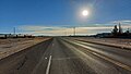 Highway 33 through Creelman
 -
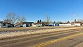 Village of Creelman
 -
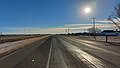 Highway 33 through Fillmore


References
- ^ a b c d e Google (February 15, 2018). "Highway 33 in Saskatchewan" (Map). Google Maps. Google. Retrieved February 15, 2018.
- ^ Adamson, J; Larry Walton. "Saskatchewan, Canada, Rand McNally 1924 Indexed Pocket Map Tourists' and Shippers' Guide". Online Canadian maps digitization Project.
- ^ a b c d e f g "2006 Community Profiles". Statistics Canada. Government of Canada. 2006. Retrieved December 26, 2007. [dead link]
- ^ Adamson, J (September 23, 2003). "Sask Cooperative Elevator Company Ltd Elevator System 1924-1925 Saskatchewan Wheat Pool Country Elevator System 1984". Canadian Maps. Online Canadian Maps Digitization Project. Retrieved December 26, 2007.
- ^ "Restructured Villages". Ministry of Municipal Affairs. Government of Saskatchewan. Archived from the original on March 25, 2008. Retrieved December 26, 2007.
- ^ a b "Post Offices and Postmasters". Library and Archives Canada Archivia Net. Government of Canada. February 12, 2007. Archived from the original on January 1, 2013. Retrieved December 26, 2007.
- ^ Sask Biz, Government of Saskatchewan (2004), Stoughton, retrieved April 15, 2007
- ^ a b "Saskatchewan City & Town Maps - Weyburn". Becquet's Custom Programming. Becquet.com. July 28, 2005. Retrieved December 27, 2007.
- ^ "History". Cornerstone Regional Economic Development Authority. November 5, 2007. Retrieved December 26, 2007. [permanent dead link]
- ^ Sask Biz, Government of Saskatchewan (2004), Tecumseh No. 65, retrieved April 15, 2007
- ^ Sask Biz, Government of Saskatchewan (2004), Edenwold No. 158, retrieved April 15, 2007
- ^ Rural Municipality Of Sherwood - Home, www.whatevercomputes.com, 2004, archived from the original on June 1, 2008, retrieved April 15, 2007
- ^ ilches, Silvia V; Adamson, J (November 2, 2004), Lajord, Saskatchewan, retrieved April 15, 2007
- ^ Sask Biz, Government of Saskatchewan (2004), Stoughton, archived from the original on April 20, 2008, retrieved April 15, 2007
- ^ Sask Biz, Government of Saskatchewan (2004), "Stoughton", Tourism, Town of Stoughton, retrieved April 15, 2007
- ^ Government of Canada, Natural Resources Canada. "Place names - Osage Wildlife Refuge". www4.rncan.gc.ca.
- ^ Dunc. (2004), "Osage Wildlife Refuge", World Index, Rumbletum.org, retrieved April 15, 2007
- ^ "Kronau, SK Golf Courses", Hillclimb Media., GolfLink.com, 1996–2007, retrieved April 15, 2007
- ^ Adamson, J. "Canadian Maps: January 1925 Waghorn's Guide. Post Offices in Man. Sask. Alta. and West Ontario". Online Canadian maps digitization Project.
- ^ Sask Biz, Government of Saskatchewan (2004), Fillmore, retrieved April 15, 2007
- ^ Ford, Ron; Storey, Gary (2006), "Farm Machinery and Equipment", CANADIAN PLAINS RESEARCH CENTER, UNIVERSITY OF REGINA, retrieved April 15, 2007
External links
- A document from Saskatchewan Highways and Transportation: Winter Highway Conditions
- Saskatchewan Highways Website-- Highway Numbering
- Lajord, Saskatchewan
- Saskatchewan Road Map RV Itineraries
- Big Things of Canada, A Celebration of Community Monuments of Canada
- Osage, Saskatchewan
![]() Media related to Saskatchewan Highway 33 at Wikimedia Commons
Media related to Saskatchewan Highway 33 at Wikimedia Commons