
Schmöckwitz
Schmöckwitz | |
|---|---|
 Aerial view of Schmöckwitz, between the lakes Seddinsee (west), Langer See (east) and Zeuthener See (south). In the north, Larger Krampe lake (Müggelheim) | |
 Coat of arms | |
Location of Schmöckwitz in Treptow-Köpenick and Berlin  | |
 Schmöckwitz  Schmöckwitz | |
| Coordinates: 52°22′00″N 13°38′00″E / 52.36667°N 13.63333°E | |
| Country | Germany |
| State | Berlin |
| City | Berlin |
| Borough | Treptow-Köpenick |
| Founded | 1375 |
| Subdivisions | 4 zones |
| Area | |
| • Total | 17.1 km2 (6.6 sq mi) |
| Elevation | 34 m (112 ft) |
| Population (2020-12-31)[1] | |
| • Total | 4,442 |
| • Density | 260/km2 (670/sq mi) |
| Time zone | UTC+01:00 (CET) |
| • Summer (DST) | UTC+02:00 (CEST) |
| Postal codes | (nr. 0915) 12527 |
| Vehicle registration | B |
Schmöckwitz (pronounced
History
The locality was founded in 1375 with the name of Smekewitz. In 1920 it merged into the city of Berlin with the "Greater Berlin Act" and from 1949 to 1990 it was part of East Berlin[2]
Geography
Overview
Located in south-eastern suburb of the city, Schmöckwitz represents the southernmost locality of Berlin, with its southernmost point at
The zone of
Subdivision
Schmöckwitz counts 4 zones (Ortslagen):
- Karolinenhof]
- Rauchfangswerder
- Schmöckwitzwerder
- Siedlung Schmöckwitz
Transport
The locality is crossed by the south-eastern branch of
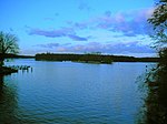
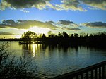
Photogallery
-
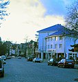 Village's entrance
 -
-
-
 Tram 68 at the end station "Alt-Schmöckwitz"


References
- ^ "Einwohnerinnen und Einwohner im Land Berlin am 31. Dezember 2020" (PDF). Amt für Statistik Berlin-Brandenburg. February 2021.
- ^ (in German) Historical chronicles of Schmöckwitz
- ^ One of the largest forests in Berlin
- ^ (in German) Ferry line 21 on BVG official site])
External links
![]() Media related to Schmöckwitz at Wikimedia Commons
Media related to Schmöckwitz at Wikimedia Commons
- (in German) Schmöckwitz page on www.berlin.de
| International | |
|---|---|
| National | |