
Shoshone Lake
| Shoshone Lake | |
|---|---|
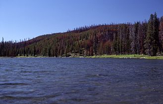
 Shoshone Lake in 1988 | |
 Shoshone Lake  Shoshone Lake | |
| Location | Yellowstone National Park, Teton County, Wyoming, U.S. |
| Coordinates | 44°22′20″N 110°42′45″W / 44.37222°N 110.71250°W[1] |
| Primary outflows | Lewis River |
| Basin countries | United States |
| Surface area | 8,050 acres (32.6 km2) |
| Max. depth | 205 feet (62 m) |
| Surface elevation | 7,795 feet (2,376 m)[1] |
Shoshone Lake is a U.S. backcountry lake with an area of 8,050 acres (33 km2; 13 sq mi) with an elevation of 7,795 feet (2,376 m) in the southwest section of
History
Shoshone Lake has had many names since it was first viewed by fur trappers in the early 19th century. Jim Bridger may have visited the lake in 1833, but visited it in 1846. Trapper Osborne Russell visited the lake in 1839. During this period the lake was called Snake Lake. A map created by Father Pierre-Jean De Smet in 1851 showed the lake as DeSmet's Lake. Walter DeLacy, the Montana map maker named the lake DeLacy's Lake when he passed through the area in 1863.
During the
A. C. Peale of the Hayden Geological Survey of 1871 visited Shoshone Lake in August 1871 but referred to it as Madison Lake.[6]
During the Hayden Geologic Survey of 1872, Frank Bradley, a member of the survey confirmed the lake was in the Snake River drainage and named the lake Shoshone Lake based on the Indian name of the Snake River.[2]
Shoshone Geyser Basin

Located at the southwest end of the lake, the

Angling
Prior to 1890, Shoshone Lake was barren of fish as
- Images of Shoshone Lake
-
 Shoshone Lake
 -
 Sunset, 1970
 -
 Lewis River Channel Outlet, 1989


See also
Further reading
- Franke, Mary Ann (Fall 1996). "A Grand Experiment-100 Years of Fisheries Management in Yellowstone: Part I". Yellowstone Science. 4 (4). Yellowstone Center for Resources, National Park Service.
- ISBN 1-56044-625-0.
- Mathews, Craig; Molinero, Clayton (1997). The Yellowstone Fly-Fishing Guide—An authoritative guide to the waters of Yellowstone National Park. Guilford, CT: The Lyons Press. ISBN 1-55821-545-X.
References
- ^ a b "Shoshone Lake". Geographic Names Information System. United States Geological Survey, United States Department of the Interior.
- ^ ISBN 0-917298-15-2.
- ^ Lisa Morgan (10 February 2004). "Yellowstone Lake Geology Talk Transcript – The floor of Yellowstone Lake is anything but quiet: Volcanic and hydrothermal processes in a large lake above a magma chamber". Yellowstone Science Talks. Archived from the original on 1 May 2004. Retrieved 16 September 2005.
- ISBN 9780806106649.
- ^ Doane, Gustavus C. (February 1871). The report of Lieutenant Gustavus C. Doane upon the so-called Yellowstone Expedition of 1870 (Report). U.S. Secretary of War.
- ISBN 0-8032-3148-2.
- ^ "Yellowstone Resources and Issues 2006" (PDF). National Park Service. 2006. p. 200.
- ISBN 0-8117-2777-7.
- ^ a b "2021 Yellowstone National Park Fishing Regulations" (PDF). nps.gov/yell. February 2022.
- ^ "Yellowstone National Park Boating Regulations" (PDF). National Park Service. Archived from the original (PDF) on 17 November 2008.
- ^ "Yellowstone Backcountry Trip Planner" (PDF). National Park Service. 2009. Archived from the original (PDF) on 7 April 2009. Retrieved 15 December 2009.
Yellowstone National Park - Cascade Corner | ||
|---|---|---|
Rivers, waterfalls, peaks and lakes in the Cascade Corner (Southwest) section of the park | ||
| Rivers |  | |
| Waterfalls and cascades | ||
| Lakes and peaks | ||
| ||
Cheyenne (capital) | |
| Topics | |
| Society |
|
| Regions | |
| Cities | |
| Counties | |