
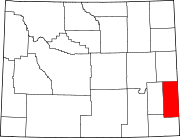
Goshen County, Wyoming
Goshen County | |
|---|---|
 | |
|
At-large | |
| Website | goshencounty |
Goshen County (
Goshen County produces more cattle than any other Wyoming county. In 1997, the county had a total of 688 farms and ranches, averaging 1,840 acres. As of 2007, this had declined slightly to 665 farms and ranches in the county.[3]
History
Goshen County was created in 1911 from a portion of Laramie County. Its government was organized in 1913.[4] This area was part of territories, at one time or another, claimed by: Spain, France, Great Britain, Mexico, and the Republic of Texas. The Louisiana Purchase in 1803 permanently established the claim of the United States to the area.[3]
By the 1820s, the
The county was apparently named for Goshen Hole, a valley in the southwest part of the county.
Geography
According to the US Census Bureau, the county has a total area of 2,232 square miles (5,780 km2), of which 2,225 square miles (5,760 km2) is land and 6.8 square miles (18 km2) (0.3%) is water.[6] The county is situated in the High Plains east of the Rocky Mountains.
Adjacent counties
- Niobrara County - north
- Platte County - west
- Laramie County - south
- Banner County, Nebraska - southeast
- Scotts Bluff County, Nebraska - east
- Sioux County, Nebraska - east
National protected area
Climate

Situated on the North Platte River, Goshen County has a semi-arid climate (Köppen climate classification BSk.)
| Climate data for Torrington, Wyoming | |||||||||||||
|---|---|---|---|---|---|---|---|---|---|---|---|---|---|
| Month | Jan | Feb | Mar | Apr | May | Jun | Jul | Aug | Sep | Oct | Nov | Dec | Year |
| Record high °F (°C) | 70 (21) |
75 (24) |
85 (29) |
91 (33) |
100 (38) |
105 (41) |
111 (44) |
105 (41) |
101 (38) |
92 (33) |
83 (28) |
77 (25) |
111 (44) |
| Mean daily maximum °F (°C) | 39.5 (4.2) |
45.0 (7.2) |
52.0 (11.1) |
61.2 (16.2) |
71.0 (21.7) |
82.4 (28.0) |
89.1 (31.7) |
87.3 (30.7) |
77.7 (25.4) |
65.4 (18.6) |
49.2 (9.6) |
41.0 (5.0) |
63.4 (17.5) |
| Daily mean °F (°C) | 24.9 (−3.9) |
30.0 (−1.1) |
37.5 (3.1) |
46.0 (7.8) |
56.2 (13.4) |
66.3 (19.1) |
72.3 (22.4) |
70.2 (21.2) |
59.8 (15.4) |
47.6 (8.7) |
34.0 (1.1) |
26.2 (−3.2) |
47.6 (8.7) |
| Mean daily minimum °F (°C) | 10.3 (−12.1) |
14.9 (−9.5) |
23.0 (−5.0) |
30.7 (−0.7) |
41.3 (5.2) |
50.2 (10.1) |
55.5 (13.1) |
53.1 (11.7) |
41.9 (5.5) |
29.7 (−1.3) |
18.8 (−7.3) |
11.3 (−11.5) |
31.7 (−0.2) |
| Record low °F (°C) | −39 (−39) |
−33 (−36) |
−26 (−32) |
−17 (−27) |
11 (−12) |
29 (−2) |
39 (4) |
32 (0) |
14 (−10) |
−9 (−23) |
−23 (−31) |
−43 (−42) |
−43 (−42) |
| Average precipitation inches (mm) | 0.31 (7.9) |
0.40 (10) |
0.70 (18) |
1.68 (43) |
2.54 (65) |
2.09 (53) |
1.78 (45) |
1.19 (30) |
1.27 (32) |
0.95 (24) |
0.57 (14) |
0.36 (9.1) |
13.84 (351) |
| Average snowfall inches (cm) | 4.8 (12) |
4.9 (12) |
4.9 (12) |
3.2 (8.1) |
0.1 (0.25) |
0.0 (0.0) |
0.0 (0.0) |
0.0 (0.0) |
0.4 (1.0) |
2.1 (5.3) |
4.8 (12) |
6.8 (17) |
32 (79.65) |
| Average precipitation days (≥ 0.01 inch) | 4.3 | 3.5 | 5.3 | 7.5 | 9.8 | 8.7 | 7.6 | 6.3 | 5.9 | 4.7 | 4.0 | 3.9 | 71.5 |
| Average snowy days (≥ 0.1 inch) | 3.8 | 2.8 | 2.5 | 1.3 | 0.2 | 0.0 | 0.0 | 0.0 | 0.2 | 0.8 | 2.4 | 3.6 | 17.6 |
| Source 1: NOAA (normals, 1971–2000) [7] | |||||||||||||
| Source 2: The Weather Channel (Records) [8] NOAA NNDC Climate Data [9] | |||||||||||||
On June 5, 2009, a weather research team known as VORTEX2 observed and measured the full life cycle of a tornado in eastern Goshen County.
Demographics
| Census | Pop. | Note | %± |
|---|---|---|---|
| 1920 | 8,064 | — | |
| 1930 | 11,754 | 45.8% | |
| 1940 | 12,207 | 3.9% | |
| 1950 | 12,634 | 3.5% | |
| 1960 | 11,941 | −5.5% | |
| 1970 | 10,885 | −8.8% | |
| 1980 | 12,040 | 10.6% | |
| 1990 | 12,373 | 2.8% | |
| 2000 | 12,538 | 1.3% | |
| 2010 | 13,249 | 5.7% | |
| 2020 | 12,498 | −5.7% | |
| 2023 (est.) | 12,642 | [10] | 1.2% |
| US Decennial Census[11] 1870–2000[12] 2010[13] 2020[14] | |||
2000 census
As of the
ancestry.There were 5,061 households, out of which 28.60% had children under the age of 18 living with them, 56.70% were married couples living together, 7.70% had a female householder with no husband present, and 32.30% were non-families. 27.60% of all households were made up of individuals, and 13.10% had someone living alone who was 65 years of age or older. The average household size was 2.38 and the average family size was 2.90.
The county population contained 24.20% under the age of 18, 9.40% from 18 to 24, 24.30% from 25 to 44, 24.80% from 45 to 64, and 17.30% who were 65 years of age or older. The median age was 40 years. For every 100 females there were 98.90 males. For every 100 females age 18 and over, there were 95.00 males.
The median income for a household in the county was $32,228, and the median income for a family was $40,297. Males had a median income of $27,713 versus $17,584 for females. The
2010 census
As of the
Of the 5,311 households, 26.4% had children under the age of 18 living with them, 53.1% were married couples living together, 7.9% had a female householder with no husband present, 34.7% were non-families, and 30.0% of all households were made up of individuals. The average household size was 2.29 and the average family size was 2.82. The median age was 43.6 years.[16]
The median income for a household in the county was $42,590 and the median income for a family was $51,978. Males had a median income of $38,247 versus $25,277 for females. The per capita income for the county was $23,753. About 7.2% of families and 13.1% of the population were below the
Communities
City
- Torrington (county seat)
Towns
- Fort Laramie
- LaGrange
- Lingle
- Yoder
Census-designated places
Unincorporated communities
Government and infrastructure
The Goshen County Fairgrounds are west of
The Wyoming Department of Corrections Wyoming Medium Correctional Institution (WMCI) is located east of Torrington on County Road 72 (Sheep Creek Rd.)[22][23][24] The WMCI, a facility of the Wyoming Department of Corrections, serves as an intake center for men not serving death sentences. The grand opening occurred on January 6, 2010.[25]
Goshen County voters have been reliably Republican for several decades. Since 1936, in only one national election did they select the Democratic Party candidate (as of 2020).
| Year | Republican | Democratic | Third party | |||
|---|---|---|---|---|---|---|
| No. | % | No. | % | No. | % | |
| 2020 | 4,878 | 78.16% | 1,203 | 19.28% | 160 | 2.56% |
| 2016 | 4,418 | 76.22% | 924 | 15.94% | 454 | 7.83% |
| 2012 | 4,178 | 71.96% | 1,458 | 25.11% | 170 | 2.93% |
| 2008 | 3,942 | 66.68% | 1,832 | 30.99% | 138 | 2.33% |
| 2004 | 4,114 | 71.19% | 1,566 | 27.10% | 99 | 1.71% |
| 2000 | 3,922 | 71.05% | 1,439 | 26.07% | 159 | 2.88% |
| 1996 | 2,989 | 54.22% | 1,923 | 34.88% | 601 | 10.90% |
| 1992 | 2,395 | 45.04% | 1,754 | 32.98% | 1,169 | 21.98% |
| 1988 | 3,075 | 61.44% | 1,875 | 37.46% | 55 | 1.10% |
| 1984 | 3,776 | 72.84% | 1,364 | 26.31% | 44 | 0.85% |
| 1980 | 3,572 | 67.21% | 1,373 | 25.83% | 370 | 6.96% |
| 1976 | 2,764 | 54.86% | 2,262 | 44.90% | 12 | 0.24% |
| 1972 | 3,629 | 70.27% | 1,515 | 29.34% | 20 | 0.39% |
| 1968 | 2,719 | 57.65% | 1,529 | 32.42% | 468 | 9.92% |
| 1964 | 2,604 | 48.65% | 2,749 | 51.35% | 0 | 0.00% |
| 1960 | 3,178 | 56.83% | 2,414 | 43.17% | 0 | 0.00% |
| 1956 | 2,825 | 57.01% | 2,130 | 42.99% | 0 | 0.00% |
| 1952 | 3,396 | 67.14% | 1,648 | 32.58% | 14 | 0.28% |
| 1948 | 2,029 | 51.91% | 1,843 | 47.15% | 37 | 0.95% |
| 1944 | 2,674 | 63.85% | 1,514 | 36.15% | 0 | 0.00% |
| 1940 | 2,861 | 58.89% | 1,982 | 40.80% | 15 | 0.31% |
| 1936 | 2,047 | 43.09% | 2,639 | 55.55% | 65 | 1.37% |
| 1932 | 1,954 | 42.57% | 2,545 | 55.45% | 91 | 1.98% |
| 1928 | 2,483 | 75.29% | 777 | 23.56% | 38 | 1.15% |
| 1924 | 1,603 | 56.15% | 464 | 16.25% | 788 | 27.60% |
| 1920 | 1,496 | 72.73% | 552 | 26.84% | 9 | 0.44% |
| 1916 | 770 | 39.77% | 1,096 | 56.61% | 70 | 3.62% |
| 1912 | 292 | 32.52% | 318 | 35.41% | 288 | 32.07% |
Transportation
Highways
U.S. Highways
 US 26
US 26 US 85
US 85
State Routes
 WYO 92 (Huntley Road)
 WYO 151 (LaGrange Road)
 WYO 152 (Yoder Road)
 WYO 153 (Springer Reservoir Road)
 WYO 154 (Veteran Road)
 Sugar Factory Road)
 WYO 158 (Horse Creek Road)
 WYO 159 (Van Tassell Road)
 WYO 160 (Old Fort Laramie Road)
 WYO 161 (Yoder-Huntley Road)
 WYO 313 (Chugwater Road)
Airport
See also
- National Register of Historic Places listings in Goshen County, Wyoming
- Wyoming
- List of cities and towns in Wyoming
- List of counties in Wyoming
- Wyoming statistical areas
External links
References
- ^ "Goshen County, Wyoming". United States Census Bureau. Retrieved June 25, 2023.
- ^ "Find a County". National Association of Counties. Archived from the original on May 31, 2011. Retrieved June 7, 2011.
- ^ a b c d Zimmer, Vickie. "Goshen County WY". The Online Encyclopedia of Wyoming History. Wyoming State Historical Society. Archived from the original on March 26, 2013. Retrieved June 30, 2015.
{{cite encyclopedia}}:|website=ignored (help) - ^ Long, John H., ed. (2004). "Wyoming: Individual County Chronologies". Wyoming Atlas of Historical County Boundaries. The Newberry Library. Archived from the original on August 3, 2015. Retrieved August 19, 2015.
- ISBN 0-87842-204-8.
- ^ "2010 Census Gazetteer Files". US Census Bureau. August 22, 2012. Retrieved August 5, 2015.
- ^ "Climatography of the US No.81" (PDF). National Oceanic and Atmospheric Administration. Archived from the original (PDF) on July 13, 2014. Retrieved January 13, 2011.
- ^ "Monthly Averages for Torrington WY". The Weather Channel. Archived from the original on October 24, 2012. Retrieved January 13, 2011.
- ^ "Climate Data Online Extremes Products". NOAA. Archived from the original on December 12, 2012. Retrieved June 3, 2012.
- ^ "QuickFacts". United States Census Bureau. Retrieved March 24, 2024.
- ^ "US Decennial Census". US Census Bureau. Retrieved August 5, 2015.
- ^ "Historical Decennial Census Population for Wyoming Counties, Cities, and Towns". Wyoming Department of Administration & Information, Division of Economic Analysis. Retrieved January 25, 2014.
- ^ "State & County QuickFacts". US Census Bureau. Archived from the original on June 6, 2011. Retrieved January 25, 2014.
- ^ "Goshen County, Wyoming". United States Census Bureau. Retrieved June 25, 2023.
- ^ "U.S. Census website". US Census Bureau. Retrieved May 14, 2011.
- ^ a b c "Profile of General Population and Housing Characteristics: 2010 Demographic Profile Data". US Census Bureau. Archived from the original on February 13, 2020. Retrieved January 12, 2016.
- ^ "Population, Housing Units, Area, and Density: 2010 - County". US Census Bureau. Archived from the original on February 13, 2020. Retrieved January 12, 2016.
- ^ "Selected Social Characteristics in the US – 2006-2010 American Community Survey 5-Year Estimates". US Census Bureau. Archived from the original on February 13, 2020. Retrieved January 12, 2016.
- ^ "Selected Economic Characteristics – 2006-2010 American Community Survey 5-Year Estimates". US Census Bureau. Archived from the original on February 13, 2020. Retrieved January 12, 2016.
- ^ Rockeagle WY Google Maps (accessed 10 January 2019)
- ^ "Goshen County Fairgrounds — Event Venue". Archived from the original on May 11, 2015. Retrieved June 30, 2015.
- ^ Torrington city, Wyoming[permanent dead link]. US Census Bureau. Retrieved on December 12, 2010.
- ^ "Wyoming Medium Correctional Institution (WMCI)". Archived from the original on July 25, 2011.. Goshen County GIS Department. 2009. Retrieved on December 12, 2010.
- ^ "Contact Institutions". Wyoming Department of Corrections. Retrieved August 22, 2010.
7076 Road 55F Torrington, WY 82240
- ^ "Wyoming Medium Correctional Institution". Wyoming Department of Corrections. Retrieved August 22, 2010.
- ^ Leip, David. "Atlas of US Presidential Elections". uselectionatlas.org. Retrieved April 5, 2018.
- ^ "Goshen County Public and Private Airports". www.tollfreeairline.com. Retrieved April 5, 2018.
Places adjacent to Goshen County, Wyoming | |
|---|---|
 | ||||
Towns |
| |||
| CDPs | ||||
| Unincorporated community | ||||
| ||||
Cheyenne (capital) | |
| Topics | |
| Society |
|
| Regions | |
| Cities | |
| Counties | |
| International | |
|---|---|
| National | |
| Other | |