
Tel Yitzhak
Tel Yitzhak
תֵּל יִצְחָק | |
|---|---|
 | |
 Tel Yitzhak | |
| Coordinates: 32°15′9″N 34°52′9″E / 32.25250°N 34.86917°E | |
| Country | Israel |
| District | Central |
| Council | Hof HaSharon |
| Affiliation | HaOved HaTzioni |
| Founded | 1938 |
| Founded by | Galician Jews |
| Population (2022)[1] | 834 |
Tel Yitzhak (Hebrew: תֵּל יִצְחָק, lit. 'Yitzhak Hill') is a kibbutz in central Israel. Located in the coastal plain to the south-east of Netanya, it falls under the jurisdiction of Hof HaSharon Regional Council. In 2022 it had a population of 834.[1]
History
The region of Tel Yitzhak, bordering the wetlands of the
Late Bronze Age (17th–13th centuries BCE), the Byzantine (4th–7th centuries CE) and Late Ottoman periods (19–early 20th centuries CE).[2] Before the 20th century the area formed part of the Forest of Sharon and was part of the lands of the village of Ghabat Kafr Sur. It was an open woodland dominated by Mount Tabor Oak, which extended from Kfar Yona in the north to Ra'anana in the south. The local Arab inhabitants traditionally used the area for pasture, firewood and intermittent cultivation. The intensification of settlement and agriculture in the coastal plain during the 19th century led to deforestation and subsequent environmental degradation.[3]
The kibbutz was established in 1938 by
tower and stockade settlement campaign. It was named after Yitzhak Steiger, a leader of HaNoar HaTzioni
in Galicia.

Masua, a center for Holocaust research and commemoration, was established on the kibbutz.[5]
Nature reserve
Southwest of the kibbutz is an 8-
Prasium majus, Anagyris, and Lavandula stoechas
.
Historic images
-
 Tel Yitzhak construction of watchtower 1938
 -
 Tel Yitzhak construction of wall, July 1938
 -
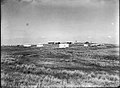 Tel Yitzhak 1939
 -
 Tel Yitzhak 1944 1:20,000 (bottom right quadrant:Tel Yits-haq)


References
- ^ a b "Regional Statistics". Israel Central Bureau of Statistics. Retrieved 21 March 2024.
- ^ Marom, Roy (2008). From Time Immemorial: Chapters in the History of Even Yehuda and its Region in Light of Historical and Archaeological Research.
- ^ Marom, Roy (2022-12-01). "The Oak Forest of the Sharon (al-Ghaba) in the Ottoman Period: New Insights from Historical- Geographical Studies". Muse. 5: 90–107.
- ISBN 9781571812643.
- ISBN 0-253-21529-3.
- ^ "List of National Parks and Nature Reserves" (PDF) (in Hebrew). Israel Nature and Parks Authority. Archived from the original (PDF) on October 7, 2009. Retrieved 2010-09-27.
- ^ "Tel Yitzhak Nature Reserve" (in Hebrew). iNature.info. Retrieved 2010-10-13.
| International | |
|---|---|
| National | |