
Thirlmere Lakes National Park
| Thirlmere Lakes National Park NSW National Parks and Wildlife Service | |
|---|---|
| Website | Thirlmere Lakes National Park |
| See also | Protected areas of New South Wales |
The Thirlmere Lakes National Park is a
History
The national park is one of the eight protected areas that, in 2000, was inscribed to form part of the UNESCO World Heritage–listed Greater Blue Mountains Area.[3] The Thirlmere Lakes National Park is the most south–easterly and the smallest of the eight protected areas within the World Heritage Site.[1]
Crisis
Two of the lakes have dried out since the mid 1980s due to removal of groundwater in the region secondary to coal mining at the Tahmoor Colliery.[4] The local community is investigating plans to revive the lakes, which might take decades otherwise.[5]
Features
The main feature of the park are the lakes, thought to have formed around 15 million years ago by geological activity, the land lifting and largely cutting them off from the local river system. Their outflow is reduced to the small Blue Gum Creek, which flows west into the Little River in the adjacent Nattai National Park to the west.[2]
The lakes and their environs contain an unusual and diverse array of flora and fauna. It contains the rare freshwater sponge
The habitat around the lakes is open sclerophyll forest, the dominant trees being rough-barked apple (Angophora floribunda) nearby and sydney peppermint (Eucalyptus piperita) and red bloodwood (Corymbia gummifera) on elevated areas. The understory species include many familiar sydney sandstone flora such as members of the genera Banksia, Acacia, pea flowers, and the New South Wales waratah (Telopea speciosissima)[2]
Climate
| Thirlmere Lakes National Park | ||||||||||||||||||||||||||||||||||||||||||||||||||||||||||||
|---|---|---|---|---|---|---|---|---|---|---|---|---|---|---|---|---|---|---|---|---|---|---|---|---|---|---|---|---|---|---|---|---|---|---|---|---|---|---|---|---|---|---|---|---|---|---|---|---|---|---|---|---|---|---|---|---|---|---|---|---|
| Climate chart (explanation) | ||||||||||||||||||||||||||||||||||||||||||||||||||||||||||||
| ||||||||||||||||||||||||||||||||||||||||||||||||||||||||||||
| ||||||||||||||||||||||||||||||||||||||||||||||||||||||||||||
Gallery
-
 Thirlmere Lake in Thirlmere Lakes National Park
 -
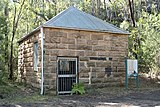 Pumphouse supplying water for steam trains at Couridjah Station
 -
 The five lakes in Thirlmere Lakes National Park
 -
 Ford in Thirlmere Lakes National Park


See also
References
- ^ a b c "Thirlmere Lakes National Park: Park management". Office of Environment and Heritage. Government of New South Wales. Retrieved 26 May 2011.
- ^ ISBN 0-9587590-1-4.
- ^ "Greater Blue Mountains Area". World Heritage List. UNESCO. 2014. Retrieved 31 August 2014.
- ^ Miskelly, Greg (29 May 2016). "Thirlmere Lakes: Coal mining to blame for damage to World Heritage area, new reports say". ABC News. Retrieved 29 August 2016.
- ^ Miskelly, Greg (30 May 2016). "Thirlmere Lakes: CLocals push for action to stop World Heritage area drying out". ABC News. Retrieved 29 August 2016.
- ^ ISBN 0-7310-7619-2.
- ^ "NASA Earth Observations: Population Density". "NASA/SEDAC". Retrieved 30 January 2016.
External links
- "Thirlmere Lakes National Park" (PDF) (PDF Map). NSW National Parks and Wildlife Service. Government of New South Wales. December 2007.
 Thirlmere Lakes National Park travel guide from Wikivoyage