
Myall Lakes National Park
| Myall Lakes National Park National Parks and Wildlife Service (New South Wales) | |
|---|---|
| Website | Myall Lakes National Park |
| See also | Protected areas of New South Wales |
Myall Lakes National Park is a
History
The Worimi Aboriginal people had inhabited the Myall Lakes National Park land area for its abundance of natural resources. These natural resources had offered a traditional hunter-gatherer lifestyle for the Worimi people. The park includes important spiritual sites that are an important part of the identity of local Aboriginal people. Dark Point Aboriginal Place served as a location for the Worimi people to gather together for ceremonies and feasts and has been of significance to Worimi people for at least 4000 years.[2]
Environment
Myall Lakes National Park incorporates a patchwork of freshwater lakes, the ocean, islands, native flora, dense littoral rainforest and beaches.
Since 1999, Myall Lakes has been listed under the Ramsar Convention.[3]
Fauna
The lakes support a large variety of birds including
Other native Fauna which can be seen in the park includes the nocturnal long-nosed bandicoot which has grey-brown fur and a pointed snout for which it uses to forage for worms and insects. The Striped marsh frog can be found near ponds and swamps and has a distinct sound which can be heard all year round.[5] The Eastern swamp crayfish was first discovered here.[6]
Climate
The average high temperature during the summer season averages between 19 °C and 27 °C. The highest temperature recorded at the park is 41.5 °C.[7] The average temperature during the winter season averages between 10 °C and 19 °C with the lowest temperature on record being 1.1 °C.[7] The wettest month typically occurs in May while the driest month occurs in November. The area's highest recorded rainfall in one day is 257.8mm.[7]
Gallery
-
 Dingo at Myall Lakes National Park
 -
 Dee's Corner
 -
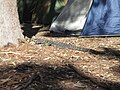 Goanna at one of the campsites
 -
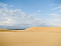 Sand dunesat Myall Lakes National Park
 -
 Local fauna at Myall Lakes National Park
 -
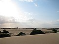 Sand dunesat Myall Lakes National Park
 -
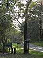 Park entrance at Myall Lakes National Park


Notes and references
- ^ "MYALL LAKES NATIONAL PARK - FORSTER AND TAREE AREA". Visit NSW - Destination NSW. Retrieved 20 May 2017.
- ^ "Myall Lakes National Park". NSW National Parks and Wildlife Service. Retrieved 20 May 2017.
- ^ "Myall Lakes: Internationally recognised wetlands". NSW National Parks and Wildlife Service. Retrieved 4 September 2018.
- ISBN 9781-74220-425-3.
- ^ "Myall Lakes National Park". Skip to contentNSW National Parks and Wildlife Service. Retrieved 20 May 2017.
- PMID 24715801.
- ^ a b c "Myall Lakes National Park Visitor Info". Skip to contentNSW National Parks and Wildlife Service. Retrieved 20 May 2017.
See also
- Protected areas of New South Wales
 Myall Lakes National Park travel guide from Wikivoyage