
Wedowee, Alabama
Wedowee, Alabama | ||
|---|---|---|
FIPS code 01-80496 | | |
| GNIS feature ID | 0153913 | |
Wedowee is a town in Randolph County, Alabama, United States. At the 2010 census the population was 823, up from 818 in 2000. The small town is the county seat of Randolph County.[2] It was initially incorporated in 1836, but its charter lapsed by the late 19th century. It was reincorporated in 1901.[3]
Randolph County High School is located in Wedowee.
History
Wedowee, which means "old water" in the
Following
Since the late 20th century, Lake Wedowee was created by the impoundment of the Tallapoosa River. This has enhanced the tourist drawing power of the town. Also known as the R. L. Harris Reservoir, the lake draws thousands of visitors to Wedowee every year. [4]
Geography
Wedowee is located on the Piedmont plateau at 33°18′31″N 85°29′8″W / 33.30861°N 85.48556°W (33.308603, -85.485447).[5] It is also located in the foothills of the Appalachian Mountains.
The city is located in the central part of Randolph County along U.S. Route 431, which is the main route through the city. U.S. 431 leads northwest 34 mi (55 km) to Oxford and southeast 13 mi (21 km) to Roanoke. Alabama State Route 48 also runs through the city, leading northeast 9 mi (14 km) to Woodland and west 16 mi (26 km) to Lineville.
According to the
Demographics
| Census | Pop. | Note | %± |
|---|---|---|---|
| 1870 | 130 | — | |
| 1910 | 435 | — | |
| 1920 | 510 | 17.2% | |
| 1930 | 396 | −22.4% | |
| 1940 | 525 | 32.6% | |
| 1950 | 559 | 6.5% | |
| 1960 | 917 | 64.0% | |
| 1970 | 842 | −8.2% | |
| 1980 | 908 | 7.8% | |
| 1990 | 796 | −12.3% | |
| 2000 | 818 | 2.8% | |
| 2010 | 823 | 0.6% | |
| 2020 | 737 | −10.4% | |
| U.S. Decennial Census[6] 2013 Estimate[7] | |||
As of the
There were 337 households, out of which 26.1% had children under the age of 18 living with them, 43.0% were married couples living together, 13.6% had a female householder with no husband present, and 40.4% were non-families. 36.5% of all households were made up of individuals, and 22.0% had someone living alone who was 65 years of age or older. The average household size was 2.23 and the average family size was 2.95.
In the town, the population was spread out, with 21.8% under the age of 18, 8.9% from 18 to 24, 27.4% from 25 to 44, 21.6% from 45 to 64, and 20.3% who were 65 years of age or older. The median age was 39 years. For every 100 females, there were 97.6 males. For every 100 females age 18 and over, there were 95.1 males.
The median income for a household in the town was $26,136, and the median income for a family was $37,292. Males had a median income of $24,250 versus $22,250 for females. The
Notable people
- interracial dating
- John Merrill – politician; former Secretary of State of Alabama
- Erica Huddleston Thomas - Journalist, television news producer, political commentator, radio personality, music video producer (Aquapalooza 2009), actress (Cash Out).
- T. Jack Lee – sixth Director of the NASA Marshall Space Flight Center in Huntsville, Alabama, 1989-1994
- Merrill Lynch; currently on the board of Alcoa
- Governor of Alabama. He had moved with his parents to Wedowee in 1839, at the age of 13; read law under John T. Heflin of Wedowee.[9] A historic marker now stands on the site of his family's home along N. Main Street (U.S. Route 431) in Wedowee.
- defensive lineman
- Jordan Scales - Private aviation business leader[10]
Gallery
-
 Downtown Wedowee
 -
 Wedowee City Hall
 -
 The Randolph County Courthouse is located in Wedowee.
 -
 A historic marker which describes the early history of Randolph County is located on the grounds of the Randolph County Courthouse in Wedowee.
 -
 This historic marker marks the site of the home of21st Governor of Alabama(1868–1870).


References
- ^ "2020 U.S. Gazetteer Files". United States Census Bureau. Retrieved October 29, 2021.
- ^ "Find a County". National Association of Counties. Retrieved June 7, 2011.
- ^ "Supplement for Alabama" (PDF). 2.census.gov. Retrieved September 16, 2017.
- ^ Small Town Historic Markers, Alabama Tourism Department, archived from the original on February 3, 2011, retrieved February 2, 2011
- ^ "US Gazetteer files: 2010, 2000, and 1990". United States Census Bureau. February 12, 2011. Retrieved April 23, 2011.
- ^ "U.S. Decennial Census". Census.gov. Retrieved June 6, 2013.
- ^ "Annual Estimates of the Resident Population: April 1, 2010 to July 1, 2013". Retrieved June 3, 2014.
- ^ "U.S. Census website". United States Census Bureau. Retrieved January 31, 2008.
- ^ Alabama Governors -- William Hugh Smith, Alabama Department of Archives and History, archived from the original on May 7, 2016, retrieved March 24, 2011
- ^ "Jordan Scales". Clay Lacy Aviation. Retrieved August 30, 2023.
External links
33°18′31″N 85°29′08″W / 33.308603°N 85.485447°W
Municipalities and communities of Randolph County, Alabama, United States | ||
|---|---|---|
| City | 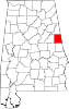 | |
| Towns | ||
| CDPs | ||
| Unincorporated communities | ||
| ||
| International | |
|---|---|
| National | |