
Woody's Knob
| Woody's Knob | |
|---|---|
 Woody's Knob From NC-226N | |
| Highest point | |
| Elevation | 4,177 ft (1,273 m) NAVD 88[1] |
| Coordinates | 35°52′48″N 82°06′15″W / 35.87995980°N 82.10429389°W[1] |
| Geography | |
 Woody's Knob Location in North Carolina | |
| Parent range | Blue Ridge Mountains |
| Topo map | USGS Spruce Pine, NC |
| Geology | |
| Age of rock | c. 3/4 Billion years |
| Climbing | |
| Easiest route | Firetower Rd. |
Woody's Knob (Charlie Woody Mountain), at an elevation of 4,170 feet, is a summit or "knob" in the Blue Ridge Mountains and one of the highest points in the unincorporated village of Little Switzerland and in Mitchell County, North Carolina.
Geography
Described by North Carolina Geodetic Survey of 1982, the summit of Woody's Knob is located approximately 2.10 statute miles (3.4 km) north northwest of the village of Little Switzerland and 3.25 statute miles (5.2 km) southwest of Spruce Pine, North Carolina. The spike station is a standard NCGS bronze disk stamped "SPRUCE PINE NCDOT 4170 ft" set into the top of a round concrete monument 30 cm in diameter projecting 5 cm above ground located directly underneath the Spruce Pine Lookout and Firetower,[2] which was constructed in 1958 as part of the Forest Service's efforts to detect woodland fires. Unmanned and standing 68.9 feet in height, today it serves as a communications transmission facility.
By vehicle, the mountain top is 5.1 statute miles from uptown Little Switzerland and the Blue Ridge Parkway. Approaching Woody's Knob on Old Chestnut Grove Church Road, Neideiger Road, Lake Laurel and Emerald Mine Road; gravel paved Firetower Road terminates at the grass covered summit. Along with the firetower mentioned above, at the mountain top stands four concrete block electric and generator houses, a wooden outhouse, one micro-wave tower, numerous vhf and uhf receivers and transceivers, a U.S. Forestry Service air monitoring station and a 180' high Homeland Security/North Carolina Highway Patrol Communications Viper Tower.
Waypoints
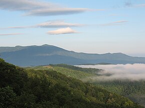
From the firetower and above the tree line, a 360° panorama, covering no less than 4 counties, can be seen. To the north northeast are the white feldspar cliffs of Chalk Mountain above
Climate
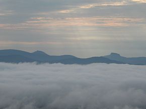
The weather atop Woody's Knob ranges from one extreme to another. During the summer months, early morning fog is frequent and daytime temperatures average in the low 70's to low 50's at night. Wintertime, temperatures easily dip into double digits below zero. Add to that, a wind chill factor caused by the prevailing wintertime north westerlies which have been measured from atop the firetower at hurricane-force winds. Ice storms can occur as early as late November which can make traveling to the top of the mountain a challenge. Average rainfall on the mountaintop is 58 inches and normal snowfall is 20 to 25 inches annually. Springtime arrives late as flower buds and leaves aren't in full bloom until after late April. Rhododendron, mountain laurel and wildflowers are blooming by mid May and blackberries and strawberries are ready to pick by mid summer while fall colors on the mountain are at their most brilliant by the last week of October.
Flora and fauna
Wildlife in the area include
Gallery
-
 Fire Tower at Summit
 -
 Western Slope & Towers at Summit
 -
 Celo Knob (6,327') Southwest View
 -
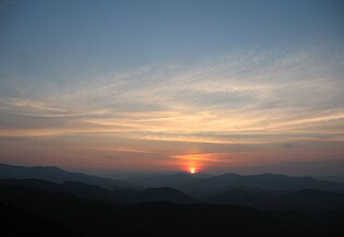
 Sunrise Behind Hawksbill & Tablerock
 -
 Black Mountains (Fall)
 -
 Black Mountains (Summer)
 -
 Sunset
 -
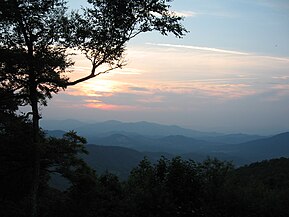 Sunset
 -
 West-Southwest View Towards Burnsville
 -
 Boone Knob; Northwest View
 -
 Local Population
 -
 Local Population
 -
 Snowfall; January, 2011
 -
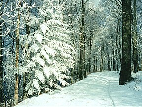 Snowfall at Summit
 -
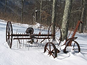 Farm Equipment
 -
 Rime Ice
 -
 Rime Ice
 -
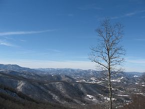
 Woody's Knob From 221


See also
- Little Switzerland, North Carolina
- Spruce Pine, North Carolina
- Blue Ridge Parkway
- Crabtree Falls (North Carolina)
- Grandfather Mountain
- Black Mountains (North Carolina)
- Table Rock (North Carolina)
- Linville Gorge Wilderness
- Mt. Mitchell
Further reading
- Duls, Louisa DeSaussure (c. 1982). The Story of Little Switzerland. Richmond, VA: Whittet & Shepperson.
- Hollifield, Chris; Biddix, David (c. 2010). Images of America; Little Switzerland. Charleston, SC: Arcadia Publishing.
References
- ^ a b "Woody". NGS Data Sheet. National Geodetic Survey, National Oceanic and Atmospheric Administration, United States Department of Commerce.
- ^ "Spruce Pine Lookout Tower". NGS Data Sheet. National Geodetic Survey, National Oceanic and Atmospheric Administration, United States Department of Commerce.
External links
Municipalities and communities of Mitchell County, North Carolina, United States | ||
|---|---|---|
| Towns |  | |
| Unincorporated communities | ||
| Ghost town | ||
| Footnotes | ‡This populated place also has portions in an adjacent county or counties | |
| ||