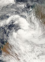
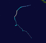
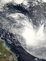
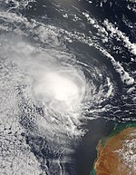
2006–07 Australian region cyclone season
| 2006–07 Australian region cyclone season | |
|---|---|
 Season summary map | |
| Seasonal boundaries | |
| First system formed | 30 December 2006 |
| Last system dissipated | 18 May 2007 |
| Strongest storm | |
| Name | George |
| • Maximum winds | 205 km/h (125 mph) (10-minute sustained) |
| • Lowest pressure | 902 hPa (mbar) |
| Seasonal statistics | |
| Tropical lows | 8 |
| Tropical cyclones | 5 |
| Severe tropical cyclones | 3 |
| Total fatalities | 5 |
| Total damage | $15.7 million (2007 USD) |
| Related articles | |
The 2006–07 Australian region cyclone season was a below average tropical cyclone season. It began on 1 November 2006 and ended on 30 April 2007; however, Tropical Cyclone Pierre formed on 17 May, after the official end date. The regional tropical cyclone operational plan also defines a tropical cyclone year separately from a tropical cyclone season, which runs from 1 July 2006 to 30 June 2007.
Tropical cyclones in this area are monitored by four
Systems

Tropical Low Isobel
| Tropical low (Australian scale) | |
| Tropical storm (SSHWS) | |
| Duration | 30 December – 5 January |
|---|---|
| Peak intensity | 85 km/h (50 mph) (10-min); 982 hPa (mbar) |
An area of increased
After the system dissipated, the BOM de-classified Isobel as a tropical cyclone as post-storm analysis showed that it did not have a well enough defined center to qualify as a tropical cyclone.[3]
Tropical Cyclone Nelson
| Category 2 tropical cyclone (Australian scale) | |
| Tropical storm (SSHWS) | |
| Duration | 5 February – 7 February |
|---|---|
| Peak intensity | 95 km/h (60 mph) (10-min); 985 hPa (mbar) |
On 30 January, a tropical low was identified by the
TCWC Brisbane Tropical Low
| Tropical low (Australian scale) | |
| Duration | 5 February – 8 February |
|---|---|
| Peak intensity | 85 km/h (50 mph) (10-min); 995 hPa (mbar) |
Just east of the remnants of Nelson, a tropical low was detected on 6 February. The low absorbed the moisture from Nelson as it moved slowly away from the coast. On 7 February, the
Tropical Low Humba
| Tropical low (Australian scale) | |
| Duration | 19 February – 20 February (exited basin) |
|---|---|
| Peak intensity | 75 km/h (45 mph) (10-min); 1000 hPa (mbar) |
Tropical Low Odette
| Tropical low (Australian scale) | |
| Duration | 2 March – 5 March |
|---|---|
| Peak intensity | 75 km/h (45 mph) (10-min); 990 hPa (mbar) |
On 2 March, the
Odette was subsequently downgraded below tropical cyclone intensity by the warning agency in Brisbane.[4]
Severe Tropical Cyclone George
| Category 5 severe tropical cyclone (Australian scale) | |
| Category 3 tropical cyclone (SSHWS) | |
| Duration | 3 March – 10 March |
|---|---|
| Peak intensity | 205 km/h (125 mph) (10-min); 902 hPa (mbar) |
A tropical low that had been centered over land in the
Later on 3 March, TCWC Darwin upgraded the low to a tropical cyclone, naming it George, the first name used from the Darwin list since Fay in March 2004. George continued to strengthen, and was upgraded to a
The Tropical Cyclone Warning Centre in
The
Cyclone George was the most powerful cyclone to hit Port Hedland since Cyclone Joan in 1975.[5] Three people were killed and twenty-eight others were injured as a result of the severe cyclone.
Severe Tropical Cyclone Jacob
| Category 3 severe tropical cyclone (Australian scale) | |
| Category 1 tropical cyclone (SSHWS) | |
| Duration | 3 March – 12 March |
|---|---|
| Peak intensity | 130 km/h (80 mph) (10-min); 971 hPa (mbar) |
A tropical low formed in the
Severe Tropical Cyclone Kara
| Category 4 severe tropical cyclone (Australian scale) | |
| Category 3 tropical cyclone (SSHWS) | |
| Duration | 24 March – 28 March |
|---|---|
| Peak intensity | 195 km/h (120 mph) (10-min); 941 hPa (mbar) |
On 24 March, TCWC Perth started issuing tropical cyclone advisories on a developing tropical low that had moved off land into waters off the
At this point, the Bureau of Meteorology had high uncertainty regarding the cyclone's future track, which generally pointed Kara to move southwards towards the Western Australian coast. Therefore, cyclone watches and warnings were issued for the entire Pilbara coast, extending as far east as Broome. The cyclone reached peak intensity late on 26 March, and began to rapidly weaken the next day due to increasing wind shear.[7] The JTWC issued its last advisory on the evening of 27 March, and TCWC Perth followed suit early on 28 March as Kara dissipated near Eighty Mile Beach in Australia.
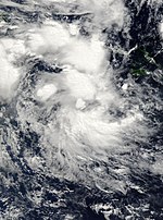
Tropical Cyclone Pierre
| Category 1 tropical cyclone (Australian scale) | |
| Tropical depression (SSHWS) | |
| Duration | 16 May – 18 May |
|---|---|
| Peak intensity | 75 km/h (45 mph) (10-min); 990 hPa (mbar) |
Early on 16 May, slightly more than two weeks after the official end to the Australian cyclone season, the
Other systems
During 25 March, TCWC Brisbane started monitoring a tropical low that was located about 390 km (240 mi) to the south-west of Honiara in the Solomon Islands.[11] Over the next day the system moved south-eastwards in an area of low vertical wind shear and moved into the South Pacific basin where the Fiji Meteorological Service started monitoring it as Tropical Depression 13F.[11]
Storm names
TCWC Perth
- Isobel
- Jacob
- Kara
TCWC Darwin
- George
TCWC Brisbane
- Nelson
- Odette
- Pierre
Season effects
| Name | Dates | Peak intensity | Areas affected | Damage (USD) |
Deaths | Refs | ||
|---|---|---|---|---|---|---|---|---|
| Category | Wind speed | Pressure | ||||||
| Isobel | 30 December – 5 January | Tropical low | 55 km/h (35 mph) | 992 hPa (29.29 inHg) | None | None | None | |
| Nelson | 5 – 7 February | Category 2 tropical cyclone | 95 km/h (60 mph) | 985 hPa (29.09 inHg) | Northern Territory, Queensland | Unknown | Unknown | |
| Low | 5 – 8 February | Tropical low | 85 km/h (50 mph) | 995 hPa (29.38 inHg) | ||||
| Odette | 2 – 5 March | Tropical low | 75 km/h (45 mph) | 990 hPa (29.23 inHg) | None | None | ||
| George | 3 – 10 March | Category 5 severe tropical cyclone | 205 km/h (125 mph) | 902 hPa (26.64 inHg) | Western Australia | $15.7 million | 5 | |
| Jacob | 3 – 12 March | Category 3 severe tropical cyclone | 130 km/h (80 mph) | 958 hPa (28.29 inHg) | Western Australia | Minimal | ||
| Kara | 23 – 30 March | Category 3 severe tropical cyclone | 155 km/h (100 mph) | 948 hPa (27.99 inHg) | None | None | ||
Pierre |
15 – 23 May 2007 | Category 1 tropical cyclone | 75 km/h (45 mph) | 990 hPa (29.23 inHg) | Solomon Islands, Papua New Guinea, Torres Straits | Unknown | Unknown | [12][citation needed] |
| Season aggregates | ||||||||
| 8 systems | 30 December – 23 May | 205 km/h (125 mph) | 902 hPa (26.64 inHg) | $15.7 million | 5 | |||
See also
- Tropical cyclones in 2006 and 2007
- List of Southern Hemisphere tropical cyclone seasons
- Atlantic hurricane seasons: 2006, 2007
- Pacific hurricane seasons: 2006, 2007
- Pacific typhoon seasons: 2006, 2007
- North Indian Ocean cyclone seasons: 2006, 2007
References
- ^ http://www.wmo.ch/web/www/TCP/TCP24-English2004.pdf [dead link]
- ^ "Perfect Storm Australia-Bound". Straits Times. Singapore. Agence France-Presse and Singapore Press Holdings. 5 January 2007. p. 19.
- ^ Gary Padgett Monthly Global Tropical Cyclone Summary – January 2007
- ^ Shaik, Hakeem A; Cleland, Samuel J. "The tropical circulation in the Australian/Asian region – November 2006 to April 2007" (PDF). Bureau of Meteorology. Archived (PDF) from the original on 2 August 2019. Retrieved 28 May 2008.
{{cite journal}}: Cite journal requires|journal=(help) - ^ a b Tropical Cyclone Tropical Cyclone George Impacts
- ^ Tropical Cyclone Season Summary: Western Australian Region: 2006 – 2007. Bureau of Meteorology. Retrieved on 19 July 2015.
- ^ a b c "Archived copy". Archived from the original on 25 March 2007. Retrieved 17 June 2017.
{{cite web}}: CS1 maint: archived copy as title (link) - ^ "Archived copy". Archived from the original on 18 May 2007. Retrieved 17 June 2017.
{{cite web}}: CS1 maint: archived copy as title (link) - ^ "Archived copy". Archived from the original on 19 May 2007. Retrieved 17 June 2017.
{{cite web}}: CS1 maint: archived copy as title (link) - ^ "Archived copy". Archived from the original on 21 May 2009. Retrieved 28 January 2017.
{{cite web}}: CS1 maint: archived copy as title (link) CS1 maint: bot: original URL status unknown (link) - ^ a b RSMC Nadi — Tropical Cyclone Centre (8 December 2008). Tropical Cyclone Seasonal Summary 2006-07 (Report). Fiji Meteorological Service. Retrieved 30 August 2015.
- ^ "2007 Tropical Cyclone Pierre (2007136S10158)". International Best Track Archive for Climate Stewardship. Retrieved 25 May 2022.

