
Aguilar, Colorado
Aguilar, Colorado | ||
|---|---|---|
ZIP code 81020[6] | ||
| Area code | 719 | |
| FIPS code | 08-00760 | |
| GNIS feature ID | 0194464 | |
| Website | aguilarco | |
Aguilar is a
History
The town was named for state legislator J. Ramon Aguilar. Aguilar owned the land that the town was built on. A post office was established at Aguilar in 1890.[9] In 1894 the town was incorporated.[10]
From September 1913 until late April 1914, much of Las Animas County was embroiled by the
Following the Ludlow Massacre on April 20, 1914, strikers launched numerous attacks of both coordinated and spontaneous natures against mining operations, strikebreakers, and the National Guard in what is known as the Ten-Day War. One of the attacks was launched against Southwestern Mine Co.'s Empire Mine on April 22, where armed strikers forced non-striking miners and their families into the mine and began an all-night siege outside. After negotiation led by Aguilar's mayor and a church minister named McDonald, the strikers abandoned the siege before fatalities on either side were reported.[12][13]: 186
.JPG)
Geography
Aguilar is located at 37°24′12″N 104°39′16″W / 37.40333°N 104.65444°W (37.403299, -104.654363),[14] about one mile west of Interstate 25.
At the
Climate
| Climate data for Aguilar | |||||||||||||
|---|---|---|---|---|---|---|---|---|---|---|---|---|---|
| Month | Jan | Feb | Mar | Apr | May | Jun | Jul | Aug | Sep | Oct | Nov | Dec | Year |
| Mean daily maximum °F (°C) | 38.2 (3.4) |
43.9 (6.6) |
51.7 (10.9) |
60.4 (15.8) |
70 (21) |
81.8 (27.7) |
88.7 (31.5) |
86.8 (30.4) |
78.1 (25.6) |
65.6 (18.7) |
49.2 (9.6) |
40.4 (4.7) |
62.9 (17.2) |
| Mean daily minimum °F (°C) | 11.9 (−11.2) |
17.1 (−8.3) |
23.8 (−4.6) |
31.6 (−0.2) |
41.7 (5.4) |
51 (11) |
56.7 (13.7) |
55 (13) |
45.7 (7.6) |
33.5 (0.8) |
21.7 (−5.7) |
13.7 (−10.2) |
33.6 (0.9) |
| Average precipitation inches (mm) | 0.6 (15) |
0.7 (18) |
1.7 (43) |
2.1 (53) |
2.6 (66) |
1.8 (46) |
2.7 (69) |
3.1 (79) |
1.6 (41) |
1 (25) |
1 (25) |
0.7 (18) |
19.6 (500) |
| Source: Weatherbase[15] | |||||||||||||
Demographics
| Census | Pop. | Note | %± |
|---|---|---|---|
| 1900 | 698 | — | |
| 1910 | 858 | 22.9% | |
| 1920 | 1,236 | 44.1% | |
| 1930 | 1,383 | 11.9% | |
| 1940 | 1,397 | 1.0% | |
| 1950 | 1,038 | −25.7% | |
| 1960 | 777 | −25.1% | |
| 1970 | 699 | −10.0% | |
| 1980 | 624 | −10.7% | |
| 1990 | 520 | −16.7% | |
| 2000 | 593 | 14.0% | |
| 2010 | 538 | −9.3% | |
| 2020 | 456 | −15.2% | |
| U.S. Decennial Census | |||
As of the
There were 243 households, out of which 23.5% had children under the age of 18 living with them, 48.1% were married couples living together, 14.4% had a female householder with no husband present, and 31.7% were non-families. 27.2% of all households were made up of individuals, and 16.0% had someone living alone who was 65 years of age or older. The average household size was 2.44 and the average family size was 2.93.
In the town, the population was spread out, with 23.3% under the age of 18, 6.6% from 18 to 24, 20.2% from 25 to 44, 28.5% from 45 to 64, and 21.4% who were 65 years of age or older. The median age was 45 years. For every 100 females, there were 97.7 males. For every 100 females age 18 and over, there were 88.8 males.
The median income for a household in the town was $23,750, and the median income for a family was $30,815. Males had a median income of $22,500 versus $21,250 for females. The
Education
Aguilar Public Schools is part of the
Aguilar Elementary School and Aguilar Junior/Senior High School are located in Aguilar.[17]
Infrastructure
Transportation
Aguilar is part of Colorado's Bustang network. It is on the Trinidad-Pueblo Outrider line.[18]
See also
- Bibliography of Colorado
- Geography of Colorado
- History of Colorado
- Index of Colorado-related articles
- List of Colorado-related lists
- Outline of Colorado
References
- ^ a b c d "Active Colorado Municipalities". Colorado Department of Local Affairs. Retrieved October 15, 2021.
- ^ "2014 U.S. Gazetteer Files: Places". United States Census Bureau. July 1, 2014. Retrieved January 5, 2015.
- ^ "Colorado Municipal Incorporations". State of Colorado, Department of Personnel & Administration, Colorado State Archives. December 1, 2004. Archived from the original on September 27, 2007. Retrieved August 18, 2007.
- ^ "2020 U.S. Gazetteer Files". United States Census Bureau. Retrieved October 31, 2021.
- ^ USGS. Retrieved August 18, 2007.
- ^ "ZIP Code Lookup". United States Postal Service. August 18, 2007. Archived from the original (JavaScript/HTML) on August 18, 2007. Retrieved August 18, 2007.
- ^ a b "Decennial Census P.L. 94-171 Redistricting Data". United States Census Bureau, United States Department of Commerce. August 12, 2021. Retrieved September 2, 2021.
- ^ "The Jose Ramon Aguilar Story". Centennial Aguilar Booklet 1994. Apishapa Valley Historical Society. Archived from the original on September 14, 2007. Retrieved August 18, 2007.
- ^ "Place Names of Colorado" (PDF). Colorado Council of Genealogical Societies. 1999. p. 5. Archived from the original (PDF) on October 27, 2017. Retrieved July 1, 2019.
- ^ "Profile for Aguilar, Colorado, CO". ePodunk. Archived from the original on July 1, 2017. Retrieved March 7, 2012.
- ^ Colorado Adjutant General's Office (1914). The Military Occupation of the Coal Strike Zone of Colorado by the National Guard, 1913-1914 (Report).
- ^ "30 BESIEGED IN MINE MAY BE SUFFOCATED; Mouth of Slope Blocked by Dynamite Explosions Caused by Strikers". The New York Times. April 23, 1914. Retrieved April 4, 2020.
- ISBN 978-0-8135-4419-9.
- ^ "US Gazetteer files: 2010, 2000, and 1990". United States Census Bureau. February 12, 2011. Retrieved April 23, 2011.
- ^ "Weatherbase: Historical Weather for Aguilar, Colorado". Weatherbase. November 2011. Retrieved November 24, 2011.
- ^ "U.S. Census website". United States Census Bureau. Retrieved January 31, 2008.
- ^ "Aguilar Reorganized School District RE-6". Aguilar Reorganized School District RE-6. Archived from the original on April 24, 2012. Retrieved March 7, 2012.
- ^ "Bustang Schedule". RideBustang. CDOT.
External links
- Town of Aguilar website
- CDOT map of the Town of Aguilar
- Aguilar History Archived July 7, 2011, at the Wayback Machine
Municipalities and communities of Las Animas County, Colorado, United States | ||
|---|---|---|
| City | 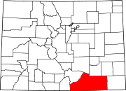 | |
| Towns | ||
| CDPs | ||
| Unincorporated communities | ||
| Ghost towns | ||
| ||
| International | |
|---|---|
| National | |