
High Plains (United States)
| High Plains | |
|---|---|
 A buffalo wallow on the High Plains.[1] | |
 Physiographic regions of the United States. The High Plains region is the center yellow area designated 13d.[2] | |
| Floor elevation | 1,800–7,000 ft (550–2,130 m)[3] |
| Length | 800 mi (1,300 km) |
| Width | 400 mi (640 km) |
| Area | 174,000 sq mi (450,000 km2) [3] |
| Geography | |
| Country | United States |


The High Plains are a subregion of the
Name
The term "Great Plains", for the region west of about the 96th or 98th meridian and east of the Rocky Mountains, was not generally used before the early 20th century. Nevin Fenneman's 1916 study, Physiographic Subdivision of the United States,[6] brought the term Great Plains into more widespread usage. Prior to 1916, the region was almost invariably called the High Plains, in contrast to the lower Prairie Plains of the Midwestern states.[7] Today the term "High Plains" is usually used for a subregion instead of the whole of the Great Plains.
Geography and climate
The High Plains has a "cold semi-arid" climate—Köppen BSk—receiving between 10–20 in (250–510 mm) of precipitation annually.
Due to low moisture and high elevation, the High Plains commonly experiences wide ranges and extremes in temperature. The temperature range from day to night is usually 30 °F (~16.5 °C), and 24-hour temperature shifts of 100 °F (~55.5 °C) are possible, as evidenced by a weather event that occurred in Browning, Montana, from January 23–24, 1916, when the temperature fell from 44 to −56 °F (7 to −49 °C). This is the world record for the greatest temperature change in 24 hours.[8] The region is known for the steady, and sometimes intense, winds that prevail from the west. The winds add a considerable wind chill factor in the winter. The development of wind farms in the High Plains is one of the newest areas of economic development.
The High Plains are anomalously high in elevation. An explanation has recently been proposed to explain this high elevation. As the
Flora
Typical plant communities of the region are
Economy
Agriculture in the forms of
The combination of oil, natural gas, and wind energy along with plentiful underground water, has allowed some areas (such as West Texas) to sustain a range of economic activity, including occasional industry. For example, the ASARCO refinery in Amarillo, Texas has been in operation since 1924 due to the plentiful and inexpensive natural gas and water that are needed in metal ore refining.[citation needed]
Demographics
The High Plains has one of the lowest population densities of any region in the continental United States; Wyoming, for example, has the second lowest population density in the country after Alaska. In contrast to the stagnant population growth in the northern and western High Plains, cities in west Texas have shown sustained growth; Amarillo and Lubbock both have populations near or above 200,000 and continue to grow.[citation needed] Smaller towns, on the other hand, often struggle to sustain their population.
Major cities and towns
- Alliance, Nebraska
- Amarillo, Texas
- Aurora, Colorado
- Benkelman, Nebraska
- Colby, Kansas
- Chadron, Nebraska
- Chappell, Nebraska
- Cheyenne, Wyoming
- Clovis, New Mexico
- Colorado Springs, Colorado
- Dodge City, Kansas
- Fort Morgan, Colorado
- Garden City, Kansas
- Goodland, Kansas
- Gering, Nebraska
- Grant, Nebraska
- Greeley, Colorado
- Guymon, Oklahoma
- Hays, Kansas
- Hobbs, New Mexico
- Imperial, Nebraska
- Kimball, Nebraska
- La Junta, Colorado
- Lamar, Colorado
- Las Vegas, New Mexico
- Liberal, Kansas
- Limon, Colorado
- Lubbock, Texas
- Midland, Texas
- Miles City, Montana
- Odessa, Texas
- Ogallala, Nebraska
- Pecos, Texas
- Pine Ridge, South Dakota
- Porcupine, South Dakota
- Portales, New Mexico
- Roswell, New Mexico
- Sidney, Nebraska
- Santa Rosa, New Mexico
- Scottsbluff, Nebraska
- Sterling, Colorado
- Tucumcari, New Mexico
- Ulysses, Kansas
- Vaughn, New Mexico
- Willard, Colorado
Gallery
-
 High Plains inOklahoma west of Guymon(2009)
 -
 Cimarron County near Boise City. (2009)
 -
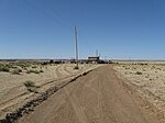
 Grain silos, a common sight on the High Plains. (2009)
 -
 High Plains inSoutheastern Colorado(2009)
 -
 The High Plains are broken in places by canyons, such as this one in Sabinoso Wilderness in New Mexico.


.jpg)
See also
- Altiplano
- Dust storm
- Flora of the Great Plains (North America)
- Great American Desert
- List of ecoregions in the United States (EPA)
- Llano Estacado
- North American Prairies Province
- Shortgrass prairie
- Steppe
- Temperate grasslands, savannas, and shrublands—Biome
- Texas High Plains AVA, wine region in the Texas section of the High Plains
- Tibetan Plateau
- Western short grasslands
- Wind power in Texas
References
- ^ Darton, Nelson Horatio (1920). Syracuse-Lakin folio, Kansas. Folios of the Geologic Atlas, No. 212: United States Department of the Interior, U.S. Geological Survey. p. 17 (plate 2). Archived from the original on October 4, 2011. Retrieved October 6, 2010.
{{cite book}}: CS1 maint: location (link) - ^ "Physiographic Regions". U.S. Department of the Interior. U.S. Geological Survey. Archived from the original on May 15, 2006. Retrieved October 6, 2010.
- ^ a b c "USGS High Plains Aquifer WLMS". U.S. Department of the Interior. U.S. Geological Survey. Archived from the original on May 27, 2010. Retrieved October 6, 2010.
- ^ File:Level III ecoregions, United States.png
- ^ "Shaded relief image of the Llano Estacado". Handbook of Texas: Llano Estacado. June 15, 2010. Archived from the original on August 1, 2013. Retrieved August 6, 2013.
- PMID 16586678.
- OCLC 186331193.
- ^ "Top Ten Montana Weather Events of the 20th Century". National Weather Service Unveils Montana's Top Ten Weather/Water/Climate Events of the 20th Century. National Weather Service. Archived from the original on March 13, 2013. Retrieved June 1, 2015.
- ^ "Why Are the High Plains So High?". THECHERRYCREEKNEwsxWS.COM. March 15, 2005. Archived from the original on March 19, 2015. Retrieved March 15, 2015.
- doi:10.1130/G36509.1.
- ^ Scott, Michon. "National Climate Assessment: Great Plains' Ogallala Aquifer drying out". climate.gov. NOAA. Archived from the original on September 27, 2019. Retrieved September 27, 2019.
External links
 Media from Commons
 Travel information from Wikivoyage
- High Plains Regional Climate Center High Plains climatological resources
- High Plains information - U.S. Department of the Interior (with map)
- Trains on the High Plains
- Texas counties map showing the ecoregion
- Public domain images of the high plains of the Llano Estacado

| International | |
|---|---|
| National | |