
Anderson County, Tennessee
Anderson County | |
|---|---|
 Anderson County Courthouse in Clinton | |
|
UTC−4 (EDT) | |
| Congressional district | 3rd |
| Website | www |
Anderson County is a
History
Before the formation of Anderson County, Tennessee, that territory was initially land of what is today called the Eastern Band of Cherokee Indians, which had been settled by several pioneer families including the Wallace, Gibbs, Freels, Frost and Tunnell families. Although the Treaty of Holston, signed in 1791, was intended as a negotiation with the Cherokee to prohibit settlement of the area including what is today Anderson County, the treaty became ineffective as more settlers moved through the Appalachian Mountains from Virginia and North Carolina into Tennessee. The flooding of white settlers into the Indian domain was cause for several skirmishes, which eased after the Treaty of Tellico in 1798 (with an origination point for relinquished land from the Cherokee being the Tellico Blockhouse) allowed for greater ease in settling the area.[4]
Anderson County was partitioned from a portion of
Like many East Tennessee counties, the residents of Anderson County were largely opposed to secession on the eve of the Civil War. On June 8, 1861, Anderson Countians voted against Tennessee's Ordinance of Secession, 1,278 to 97.[6]
The construction of
During World War II, the federal government's Manhattan Project brought more change to the county, including the displacement of more families and the founding of Oak Ridge.
The Museum of Appalachia in Norris commemorates pioneer and rural life of past decades in Anderson County and the surrounding region. It is also an antique shop that sells artifacts from the times of the first settlers to the times of the Coal Creek War
Geography
According to the
Adjacent counties
- Campbell County (north)
- Union County (northeast)
- Knox County (southeast)
- Roane County (southwest)
- Morgan County (west)
- Scott County (northwest)
National protected area
State protected areas
- Norris Dam State Park (part)
- North Cumberland Wildlife Management Area (part)
Demographics
| Census | Pop. | Note | %± |
|---|---|---|---|
| 1810 | 3,959 | — | |
| 1820 | 4,668 | 17.9% | |
| 1830 | 5,310 | 13.8% | |
| 1840 | 5,658 | 6.6% | |
| 1850 | 6,938 | 22.6% | |
| 1860 | 7,068 | 1.9% | |
| 1870 | 8,704 | 23.1% | |
| 1880 | 10,820 | 24.3% | |
| 1890 | 15,128 | 39.8% | |
| 1900 | 17,634 | 16.6% | |
| 1910 | 17,717 | 0.5% | |
| 1920 | 18,298 | 3.3% | |
| 1930 | 19,722 | 7.8% | |
| 1940 | 26,504 | 34.4% | |
| 1950 | 59,407 | 124.1% | |
| 1960 | 60,032 | 1.1% | |
| 1970 | 60,300 | 0.4% | |
| 1980 | 67,346 | 11.7% | |
| 1990 | 68,250 | 1.3% | |
| 2000 | 71,330 | 4.5% | |
| 2010 | 75,129 | 5.3% | |
| 2020 | 77,123 | 2.7% | |
| 2023 (est.) | 80,234 | [8] | 4.0% |
| U.S. Decennial Census[9] 1790-1960[10] 1900-1990[11] 1990-2000[12] 2010-2020[2] | |||

2020 census
| Race | Number | Percentage |
|---|---|---|
White (non-Hispanic)
|
66,044 | 85.63% |
Black or African American (non-Hispanic)
|
2,841 | 3.68% |
Native American
|
217 | 0.28% |
Asian
|
975 | 1.26% |
Pacific Islander
|
53 | 0.07% |
Other/Mixed
|
4,173 | 5.41% |
Latino
|
2,820 | 3.66% |
As of the 2020 United States census, there were 77,123 people, 30,175 households, and 19,074 families residing in the county.
2000 census
As of the
According to the
There were 29,780 households, out of which 29.60% had children under the age of 18 living with them, 53.80% were married couples living together, 11.50% had a female householder with no husband present, and 31.10% were non-families. 27.70% of all households were made up of individuals, and 12.10% had someone living alone who was 65 years of age or older. The average household size was 2.37 and the average family size was 2.88.
In the county, the population was spread out, with 23.20% under the age of 18, 7.50% from 18 to 24, 27.30% from 25 to 44, 25.50% from 45 to 64, and 16.60% who were 65 years of age or older. The median age was 40 years. For every 100 females, there were 91.10 males. For every 100 females age 18 and over, there were 87.40 males.
The median income for a household in the county was $35,483, and the median income for a family was $42,584. Males had a median income of $33,710 versus $23,467 for females. The
Economy
Anderson County has a thriving tourism industry, thanks to major attractions such as Norris Lake, the Green McAdoo School, the Museum of Appalachia, and American Museum of Science and Energy, and the county is considered a part of the Norris Highlands.
Communities

Cities
Town
- Oliver Springs (partial)
Census-designated place
Unincorporated communities
Politics
The last Democrat to carry this county was Bill Clinton in 1996.
| Year | Republican | Democratic | Third party(ies) | |||
|---|---|---|---|---|---|---|
| No. | % | No. | % | No. | % | |
| 2024 | 24,582 | 67.26% | 11,525 | 31.53% | 441 | 1.21% |
| 2020 | 23,184 | 65.18% | 11,741 | 33.01% | 645 | 1.81% |
| 2016 | 19,212 | 64.30% | 9,013 | 30.16% | 1,656 | 5.54% |
| 2012 | 18,968 | 63.95% | 10,122 | 34.13% | 569 | 1.92% |
| 2008 | 19,675 | 62.32% | 11,396 | 36.10% | 499 | 1.58% |
| 2004 | 18,510 | 58.42% | 12,896 | 40.70% | 276 | 0.87% |
| 2000 | 14,688 | 51.04% | 13,556 | 47.10% | 535 | 1.86% |
| 1996 | 11,943 | 43.40% | 13,457 | 48.91% | 2,116 | 7.69% |
| 1992 | 11,838 | 41.38% | 13,482 | 47.12% | 3,291 | 11.50% |
| 1988 | 15,056 | 60.74% | 9,589 | 38.68% | 143 | 0.58% |
| 1984 | 16,783 | 61.31% | 10,415 | 38.05% | 176 | 0.64% |
| 1980 | 14,235 | 55.31% | 10,194 | 39.61% | 1,307 | 5.08% |
| 1976 | 10,494 | 43.29% | 13,455 | 55.50% | 293 | 1.21% |
| 1972 | 13,865 | 66.03% | 6,713 | 31.97% | 421 | 2.00% |
| 1968 | 10,233 | 47.04% | 7,198 | 33.09% | 4,323 | 19.87% |
| 1964 | 8,860 | 42.18% | 12,146 | 57.82% | 0 | 0.00% |
| 1960 | 11,153 | 52.56% | 9,878 | 46.55% | 190 | 0.90% |
| 1956 | 11,071 | 52.42% | 9,368 | 44.35% | 682 | 3.23% |
| 1952 | 10,489 | 53.88% | 8,939 | 45.92% | 38 | 0.20% |
| 1948 | 5,372 | 45.38% | 5,915 | 49.97% | 550 | 4.65% |
| 1944 | 3,424 | 49.48% | 3,476 | 50.23% | 20 | 0.29% |
| 1940 | 1,852 | 45.27% | 2,218 | 54.22% | 21 | 0.51% |
| 1936 | 1,805 | 42.84% | 2,348 | 55.73% | 60 | 1.42% |
| 1932 | 1,605 | 59.51% | 1,081 | 40.08% | 11 | 0.41% |
| 1928 | 2,304 | 81.27% | 531 | 18.73% | 0 | 0.00% |
| 1924 | 1,495 | 69.28% | 548 | 25.39% | 115 | 5.33% |
| 1920 | 3,127 | 80.30% | 748 | 19.21% | 19 | 0.49% |
| 1916 | 1,730 | 75.68% | 537 | 23.49% | 19 | 0.83% |
| 1912 | 539 | 23.04% | 597 | 25.52% | 1,203 | 51.43% |
See also
References
- ^ Tara Mitchell Mielnik, "Anderson County," Tennessee Encyclopedia of History and Culture. Retrieved: March 31, 2013.
- ^ a b "Anderson County, Tennessee". quickfacts.census.gov. United States Census Bureau. Retrieved August 29, 2021.
- ^ "Find a County". National Association of Counties. Archived from the original on May 31, 2011. Retrieved June 7, 2011.
- ISBN 0-89865-770-9.
- ISBN 0-8063-8003-9.
- ^ Oliver Perry Temple, East Tennessee and the Civil War (R. Clarke Company, 1899), p. 199.
- ^ "2010 Census Gazetteer Files". United States Census Bureau. August 22, 2012. Retrieved April 1, 2015.
- ^ "Annual Estimates of the Resident Population for Counties: April 1, 2020 to July 1, 2023". United States Census Bureau. Retrieved March 14, 2024.
- ^ "U.S. Decennial Census". United States Census Bureau. Retrieved April 1, 2015.
- ^ "Historical Census Browser". University of Virginia Library. Retrieved April 1, 2015.
- ^ Forstall, Richard L., ed. (March 27, 1995). "Population of Counties by Decennial Census: 1900 to 1990". United States Census Bureau. Retrieved April 1, 2015.
- ^ "Census 2000 PHC-T-4. Ranking Tables for Counties: 1990 and 2000" (PDF). United States Census Bureau. April 2, 2001. Archived (PDF) from the original on October 9, 2022. Retrieved April 1, 2015.
- ^ Based on 2000 census data
- ^ "Explore Census Data". data.census.gov. Retrieved December 26, 2021.
- ^ "U.S. Census website". United States Census Bureau. Retrieved May 14, 2011.
- ^ Leip, David. "Dave Leip's Atlas of U.S. Presidential Elections". uselectionatlas.org. Retrieved March 9, 2018.
External links
- Official site
- Anderson County Chamber of Commerce
- Anderson County, TNGenWeb - free genealogy resources for the county
- Anderson county landforms
Places adjacent to Anderson County, Tennessee | ||||||||||||||||
|---|---|---|---|---|---|---|---|---|---|---|---|---|---|---|---|---|
| ||||||||||||||||
Municipalities and communities of Anderson County, Tennessee, United States | ||
|---|---|---|
| Cities | 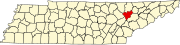 | |
| Town | ||
| CDPs | ||
| Other communities | ||
| Ghost towns/ neighborhoods | ||
| Footnotes | ‡This populated place also has portions in an adjacent county or counties | |
| ||
| Principal city |   | |
|---|---|---|
| Other cities | ||
| Counties | ||
36°07′N 84°12′W / 36.11°N 84.20°W
| International | |
|---|---|
| National | |