
Battenberg (Eder)
Battenberg | |
|---|---|
 Oberstadt (Upper Town) with Neuburg (New Castle) | |
 Coat of arms | |
Location of Battenberg within Waldeck-Frankenberg district 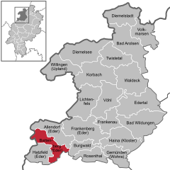 | |
Ortsteile | |
| Government | |
| • Mayor (2020–26) | Christian Klein[1] |
| Area | |
| • Total | 64.73 km2 (24.99 sq mi) |
| Elevation | 340 m (1,120 ft) |
| Population (2022-12-31)[2] | |
| • Total | 5,500 |
| • Density | 85/km2 (220/sq mi) |
| Time zone | UTC+01:00 (CET) |
| • Summer (DST) | UTC+02:00 (CEST) |
| Postal codes | 35088 |
| Dialling codes | 06452 |
| Vehicle registration | KB |
| Website | www.battenberg-eder.de |
Battenberg is a small town in the district of
.In 1624, Battenberg was incorporated into the
Battenberg is the origin of the medieval House of Battenberg (
The Battenberg cake and hence also the Battenburg markings both indirectly derive their name from the town.

.JPG)

_01.jpg)
Geography
Location
The centre of Battenberg lies in the Ederbergland, or Eder Highland, to which the Burgwald abutting the town to the east also belongs, on the southern edge of the
Neighbouring communities
Battenberg borders in the north on the community of Bromskirchen, in the northeast on the community of Allendorf, in the southeast on the community of Burgwald (all three in Waldeck-Frankenberg), in the south on the community of Münchhausen am Christenberg (Marburg-Biedenkopf), and in the west on the towns of Hatzfeld (Waldeck-Frankenberg) and Bad Berleburg (Siegen-Wittgenstein in North Rhine-Westphalia).
Incorporated villages
Battenberg consists of:
- Battenberg proper including the tiny hamlet of Neu-Jägersdorf (de:Neu-Jägersdorf), also known as "Kröge", on the other side of the Eder.
and the incorporated villages of:
- Berghofen (de:Berghofen (Battenberg))
- Dodenau (de:Dodenau)
- Frohnhausen (de:Frohnhausen (Battenberg)): the farthest away from Battenberg proper.
- Laisa (de:Laisa)
Right next to Battenberg proper on the western side of the Eder is Battenfeld (de:Battenfeld), a district of the neighbouring town of Allendorf (Eder).
-
 Map of the Rothaar Mountains with Battenberg visible at the eastern edges of the mountains, the Eder Uplands.
 -

-
 Location of Battenberg within the district of Waldeck-Frankenberg


_in_KB.svg)
History
In 778 fighting took place near Laisa and Battenfeld as part of
The dynasty of the counts of Battenberg ceased to exist in 1314, their castle was demolished throughout the following centuries. When
Population development
| 31 December 1988 | : 5,099 inhabitants |
| 31 December 1991 | : 5,602 inhabitants |
| 31 December 1995 | : 5,693 inhabitants |
| 31 December 2000 | : 5,752 inhabitants |
| 31 December 2004 | : 5,701 inhabitants |
Politics
Town council
Municipal elections held on 6 March 2016 apportioned the town council's 31 seats thus:
| Party name | Number of seats |
|---|---|
CDU |
6 seats |
| SPD | 6 seats |
| Bürgerliste Stadt Battenberg | 6 seats |
| Bürgerliste der Stadtteile Laisa, Frohnhausen und Berghofen | 6 seats |
| Bürgerliste Dodenau | 5 seats |
| FDP | 2 seats |
Note: Bürgerlisten are "citizens' lists", not actual political parties.
Coat of arms
Battenberg's civic coat of arms might heraldically be described thus: Per pale sable and argent.
The tinctures come from the arms borne by the town's old overlords, the Counts of Battenberg(a branch of the Counts of Wittgenstein). Battenberg's arms have their roots in the 13th century, putting them among Hesse's oldest municipal coats of arms.
Various other
Town partnerships
 Senonches, France
 Romsey, United Kingdom
 Litvínov, Czech Republic
- Horní Jiřetín, Czech Republic
 Loon op Zand, Netherlands
Adoption
- In 1954, Battenberg "adopted" Sudeten Germans who had been driven out of the community of Obergeorgenthal (Horní Jiřetín) in the Brüx district.
Notable people
- Andreas Steinhöfel (born 1962), writer and translator
- Leonie Schwertmann (born 1994), volleyball player
References
- Hessisches Statistisches Landesamt. 5 September 2022.
- Hessisches Statistisches Landesamt. June 2023.
- ...
External links
- Official website
- Laisa
- Battenberg at Curlie
Towns and municipalities in Waldeck-Frankenberg district | ||
|---|---|---|
 | ||
| International | |
|---|---|
| National | |
| Geographic | |