Chalan Beel
| Chalan Beel | ||
|---|---|---|
 Chalan Beel | ||
| Location | Natore (40%)
Sirajganj (35%) Pabna (25%) (Primary inflows Atrai River and 46 others | |
| Basin countries | Bangladesh | |
| Surface area | 26 km2 (10 sq mi) | |
| Average depth | 2 m (6.6 ft) | |
| Max. depth | 4 m (13 ft) | |
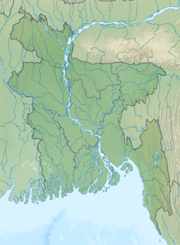
Chalan Beel (Bengali: চলনবিল) is a wetland in the Sirajganj, Natore and Pabna districts of Bangladesh. It is a large inland depression, marshy in character, with rich flora and fauna.[1] Forty-seven rivers and other waterways flow into the Chalan Beel.[2] As silt builds up in the beel, its size is being reduced.[3]
History
The most important factor dominating the river history in Bengal is the large proportion of silt carried by its rivers. It is the silt which has created the land and made it habitable by building it up through the centuries. It is silt which is fertilising the land, but the silt, which has been the most beneficial gift of nature, has also produced most of the river problems now confronting the people of Bengal. Silt deposited in the old river channel beds has forced them to change course, creating problems for abandoned areas while assisting in developing new areas.[4]
The main volume of water from the
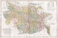
Another possible explanation for the depression is ongoing course changes in the Padma. In Ven den Brouck's map of Bengal, prepared in 1660, the main channel of the Padma is shown flowing through
Impact of railways
An estimate taken in 1945 found about 47 rivers and other waterways flowed into the Chalan Beel, a
Flora and fauna
The banks of the beel are covered with dense stands of
Pollution
Chalan Beel has experienced the negative effects of pesticide use in the surrounding farmlands. In 2010, Bangladesh Agricultural University research, found pesticide use has increased sixfold since 1982, and the fish population of Chalan Beel has halved in the same period. A 25 kilometre highway constructed on the Beel has divided into two and caused havoc on the fish breeding by disrupting their movement. Commercial overfishing, grill and drag net and other destructive fishing have harmed the fish population.[7]

References
- ^ ISBN 978-984-31-1090-9. Retrieved 29 November 2007.
- ^ ISBN 81-7596-330-1. Retrieved 29 November 2007.
- ^ Alam, Mohd Shamsul; Hossain, Md Sazzad (2012). "Chalan Beel". In Islam, Sirajul; Jamal, Ahmed A. (eds.). Banglapedia: National Encyclopedia of Bangladesh (Second ed.). Asiatic Society of Bangladesh.
- ^ Majumdar, S.C., Chief Engineer, Bengal, Rivers of the Bengal Delta, Government of Bengal, 1941. p. 109–110
- ^ Majumdar, S.C., p. 54
- ISBN 81-7079-270-3
- ^ "Bangladesh's once plentiful rivers run low on fish". The Independent. London. Agence France-Presse. 26 December 2010. Archived from the original on 22 July 2015. Retrieved 12 July 2015.


