
Darling Downs
| Darling Downs Federal division(s) | Groom, Maranoa | ||||||||||||||
|---|---|---|---|---|---|---|---|---|---|---|---|---|---|---|---|
| |||||||||||||||
The Darling Downs is a
The region has developed a strong and diverse agricultural industry largely due to the extensive areas of
The
The region is recognised as a cultural icon on the list of Queensland's Q150 icons.[5]
Geography

The largest city and commercial centre of the Darling Downs is


The Darling Down is situated in the drainage basins of the Condamine River and Maranoa River and tributaries. The Condamine River flood plain is noted for its good soils formed by basaltic alluvium.[7] On the northern boundaries of the Downs are the Bunya Mountains and the Bunya Mountains National Park. The region to the north is the South Burnett and the Maranoa lies to the west. A section of the western downs lies over coal deposits of the Surat Basin. Towards the coast, the mountains of the Scenic Rim form the headwaters of the westward flowing Condamine.
Climate
The majority of the Darling Downs has a
Southern Downs
Part of the Darling Downs, which includes the towns of Allora, Clifton, Warwick, Killarney and the rocky district in the south known as the
History

Baranggum (also known as Barrunggam, Barunggam Parrungoom, Murrumgama) is an
Originally, the Darling Downs was covered with a wealth of indigenous

Allan Cunningham set out to explore the area to the west of Moreton Bay in 1827, crossing to the west of the Great Dividing Range from the Hunter Region and travelling north. In June 1827, Cunningham climbed to the top of Mount Dumaresque[11] (near what is now Clintonvale close to Maryvale) and after wrote in his diary that this lush area was ideal for settlement. Exploring around Mount Dumaresque, Cunningham found a pass, now known as Cunninghams Gap. Cunningham returned to Moreton Bay in 1828 and with Charles Fraser charted the route through the pass to the Darling Downs.[12] Ludwig Leichhardt in 1844 saw the remains of a camp showing the signs of white men through ridge poles and steel axes.
News of the lush pastures quickly spread resulting in a land grab that authorities in the distant New South Wales colony found difficult to stop.[13] Patrick Leslie was the first European person to settle on the Darling Downs in 1840, establishing a sheep property at Canning Downs on the Condamine River in 1846. Other well-established residences on the southern downs include Glengallan Homestead, Talgai Homestead, Pringle Cottage and Rosenthal Homestead. One of the first stations to be established was Jimbour House. It was also the point where Leichhardt launched his expedition to the Northern Territory in 1844.[14]
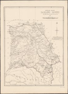
| Railway lines on the Darling Downs | ||||
|---|---|---|---|---|
| From | To | Line | Opened | Closed |
| Toowoomba | Dalby | Western | 1868 | – |
| Toowoomba | Warwick | Southern | 1871 | – |
| Toowoomba | Miles | Western | 1878 | – |
| Warwick | Stanthorpe | Southern | 1881 | – |
| Toowoomba | Cabarlah | Crows Nest | 1883 | 1961 |
| Warwick | Killarney | Killarney | 1885 | 1964 |
| Toowoomba | Crows Nest | Crows Nest | 1886 | 1961 |
| Warwick | Allora | Goomburra | 1897 | 1995 |
| Hendon | Goomburra | Goomburra | 1897 | 1995 |
| Wyreema | Millmerran | Millmerran | 1897 | – |
| Warwick | Goondiwindi | South Western | 1904 | – |
| Dalby | Bell | Bell | 1906 | 1972 |
| Kingsthorpe | Haden | Haden | 1910 | 1964 |
| Dalby | Tara | Glenmorgan | 1911 | – |
| Warwick | Maryvale | Maryvale | 1911 | 1960 |
| Oakey | Cooyar | Cooyar | 1913 | 1969 |
| Miles | Wandoan | Wandoan | 1913 | – |
| Dalby | Jandowae | Jandowae | 1914 | 2013 |
| Oakey | Cecil Plains | Cecil Plains | 1915 | 1984 |
| Cottonvale | Amiens | Amiens | 1920 | 1974 |
By 1844 there 26 properties including a number of sheep stations with more than 150,000 head.
In 1854,
The 1891 Australian shearers' strike started at Jondaryan. The Darling Downs experienced a water crisis as the Condamine River dried up during the severe drought of 1994/1995.[18]
During the early 20th century dairy was a significant industry for Queensland. The 1930s saw the peaking of the dairy industry on the Downs with 6,500 farms and over 200,000 milking cows.[7] The Downs Co-operative Dairy Association expanded, constructed or purchased at least 10 butter and cheese factories across the Darling Downs.[19] The Downs Co-operative Dairy Association Limited Factory in Toowoomba closed in 2006.[20]
In 2010, the population of the Darling Downs was estimated to be 241,537 people.[21]
In 2022, the
Industry
The Queensland Gas Pipeline oil pipeline and the Roma to Brisbane Pipeline, Australia's first natural gas pipeline both cross the region from west to east. There are three
After agriculture and mining and manufacturing are the next most important sectors. Manufacturing focuses on food and beverages but also the production of machinery, equipment and metal products.[25]
Agriculture
The region produces around one quarter of the state's agricultural output.[26] Water for irrigation is mostly sourced from groundwater from alluvial aquifers. Water is also extracted from streams, off-stream reservoirs and on-farm dams.[27] The lower temperatures of the milder summers in the Stanthorpe and Killarney regions allows farmers to grow lettuce, celery, brassicas and potato.[27]
The Darling Downs contains the largest deposit of rich black agricultural soils in Australia.[23] A commonly grown grass species Panicum coloratum, also known as Bambatsi, is well-suited for pastures used for grazing because it is suitable to the heavy-cracking clay soils found in the area.[28] The eastern Downs feature a wide range of soil types.[27]
Brothers Friedrich Wilhelm Ernst Ziesemer and Theodor Martin Peter Ziesemer were significant pioneers of large scale wheat farming on the Darling Downs.[29]
Meat

The area is home to Australia's largest concentration of feedlots.
Wine
In the
Attractions

The region is popular with tourists because of its many natural and heritage attractions, including the Goomburra State Forest,
The town of
The Cobb & Co Museum has displays of horse-drawn vehicles and material on the history of the Darling Downs. The Jondaryan Woolshed is a heritage-listed shearing shed situated at a site where a tourist operator has collected numerous related structures. The region has also a small zoo, Darling Downs Zoo near Clifton.
The region has uncovered important megafauna fossil finds.[35] The rich discoveries have lent weight to the theory that humans were not a factor in the extinction of the ancient megafauna species.[36] Many of the fossils in the region date to the Pleistocene[37] and include species such as Diprotodon optatum, the largest-ever marsupial. In 2021, examination of a partial skull revealed a site on the Darling Downs was the location for a new species of Tomistominae crocodile, representing the largest extinct crocodile species ever discovered in Australia.[38]
The Darling Downs Golf Association has 21 affiliated golf clubs on the Darling Downs.

Environment
Before European settlement many areas on the Darling Downs were fertile wilderness. For example, around Ma Ma Creek, rich swampy wetlands provided a haven for many animal species not currently found on the downs. The Darling Downs hopping mouse and paradise parrot have both become extinct since cattle farming began.
The New Acland Mine expansion, north of Oakey, has been delayed by the largest environmental public interest court cases in Australian history.[39]
Awards
In 2009 as part of the
In fiction
Steele Rudd (Arthur Davis) wrote a series of comic novels on rural life, starting with On Our Selection (1899), about Dad, Mother and Dave Rudd of Snake Gully. The Rudds had four (or six) acres adjoining a sheep run in the Darling Downs. The stories were made into films and a radio series.
See also
References
- ^ Australian Bureau of Statistics (31 March 2011). "Regional Population Growth, Australia, 2009–10". Archived from the original on 13 October 2011.
- ^ "Darling Downs and Granite Belt tourist map c1935". Queensland Historical Atlas. Queensland Museum and others. Archived from the original on 20 March 2016. Retrieved 26 February 2016.
- ^ "Darling Downs | region, Queensland, Australia". Encyclopædia Britannica. Archived from the original on 12 March 2016. Retrieved 26 February 2016.
- ^ Isbell, Ray (26 February 2016). "Vertosols – Australian Soil Classification". Australian Soil Classification. Archived from the original on 7 March 2016.
- ^ "Q150 icons list". The Brisbane Times. 10 June 2009. Retrieved 7 December 2023.
- ^ "Darling Downs". Encyclopædia Britannica. Archived from the original on 27 March 2010. Retrieved 6 November 2010.
- ^ a b "Darling Downs". Queensland Places. Centre for the Government of Queensland. Archived from the original on 1 November 2014. Retrieved 1 November 2014.
- ^ "Baranggum". State Library of Queensland. Retrieved 15 January 2020.
- ^ [citation needed]
- ^ "A brief history of the Indigenous People of the Darling Downs". Local history library. Toowoomba Regional Council. 21 March 2013. Archived from the original on 24 October 2014.
- ^ "Moogerah Peaks National Park: Nature, culture and history". Department of National Parks, Recreation, Sport and Racing. 19 October 2009. Archived from the original on 4 November 2014. Retrieved 4 November 2014.
- from the original on 13 November 2012, retrieved 9 November 2012
- ISBN 978-0-521-87692-6.
- ISBN 1876561424.
- ISBN 0643102388. Archivedfrom the original on 10 December 2016.
- ISBN 0521469155. Archivedfrom the original on 10 December 2016.
- ^ French, Maurice. "Black soil and 'rolling grass seas'". Queensland Historical Atlas. Archived from the original on 19 June 2019. Retrieved 19 June 2019.
- The Courier Mailp. 3. 3 June 1995.
- ^ "The Downs Co-operative Dairy Association Limited Factory (former) (entry 602596)". Queensland Heritage Register. Queensland Heritage Council. Retrieved 15 August 2015.
- ^ "The Downs Co-operative Dairy Association Limited Factory (former) (entry 602596)". Queensland Heritage Register. Queensland Heritage Council. Retrieved 1 August 2014.
- ^ Australian Bureau of Statistics (31 March 2011). "Regional Population Growth, Australia, 2009–10". Archived from the original on 13 October 2011.
- ^ Carroll, David (27 May 2021). "Stanwell announces new battery as part of state storage blitz". pv magazine. Retrieved 18 July 2023.
- ^ a b "Darling Downs farmers get dirty over invasion". The Australian. News Limited. 3 September 2011. Archived from the original on 31 December 2014.
- S2CID 255892630.
- ^ "Business and Industry Portal: Darling Downs". Government of Queensland. 6 November 2013. Archived from the original on 1 November 2014.
- ^ "Darling Downs Regional Plan". Department of State Development, Infrastructure and Planning. 18 August 2014. Archived from the original on 4 March 2015.
- ^ a b c "Vegetable production in South East Queensland". Department of Agriculture, Fisheries and Forestry. 15 April 2014. Archived from the original on 24 March 2015.
- ^ "Selecting the right pasture species". Grazing and pasture management. The State of Queensland. July 2013. Archived from the original on 4 November 2014. Retrieved 4 November 2014.
- OCLC 70677943. Retrieved 18 February 2012.
- ^ "Darling Downs & South West Queensland". Government of Queensland. Archived from the original on 1 November 2014. Retrieved 1 November 2014.
- ^ Jon Condon (10 February 2010). "Pittsworth, Killarney abattoirs close". Queensland Country Life. Archived from the original on 12 October 2014.
- ^ Jon Condon (27 September 2012). "Small country abattoirs making a comeback". Beef Central. Nascon Media. Archived from the original on 1 November 2014.
- ^ Arlie Felton-Taylor (11 May 2012). "Hopes Oakey abattoir strike could end next week". ABC Rural. Australian Broadcasting Corporation. Archived from the original on 28 November 2014.
- ^ a b Kate Stark (7 March 2014). "Oakey Abattoir's world first". Queensland Country Life. Archived from the original on 1 November 2014.
- ^ "Australia's fossil past". Australia's Culture Portal. 11 December 2007. Archived from the original on 20 July 2008. Retrieved 23 June 2008.
- ^ Keating, Rebecca (30 May 2005). "Study clears humans over megafauna extinction". ABC News Online. Archived from the original on 6 April 2011. Retrieved 24 June 2008.
- PMID 28954903.
- ^ Ristevski, Jorgo; Salisbury, Steven W. (16 June 2021). "'River boss' largest extinct croc species ever discovered in Australia". Australian Geographic. Retrieved 25 October 2021.
- ^ Joshua, Robertson (26 June 2017). "Activists ask consumer watchdog to investigate Acland mine ad campaign". The Guardian. Guardian News & Media. Retrieved 29 October 2021.
- ^ Bligh, Anna (10 June 2009). "PREMIER UNVEILS QUEENSLAND'S 150 ICONS". Queensland Government. Archived from the original on 24 May 2017.
External links
- Tour of The Minister for Lands (the Hon. E. H. Macartney) in the Darling Downs and Maranoa districts, May and June, 1911, State Library of Queensland
- Southern Darling Downs
- Toowoomba.org – Toowoomba's Homepage
| General | |||||
|---|---|---|---|---|---|
| Politics and Government |
| ||||
| Regions | |||||
| Cities and towns | |||||
| People | |||||